
-
1:45

Windy and wet this weekend, but unseasonable warmth as well
-
3:13

Local players react to $3 million investment in Byer Softball...
-
0:32

Layoffs at Whirlpool could affect workers in Benton Harbor
-
1:03

Annual District Sisterhood Conference at Ivy Tech empowers students
-
1:49

Back home in downtown South Bend, YMCA to open new location
-
2:16

This week’s ABC57 Cub Reporter is Nicholas Zentz
-
3:05

Amazon Web Services invests $11 billion to build data center...
-
4:05

Riley High School student center stage at the NFL Draft
-
1:35

Rain, wind, and milder temperatures forecast this weekend
-
2:49

Joe Alt expected to be drafted in the first round of NFL Draft
-
2:11

Students gearing up for local careers in Manufacturing
-
2:13

Sunny today, but expect a wetter and warmer weekend

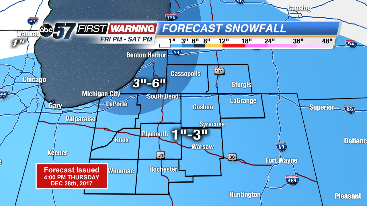
Not as cold tonight, temperatures will stay above zero but snow returns to the forecast. Light snow, less than an inch for most the area Thursday night into Friday morning.
The big question will be if we break 20 on Friday, it’s the only day that it could happen in the next week. The warm-up will precede a clipper system that will bring area-wide significant snowfall Friday night and Saturday. A widespread one to three inches is likely Friday night with lake effect adding at least another one to three Saturday, for some. Bitter cold returns for New Year’s with lows falling back below zero early next week.
Tonight: Light snow showers, low of 8.
Friday: Mostly cloudy, snow starting by the evening, high of 18.
Saturday: Lake effect snow, high of 14.
Sunday: Mostly cloudy, highs in the low teens.