Roller coaster temperatures with week with no sign of true winter
By: Emily Kennedy
Posted: Jan 6, 2020 3:09 AM EDT

-
1:04

Overall pleasant for Michiana
-
1:52

South Bend Common Council issues an official apology to residents...
-
0:54

Slightly cool out the door
-
1:54

Suspect identified, charged in fatal hit-and-run of Timothy Johnson
-
0:39

Prairie Street Cemetery works to clear storm damage
-
1:36

Reaching out for support gives father a second chance in life
-
2:08

St. Joseph County police investigating Bypass incident from Saturday...
-
2:07

Color guard coach charged with Sexual Misconduct with a Minor
-
1:09

Pleasant for the rest of today
-
0:52

Still raining out the door
-
1:17

The 80s return next week
-
1:22

Rain showers for the rest of the day

Monday, January 6th, 2020
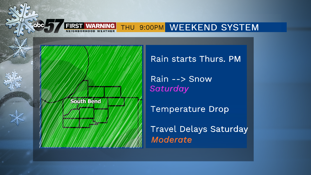
Plenty of sunshine today, making it a perfect day to take down the Christmas lights if you haven't yet. Clouds start to move back in tomorrow and as a week cold front moves through, we could briefly see snow/mix. That drops our daytime highs into the upper 20s for Wednesday with lake effect flurries possible in Michigan. We warm right back up Thursday into the mid 40s! Rain comes along with it late that evening and will last into Friday. Colder air start to move back in Saturday and that's when it could get messy as rain turns to snow.
Today: Mostly sunny. High of 43.
Tonight: Partly cloudy. Low of 28.
Tuesday: Mostly cloudy, slight chance of snow/mix. High of 38.
Wednesday: Partly to mostly cloudy. High of 28.
Sign up for the ABC 57 Newsletter