Round Three: More heavy rain overnight

-
1:45

Windy and wet this weekend, but unseasonable warmth as well
-
3:13

Local players react to $3 million investment in Byer Softball...
-
0:32

Layoffs at Whirlpool could affect workers in Benton Harbor
-
1:03

Annual District Sisterhood Conference at Ivy Tech empowers students
-
1:49

Back home in downtown South Bend, YMCA to open new location
-
2:16

This week’s ABC57 Cub Reporter is Nicholas Zentz
-
3:05

Amazon Web Services invests $11 billion to build data center...
-
4:05

Riley High School student center stage at the NFL Draft
-
1:35

Rain, wind, and milder temperatures forecast this weekend
-
2:49

Joe Alt expected to be drafted in the first round of NFL Draft
-
2:11

Students gearing up for local careers in Manufacturing
-
2:13

Sunny today, but expect a wetter and warmer weekend

Update: Round three will bring another round of heavy rain after midnight, lightning and thunder. The severe threat remains low but flooded roads my persist into Tuesday morning.
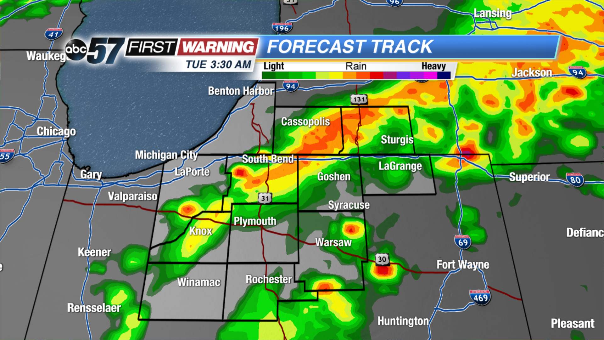
Another round of thunderstorms will roll through Michiana this evening. The window for possible severe weather and flooding will be between 7 PM and midnight. Threats include gusty wind, hail, lightning, heavy rain and flooding.
Showers start Tuesday, then clouds gradually break the rest of the day. A few much needed dry days return to the forecast midweek. Wednesday and Thursday will be drier and less humid with sunshine. The humidity build again to end the week along with the chance of showers and Thunderstorms.
Tonight: Thunderstorms are likely, showers linger into the morning, low 62.
Tuesday: Morning showers, gradually clearing, high 72.
Wednesday: Mostly sunny, highs in the mid-70s.
Thursday: Mostly sunny, highs in the mid-70s.