



ABC57 First Warning Neighborhood Weather Forecast
Monday, October 11th, 2021
Today starts out partly cloudy but clouds will increase through the afternoon. Storms arrive around dinner time and as they move in, they could be strong/severe. The severe threat timeframe is from 5pm until 10pm. The main threats are heavy rain, strong wind, and an isolated tornado.
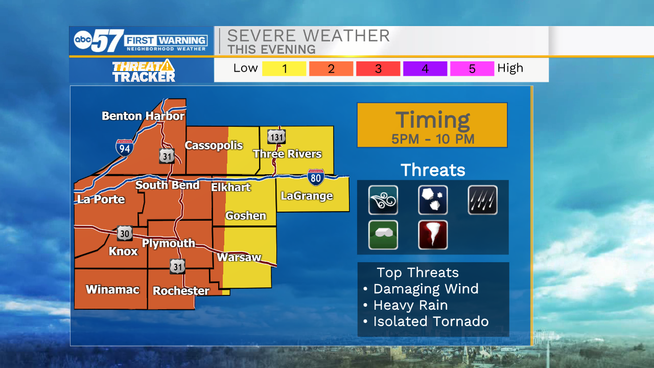
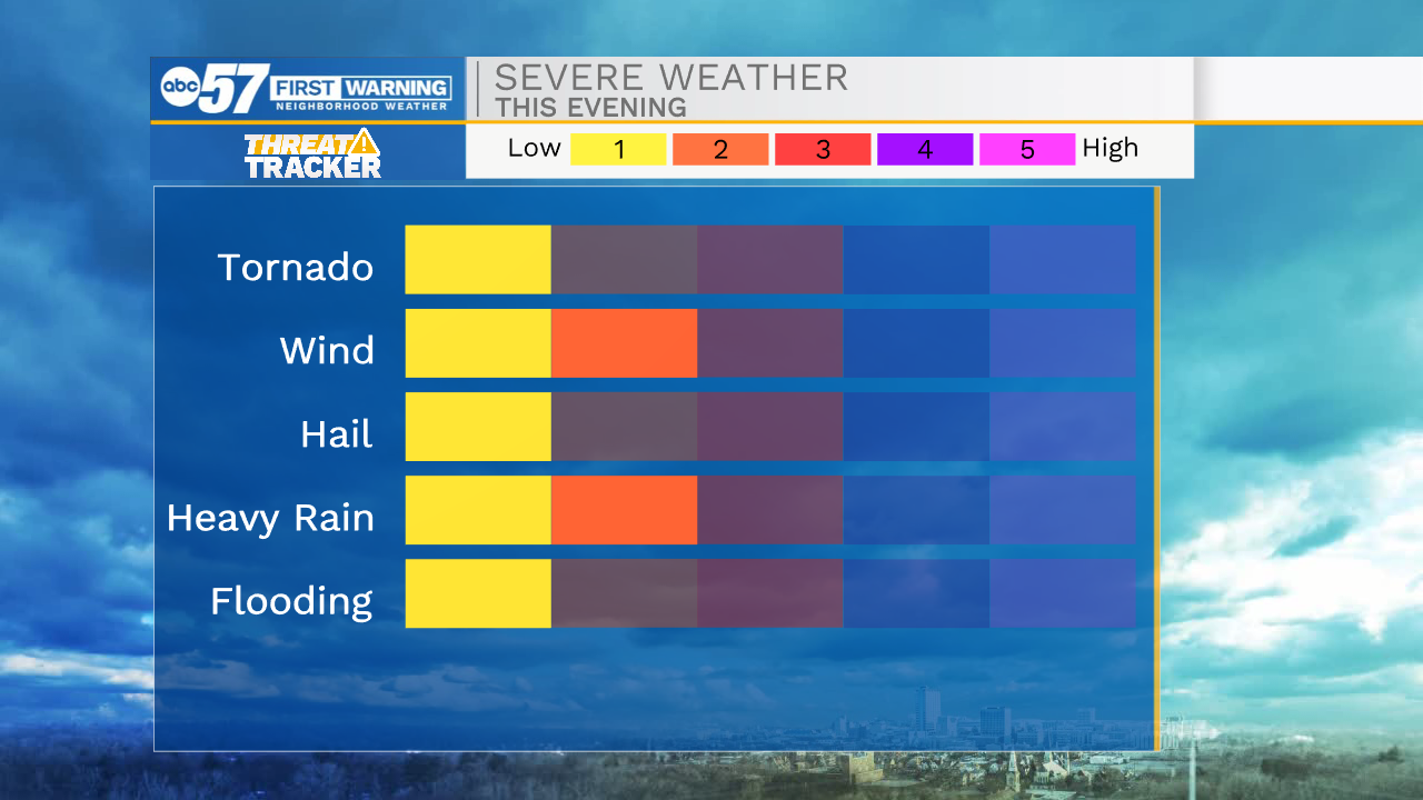
Scattered thunderstorms continue overnight but start to clear by early Tuesday. A few more clouds will hang around for part of Tuesday with more sunshine on Wednesday. Another round of showers and storms moves through Wednesday night into Thursday morning. The chance of rain continues for Friday and true fall weather arrives behind it over the weekend.
Today: Evening storms, strong/severe possible. High 82.
Tonight: Scattered thunderstorms. Low 60.
Tuesday: Mostly to partly cloudy. High 72.
Wednesday: Partly cloudy, shower chance Late. High 76.