Some chances for stronger storms today


We have a few severe weather ingredients that will be in play later this afternoon. First off is the CAPE, or storm energy.
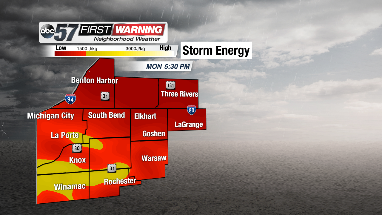
Notice the yellows and bright yellows sweeping in from the south and west. These aren't incredibly high numbers, but it'll be enough to support a few stronger storms. The southwestern portion of our area has the best chance of seeing those stronger storms based on the storm energy alone.
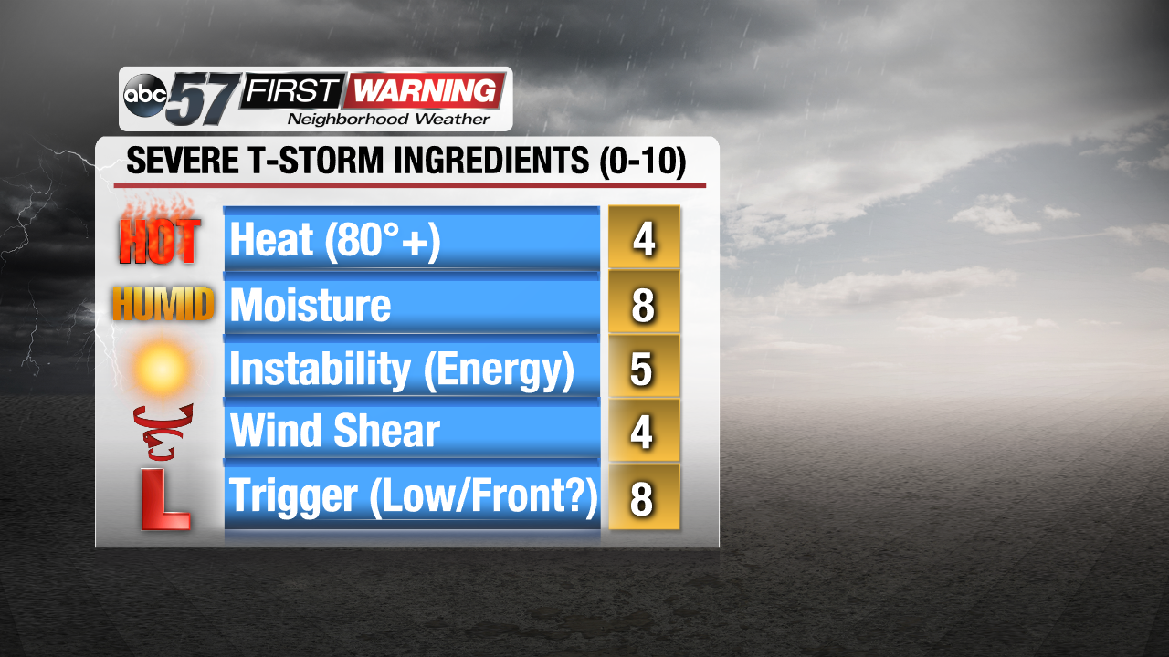
Taking a look at other factors today, we have the trigger for sure as the low pressure system and warm front will be moving in today, allowing the showers and storms to fire up. The mugginess will only increase throughout the day as well, providing plenty of moisture for storms, and also adding to the threat of heavy rain. Heat, wind shear, and overall storm energy are in fair supply, translating to a low severe threat for today, but it's always a good idea to be weather aware.
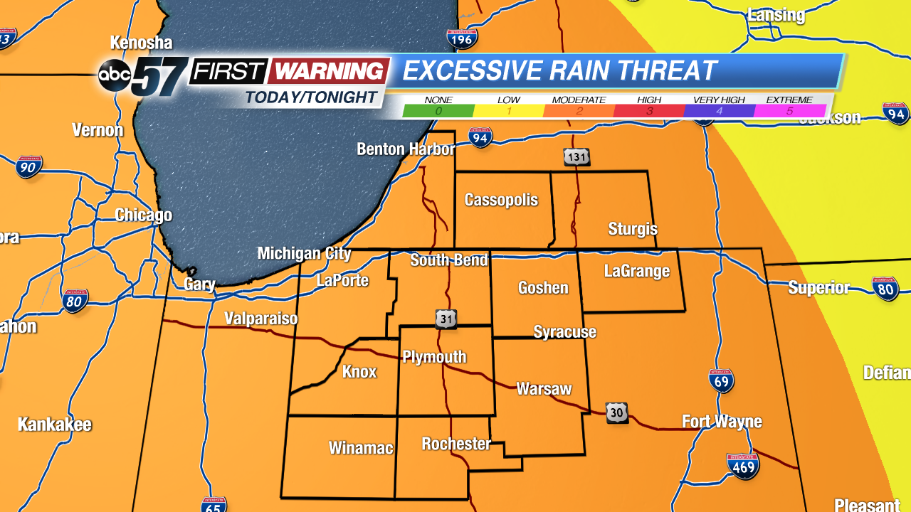
The other problem we have eyes on is the localized flooding, or even street flooding, could be possible this afternoon. Take a look at what the Weather Prediction Center has put out for our area. We're under the moderate risk area for seeing the heavy rain today and tonight, which could lead to flash flooding in isolated areas. It'll really depend on what the heaviest of the storms set up later today. 1 to 2 inches or more is possible today and tomorrow, with locally higher amounts under thunderstorms. Just know that the concern for excessive rain exists later today, especially in western and central Michiana.
And if you find a road that has been washed out, please turn around and find another way to your destination.
For more on today's heavy rain potential, check out the video here: