Staying cold, light snow through midweek
Posted: Dec 4, 2018 4:36 PM EDT

-
4:24

Michiana Crime Stoppers shredding event
-
1:16

’IvyCares’ program setting students up for success in and...
-
1:45

Windy and wet this weekend, but unseasonable warmth as well
-
3:13

Local players react to $3 million investment in Byer Softball...
-
0:32

Layoffs at Whirlpool could affect workers in Benton Harbor
-
1:03

Annual District Sisterhood Conference at Ivy Tech empowers students
-
1:49

Back home in downtown South Bend, YMCA to open new location
-
2:16

This week’s ABC57 Cub Reporter is Nicholas Zentz
-
3:05

Amazon Web Services invests $11 billion to build data center...
-
4:05

Riley High School student center stage at the NFL Draft
-
1:35

Rain, wind, and milder temperatures forecast this weekend
-
2:49

Joe Alt expected to be drafted in the first round of NFL Draft

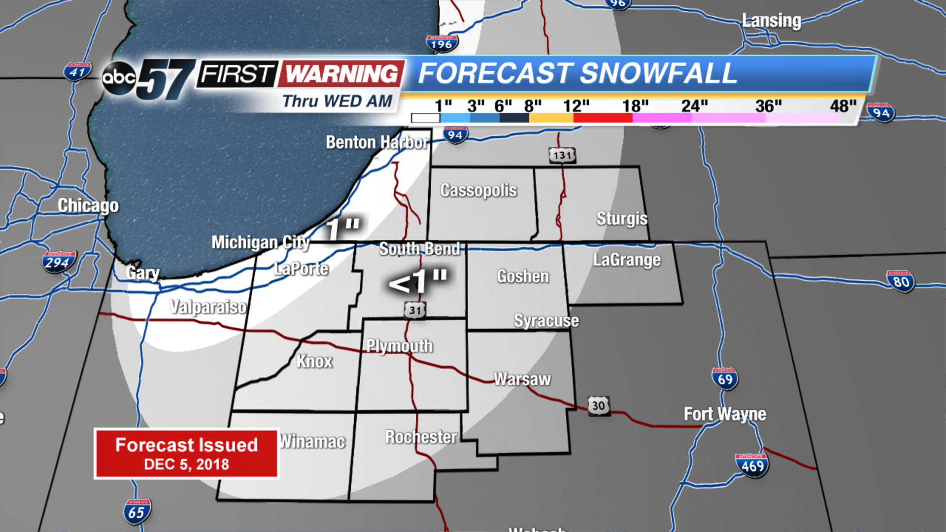
Light lake effect snow showers start Wednesday, up to an inch of accumulation is possible. The wind changes direction ahead of cold front but temperatures do little warming. Light snow is likely again Thursday morning, early estimates still on the order of around one inch. Major change to end the week, the forecast is still cold but sunshine looks to dominate the forecast through the weekend. Next week trends milder.
Tonight: Mostly cloudy with a chance of lake effect snow showers. Low of 24.
Wednesday: Mostly cloudy with lake effect ending early, then partly sunny. High of 32.
Thursday: Light snow early, mostly cloudy and breezy. High of 32.
Friday: Partly cloudy, high of 28.
Sign up for the ABC 57Newsletter