
-
1:25

Mild for now, Rainy Father’s Day
-
1:59

Madison Lifestyle District Development construction is underway
-
1:45

Latest rain reports, Much quieter today
-
0:52

Benton Harbor moving forward with Buss Avenue property renovations
-
1:38

Community tornado shelters open in rural counties ahead of storm...
-
2:21

Microsoft breaks ground on new Data Center in La Porte, Indiana
-
3:43

Demolition underway to make room for Colfax Corner development
-
5:20

CARE University helping support college students day to day
-
5:34

Suspect dead after officer-involved shooting on South Bend’s...
-
1:45

The rain and storm threat clear this evening
-
2:32

Some optimism that the risk for severe weather is slightly decreasing
-
1:07

What’s expected from the Fed’s interest rate decision Wednesday

They severe threat is lowering, but thunderstorms are still likely. There is limited energy for storms to ramp-up to severe, and clouds ahead of the storms will only continue to reduce that factor. Plan on a round of rain this evening with thunder and lightning. There still could be severe weather, straight line wind, even a tornado but that threat is likely isolated.
Temperatures start to cool this week, 70s through midweek and 60s by the weekend. The next fall front hits Thursday into Friday with rain likely. This weekend is fair and much cooler, highs in the 60s.
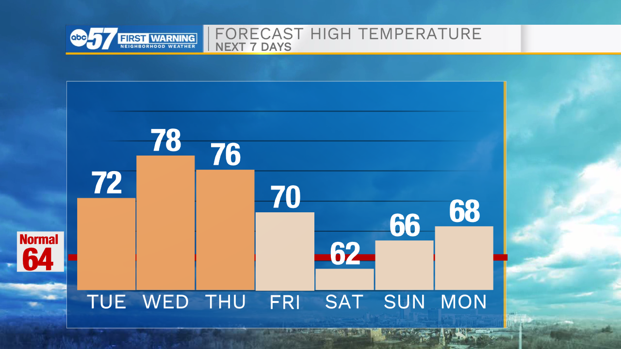
Tonight: Scattered thunderstorms. Low 60.
Tuesday: Mostly to partly cloudy. High 72.
Wednesday: Partly cloudy. High 78.
Thursday: Rain showers. High 76
Sign up for the ABC 57 Newsletter