
-
0:57

Warmer stepping out the door
-
3:52

Hyperscale CEO hears residents concerns over expanding Dowagiac...
-
0:50

City of South Bend addresses trouble some short-term rentals
-
1:56

Lake Michigan Hills celebrates its 66th annual Chamber Golf Outing
-
1:56

Fun and 4H at the LaGrange County Fair
-
1:44

La Porte County workers take precautions during this week’s...
-
2:23

Mark Quatrani’s standout season at Notre Dame ends with selection...
-
2:50

Jack Radel becomes Notre Dame’s highest MLB draft pick in more...
-
2:38

Explosive diarrhea cases on the rise in Michigan
-
3:44

Investigation into Friday’s State Trooper shooting under investigation,...
-
3:30

Law enforcement officers react to rash of NW Indiana officers...
-
2:51

South Bend neighbors react to talks of regulations on short-term...

Temperatures climb and the humidity spikes this weekend. Highs in the 90s and a heat index near 100 will make for hazardously hot conditions. Practice heat safety keeping cool and staying hydrated. The chance of isolated showers and storms will also be in the forecast, the best chance coming early Saturday.
The heat breaks Monday night with a strong cold front that is likely to produce a line of thunderstorms that could be strong to severe. Timing of the front will critical in forecasting the likelihood of severe weather.
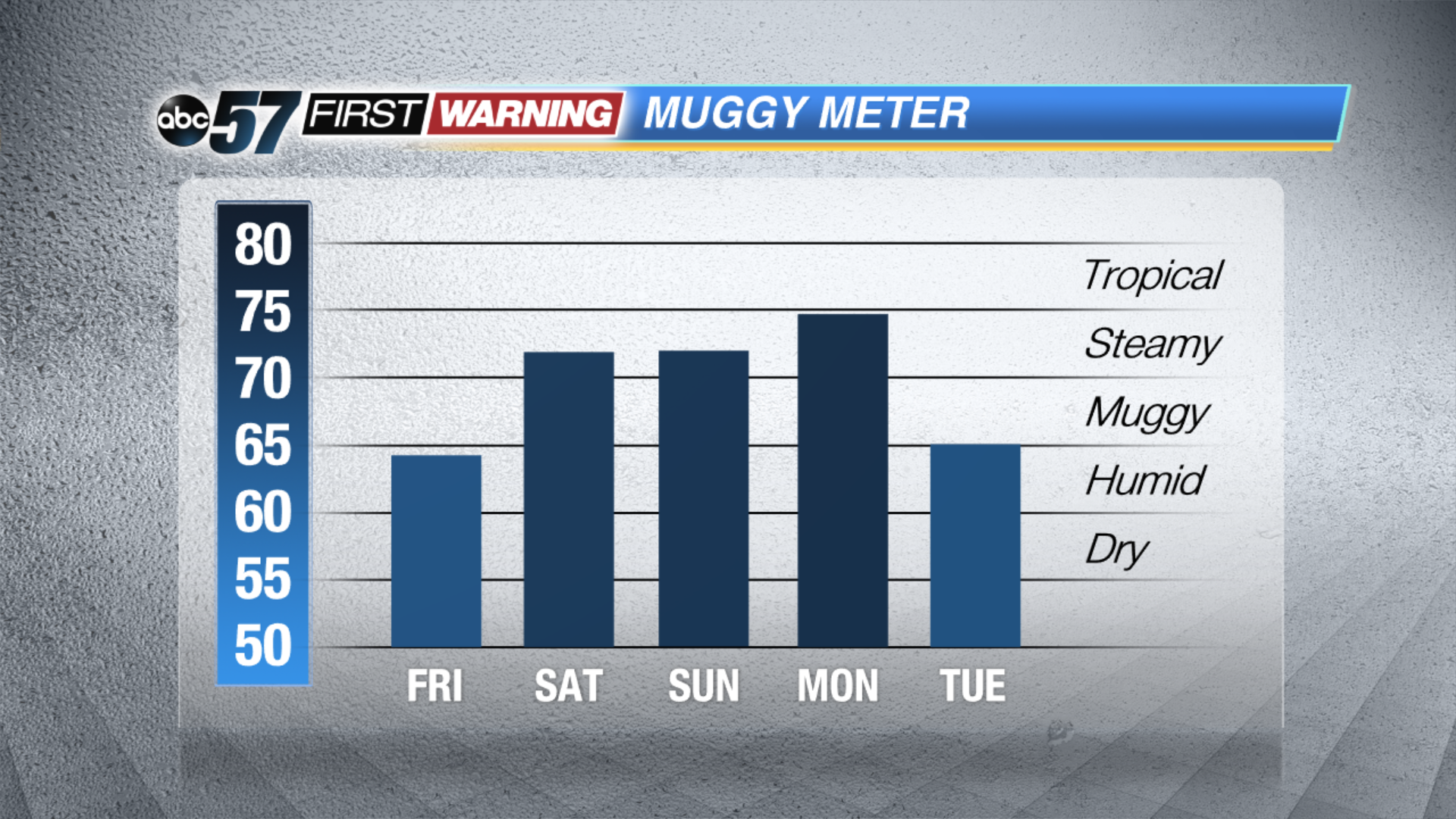
Tonight: Mostly clear, low of 60.
Friday: Mostly sunny, high of 86.
Saturday: Partly cloudy, mainly AM isolated t-storms, high of 90.
Sunday: Hot and humid, highs in the low to mid 90s, heat index near 100.
Sign up for the ABC 57 Newsletter