ABC57 First Warning Neighborhood Weather Forecast
Tuesday, June 8th, 2021
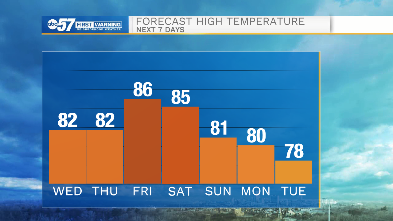
The wet week continues today with isolated showers and storms possible after lunch. You'll see some sunshine today too with partly cloudy skies at times. The heat and humidity stick with us through the week so you need to keep the A/C on. Thunderstorms are more scattered on Wednesday and Thursday as an area of low pressure passes through. Friday and Saturday look brighter with just a stray shower or storm possible. Finally on Sunday, it'll be completely dry with less humidity and just a little cooler.
Today: Partly cloudy with isolated showers and thunderstorms. High 83.
Tonight: Mostly cloudy with showers possible late. Low 68.
Wednesday: Mostly cloudy with scattered showers and thunderstorms. High 82.
Thursday: Partly sunny with a chance of showers and thunderstorms. High 82.