

-
3:01

Michiana counties continue storm cleanup efforts with federal...
-
2:08

Wheezer previews new album alongside fans at Ignition Music Garage
-
2:48

Kyngstonn Viliamu-Asa returns to full-contact work as Notre Dame...
-
1:17

Drier to start week
-
0:49

Morning storms end a wet week
-
2:33

Photos and videos coming out of Milford community after FBI search...
-
2:09

Taste of Niles brings community members to taste local food and...
-
1:12

Art Beat 2026 brought more than 600 artists to South Bend
-
1:46

Severe weather less likely, more prevalent heavy rain threat
-
0:38

One person left injured after early morning shooting on Saturday
-
1:01

Potentially severe weather through today
-
2:39

Residents of La Porte County work together after severe weather...

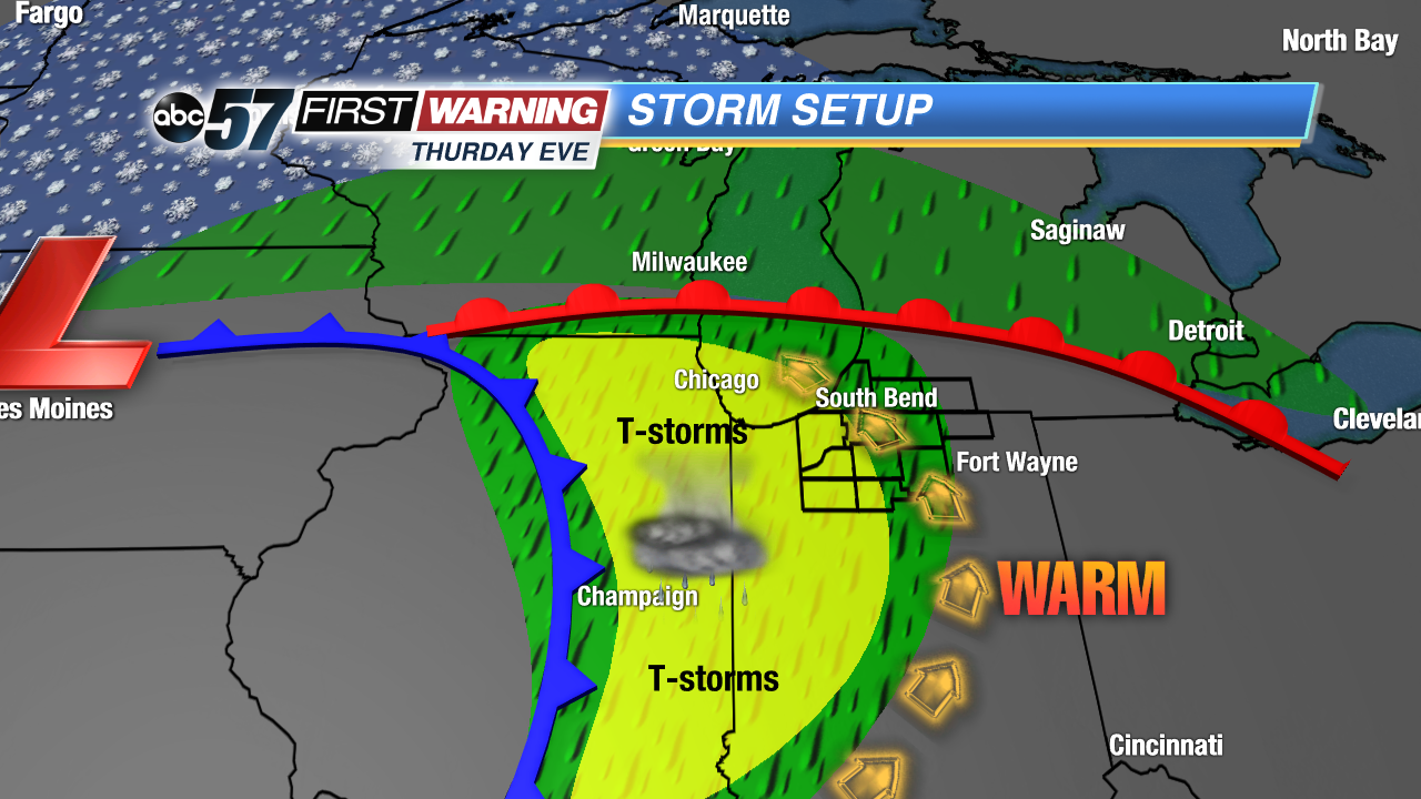
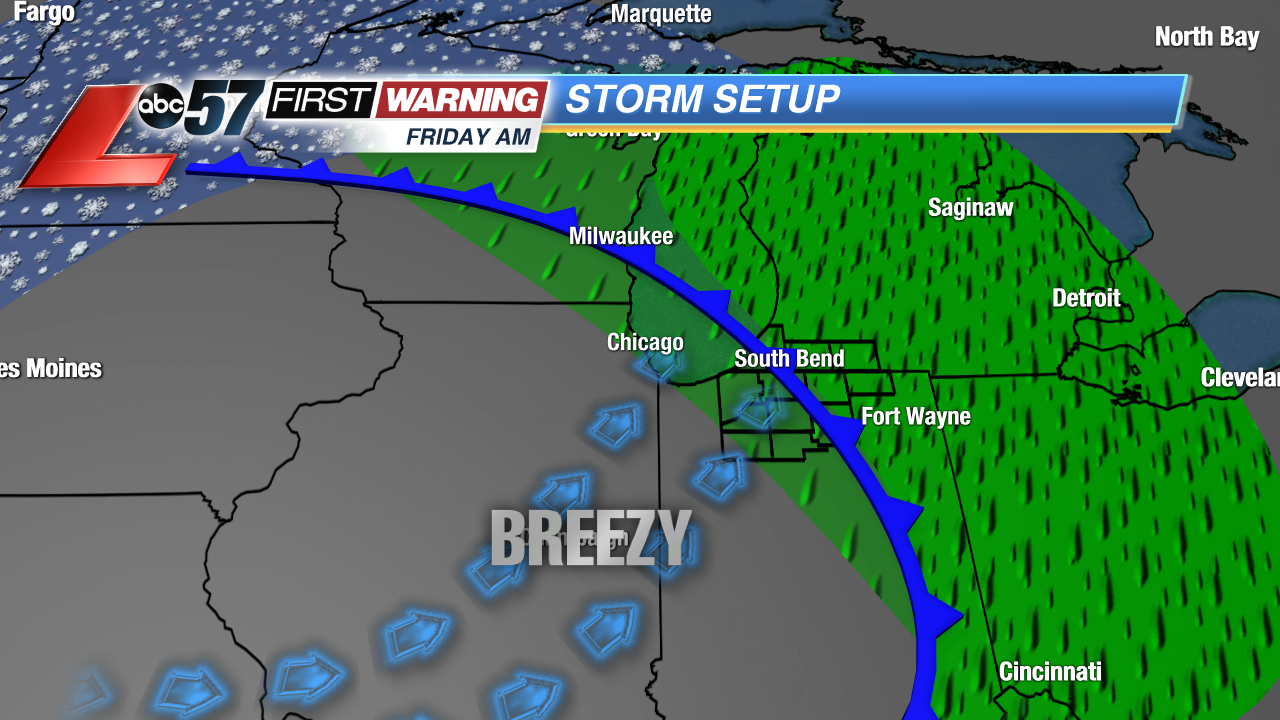
Temperatures surge Thursday. The day starts in the upper 30s and ends in the low 70s by the early evening. The sudden warm-up is fed by a strong southerly breeze. The approaching cold front from this system will produce heavy rain and possibly thunderstorms overnight into Friday. A few t-storms could be strong to severe but given the timing the overall threat remains low. The wind stays gusty into Friday as temperature fall into the weekend.
Tonight: Mostly cloudy, low of 38.
Thursday: Breezy, chance of evening rain/storms, high of 72.
Friday: Breezy, few morning showers, high of 55.
Saturday: Sunny, high of 52.
Sign up for the ABC 57 Newsletter