
-
1:10

Refreshing start to the day
-
2:02

La Casa de Amistad holds their very own Tianguis de los Ninos
-
1:28

Michiganders will be seeing a local ballot measure in the upcoming...
-
2:27

A South Bend nonprofit clears up confusion about its energy assistance...
-
3:44

New peninsula forms on Silver Beach due to dredging, beachgoers...
-
3:19

Notre Dame’s Coaches vs. Cancer Golf Classic tops $5 million...
-
1:02

South Bend bomb squad and US Air Force part of Tuesday morning...
-
0:43

Harbor Shores Community Redevelopment begins next phase of St....
-
1:29

Pleasant day, bad for beachgoers
-
2:55

Outdoor summer festival coming to South Bend Saturday
-
0:57

Scattered storms through early morning
-
2:13

Microsoft to partner with Ivy Tech in La Porte to launch Data...

Warm and very humid weather will be the forecast the rest of the week. The head index will be 90 or above each afternoon with dewpoints in the 70s. This will likely be the muggiest air so far this season. The extreme mugginess will fuel the day-night cycle of thunderstorms. Storms could once again produce heavy downpours along with the possibility of flooding. The patter does not break until next week.
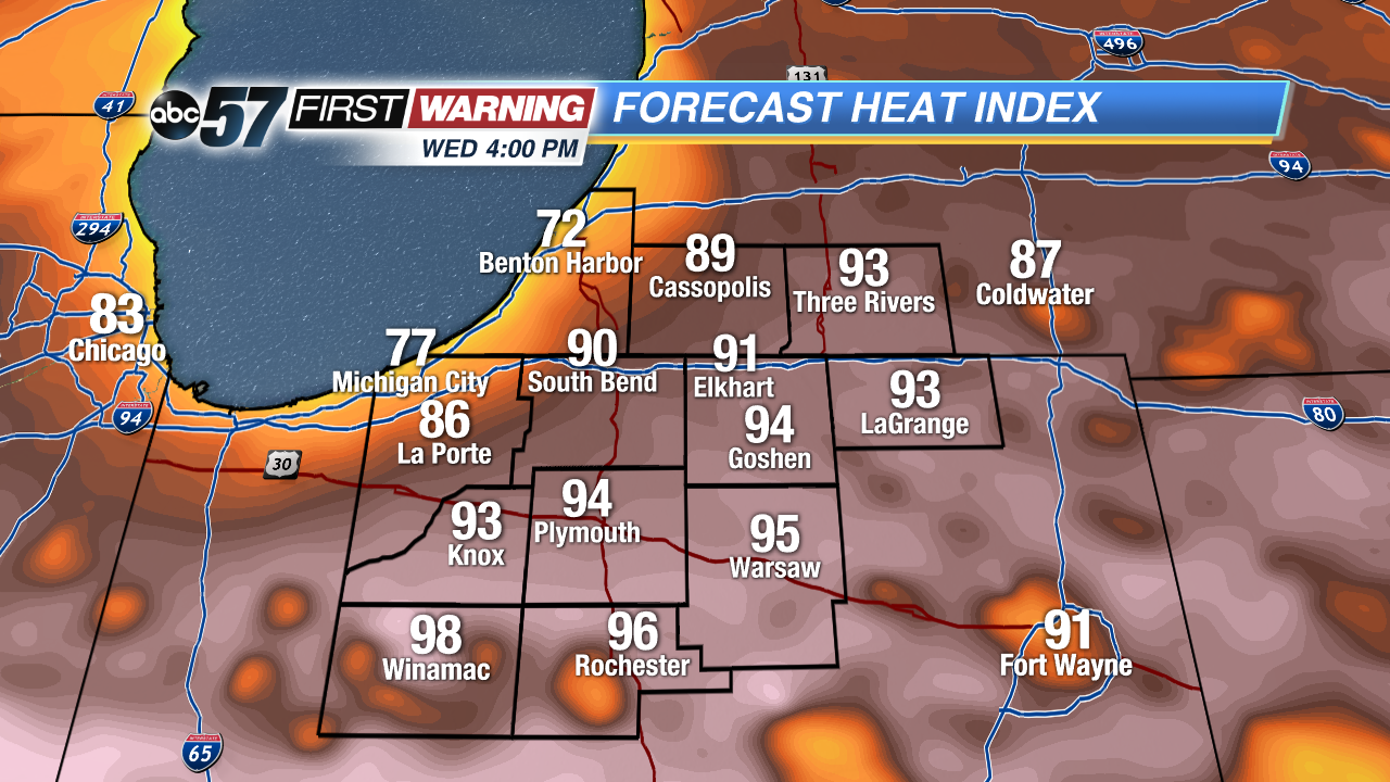 Heat index Wednesday afternoon well into the 90s for most the area.
Tonight: Mostly to partly cloudy, low 66.
Wednesday: Partly cloudy, high 87, isolated showers/storms.
Thursday: Very humid, partly cloudy, afternoon thunderstorms, high 90.
Friday: Very humid, partly cloudy, afternoon thunderstorms, high 88.
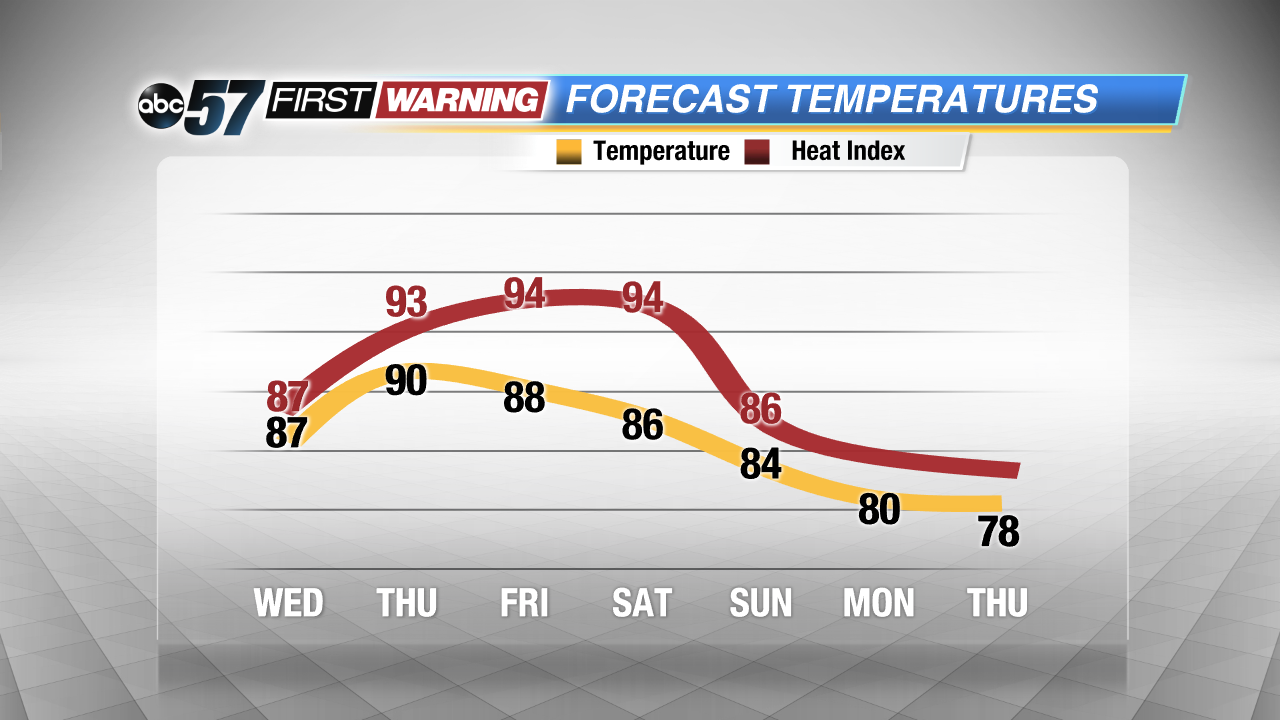 Extremely steamy through the weekend, no relief until early next week.
Sign up for the ABC 57 Newsletter