Wet start to the week and warming up

-
2:38

Marshall County Blueberry Festival returns Sept. 4-7
-
3:17

Proposed TIF District Near Granger Data Center Faces Pushback
-
0:42

Niles City Council approves solar power agreements
-
2:47

Sophomore quarterback Cortney Davis helps Riley open season with...
-
2:55

Juengst sworn in as new Elkhart police chief
-
0:47

Judge dismisses South Bend Chocolate Company lawsuit against...
-
0:57

Another pleasant day across Michiana
-
0:54

Cool for August out the door
-
1:55

Wellfield Botanic Gardens hosts 17th Annual Taste of the Gardens
-
2:27

MariachiND and Folklorico Azul y Oro bring culture to Four Winds...
-
1:12

Mild day across Michiana...besides at the beach
-
0:57

Mild and mostly dry Sunday

ABC57 First Warning Neighborhood Weather Forecast
Monday, May 17th, 2021
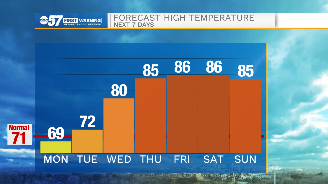
Scattered showers today with a majority of the rain falling south of the Toll Road. A couple rumbles of thunder are possible. The chance of rain continues tonight into Tuesday but daytime highs remain warm. Much warmer air moves in on Wednesday, pushing daytime highs to 80 degrees! An isolated shower or storm is possible but most of the day is dry with mostly cloudy skies. Thursday through the weekend remains in the 80s with more sunshine to enjoy outside!
Today: Mostly cloudy with scattered rain showers. High 69.
Tonight: Cloudy with a chance of rain. Low 54.
Tuesday: Mostly cloudy. Few showers possible. High 72.
Wednesday: Mostly cloudy. Isolated shower/storm possible. High 80.