Wintry mix Thursday night, still chilly Friday

-
3:13

Local players react to $3 million investment in Byer Softball...
-
0:32

Layoffs at Whirlpool could affect workers in Benton Harbor
-
1:03

Annual District Sisterhood Conference at Ivy Tech empowers students
-
1:49

Back home in downtown South Bend, YMCA to open new location
-
2:16

This week’s ABC57 Cub Reporter is Nicholas Zentz
-
3:05

Amazon Web Services invests $11 billion to build data center...
-
4:05

Riley High School student center stage at the NFL Draft
-
1:35

Rain, wind, and milder temperatures forecast this weekend
-
2:49

Joe Alt expected to be drafted in the first round of NFL Draft
-
2:11

Students gearing up for local careers in Manufacturing
-
2:13

Sunny today, but expect a wetter and warmer weekend
-
0:54

Goodwill ’Little Black Dress’ event raises funds for community...

A messy mix of rain changing to snow overnight. As with any mixed precipitation situation, temperatures are key. Most precip will fall as rain through the evening, changing to snow around midnight. Milder ground temperatures will melt most of the snow but there could be grassy accumulation and slick or slushy spots on the roads.
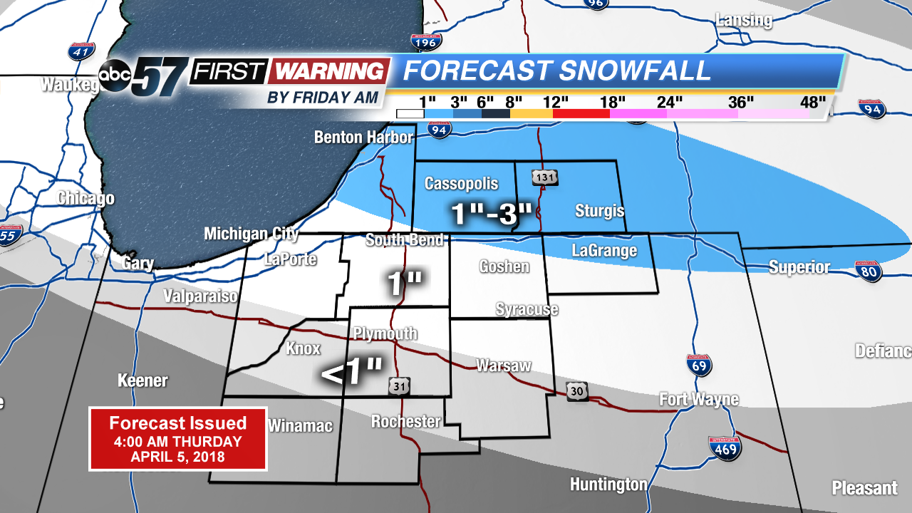
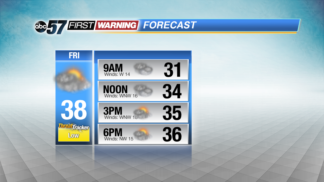
Friday, a few slick spots are possible, with a chance of morning snow or mix. The rest of the day stays chilly and mostly cloudy. The cold weather continues through the weekend, skies clear Saturday into Sunday but temperatures struggle to warm. There’s another chance of snow Sunday night, before we may see a real spring warm-up next week.
Tonight: Rain showers changing to snow, low of 30.
Friday: Mostly cloudy, chance of wintry mix early, high of 38.
Saturday: Partly cloudy to mostly sunny, high of 34.
Sunday: Partly cloudy, highs in the upper 30s.