
-
1:22

Two men facing charges in the June 7 murder of Kristina Ortiz
-
0:46

Annual Folds of Honor Charity Classic golf outing Friday
-
2:07

Severe storms possible Saturday
-
1:26

Duck, Duck, Go! Duck races at the Elkhart County 4-H Fair
-
4:12

Premier Arts debuts all-youth ’The Little Mermaid’
-
1:26

Rockin’ the 4-H Exhibit
-
4:28

Firefighter’s Blues Festival continues to serve community
-
2:30

Man identified after body pulled from river near Beardsley Avenue
-
3:22

Dealing with mosquitoes this summer
-
1:59

Sunny end to week, severe storms possible tomorrow
-
2:08

Seitz Park officially opens, showcasing its new renovations.
-
3:55

Indiana test scores reveal progressive growth in Math, flatlining...

Winter weather comes roaring back to Michiana. Temperatures will drop sharply tonight as rain changes to sleet and snow. Slick roads are the top concern, overall snow accumulation may be at a minimum but don’t let your guard down as ice is the main concern, after previous salt treatments are washed away.
Snow showers come to an end by midday Friday but temperatures won’t get any warmer. Temperatures drop into the teens with light lake effect snow showers near the lake Friday night into Saturday. The cold last through the weekend with another round of snow Monday.
Tonight: Rain changing to wintry mix and snow, low of 26. 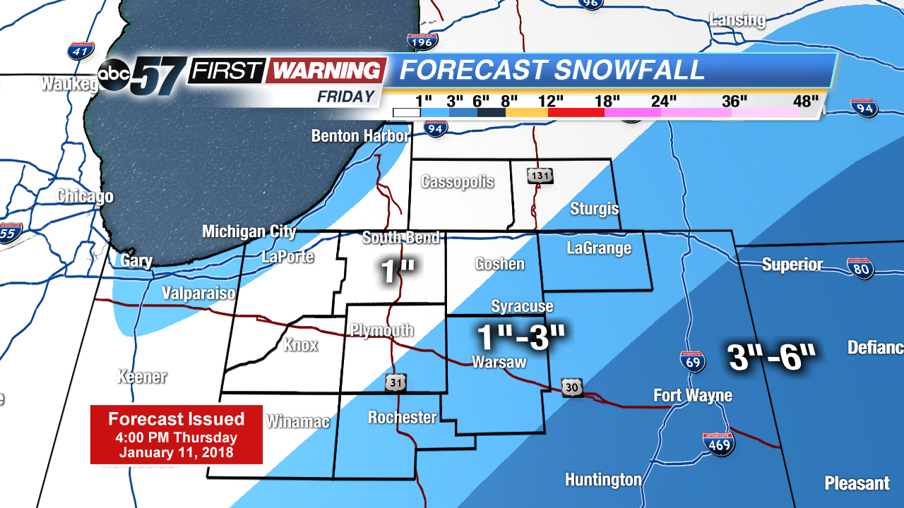 System snow Frday
Friday: Morning snow showers, high of 28.
Saturday: Mostly cloudy, lake effect snow showers, high of 20.
Sunday: Partly cloudy, high of 18.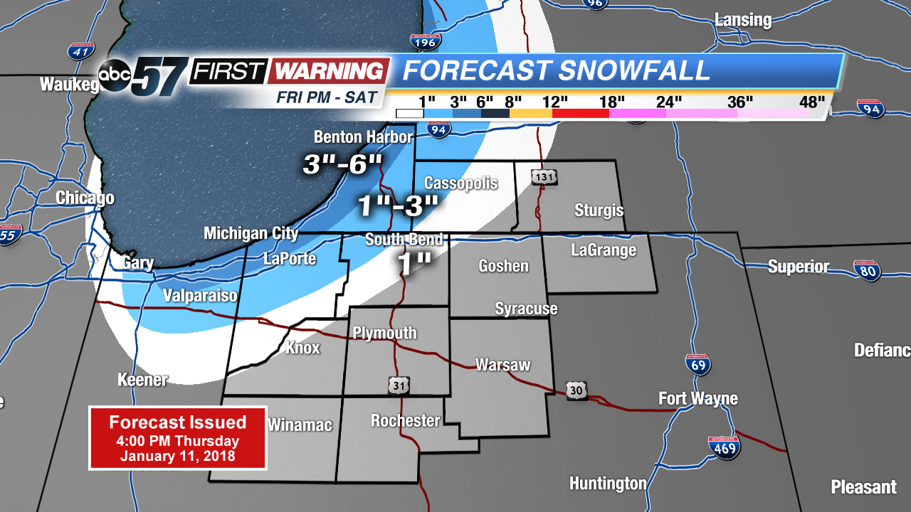 Lake effect snow Friday night through Saturday