
-
3:20

Michigan City residents raise concern about Google’s Hyperscale...
-
2:32

Residents seek answers in fatal officer-involved shooting
-
0:48

Cool conditions continue this weekend
-
0:37

Two injured in single-vehicle crash, passenger ejected from vehicle
-
0:51

Cooling and drying through morning
-
0:47

Severe threat over
-
2:22

Notre Dame and Villanova to open 2026-27 basketball season in...
-
2:41

It’s about to get more expensive to use the Toll Road
-
1:01

South Bend Mayor Mueller builds on last year’s clean-up efforts
-
1:29

A principal puckers-up for a good cause
-
0:55

Karl King Tower not designated ’Chronic Problem Property’...
-
1:22

AHEPA Senior Living brings high-demand units for low-income seniors

A break between storm systems Thursday and most of Friday. The lull will be cool and quiet before temperatures start to warm Friday afternoon. Rain starts Friday night and will last into Saturday morning. The wind also increases Friday night and will peak Saturday. Saturday afternoon and evening gusts could top 40 mph. Temperatures drop through Sunday, turning on some light lake effect snow showers.
Tonight: Mostly to partly cloudy, low 34.
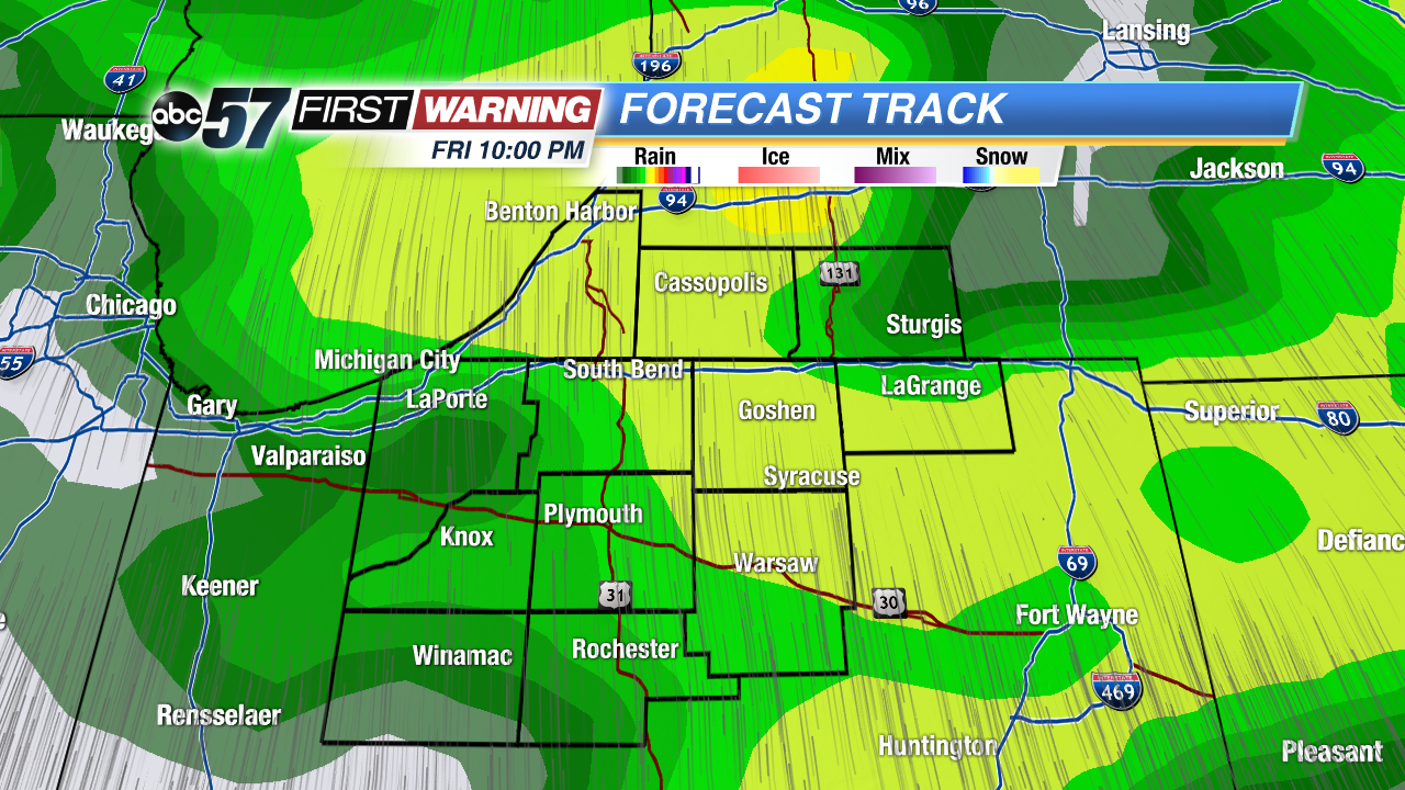 Rain begins Friday night
Thursday: Mostly to partly cloudy, high 40.
Friday: Increasing clouds and wind, rain arrives late, highs in the upper 40s.
Saturday: Rain then windy, highs near 50 but falling through the afternoon.
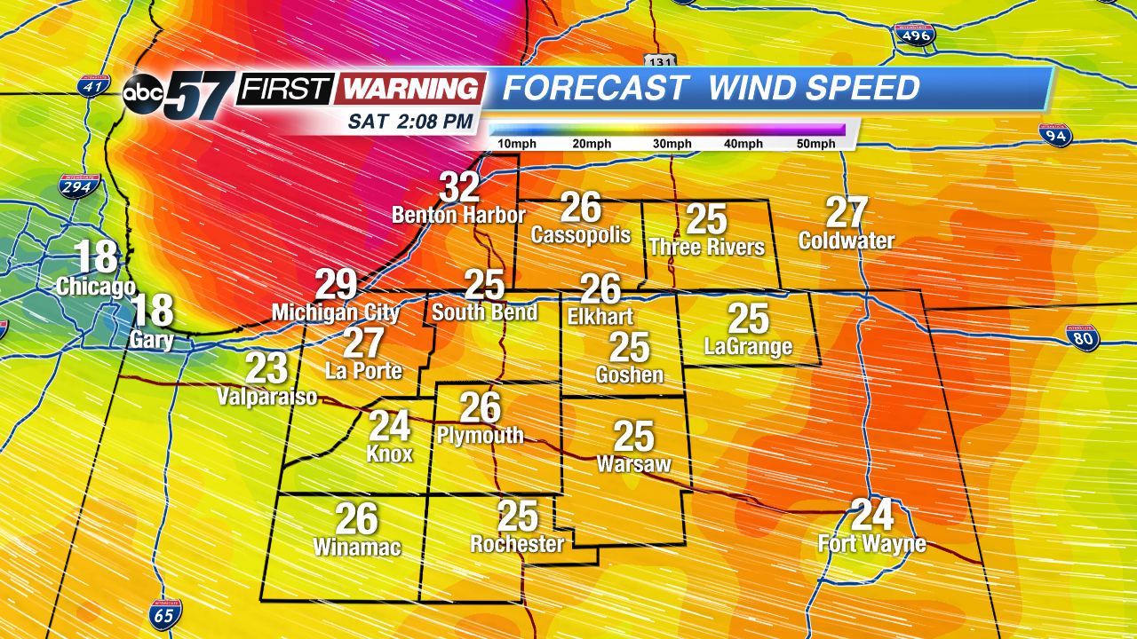 Strongest wind starts Saturday afternoon
Sign up for the ABC 57 Newsletter