
-
1:16

Chilly today, cold tonight
-
3:16

Importance of water safety with warm weather around the corner
-
5:38

Celebrate with the Ivy Tech Impact Gala
-
5:27

Magician Andy Gross comes to Goshen Theater
-
0:53

Cold and soaking rain through this morning
-
2:11

This week’s ABC57 Cub Reporter is Lucas Castillo
-
2:48

Mishawaka Mayor Dave Wood gives the State of the City address
-
3:34

Indiana leads the U.S. in gas price increases
-
1:31

The Great Futures Breakfast held by the Elkhart Boys & Girls...
-
1:10

Boys & Girls Club of Benton Harbor wins a violence prevention...
-
2:28

Local landscaper turns heads with his manicured lawns and young...
-
2:38

Skylar Diggins returns to the Midwest as Chicago Sky look for...

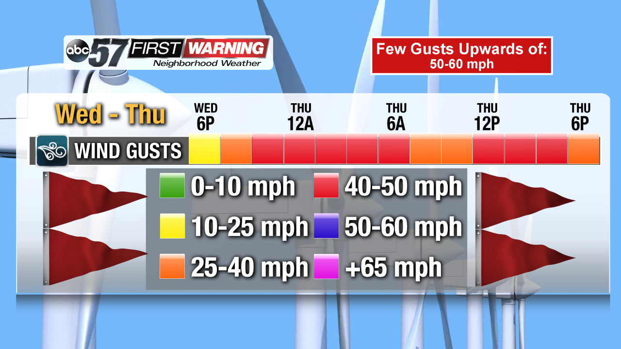
A wet and windy midweek in the forecast. Rain showers start Wednesday and will stay in the forecast off-and-on through Thursday. The wind will increase through Wednesday, with gusts as high as 30 mph and peaking in the 45 to 50 mph range Thursday. Heavier rain showers and even thunderstorms are possible Thursday. Temperatures rise from the 50s into the 60s before falling Friday. The weekend is colder but fair.
Tonight: Cloudy, chance of rain, low of 38.
Wednesday: Scattered showers, becoming breezy, high of 58.
Thursday: Windy, gusts up to 50 mph, rain likely and thunder possible, high of 66.
Friday: Mostly cloudy, chance of snow as temperatures fall from 44.
More on Why It's So Windy
Sign up for the ABC 57 Newsletter