
-
2:43

Cubs clobber White Sox in first game of ’Crosstown Classic’
-
2:00

South Bend Police Department honors the fallen
-
0:52

St. Joe/Benton Harbor Rotary holds ribbon-cutting ceremony for...
-
2:25

Irish lacrosse head to NCAA quarterfinals with Johns Hopkins...
-
3:09

Cubs, White Sox open first Crosstown Classic series of summer...
-
3:45

South Bend Cubs dedicate plaque to Indiana born composer of ’Take...
-
1:52

Concord fourth graders launch weather balloon following months...
-
4:55

Gus Macker 3-on-3 basketball tournament returns to Benton Harbor
-
4:38

Discon at the Carousel 2026
-
2:28

Registration open for ’Gus Macker on The River’
-
3:01

Makers Collective Market features local small businesses
-
1:01

Breezy but warming up today

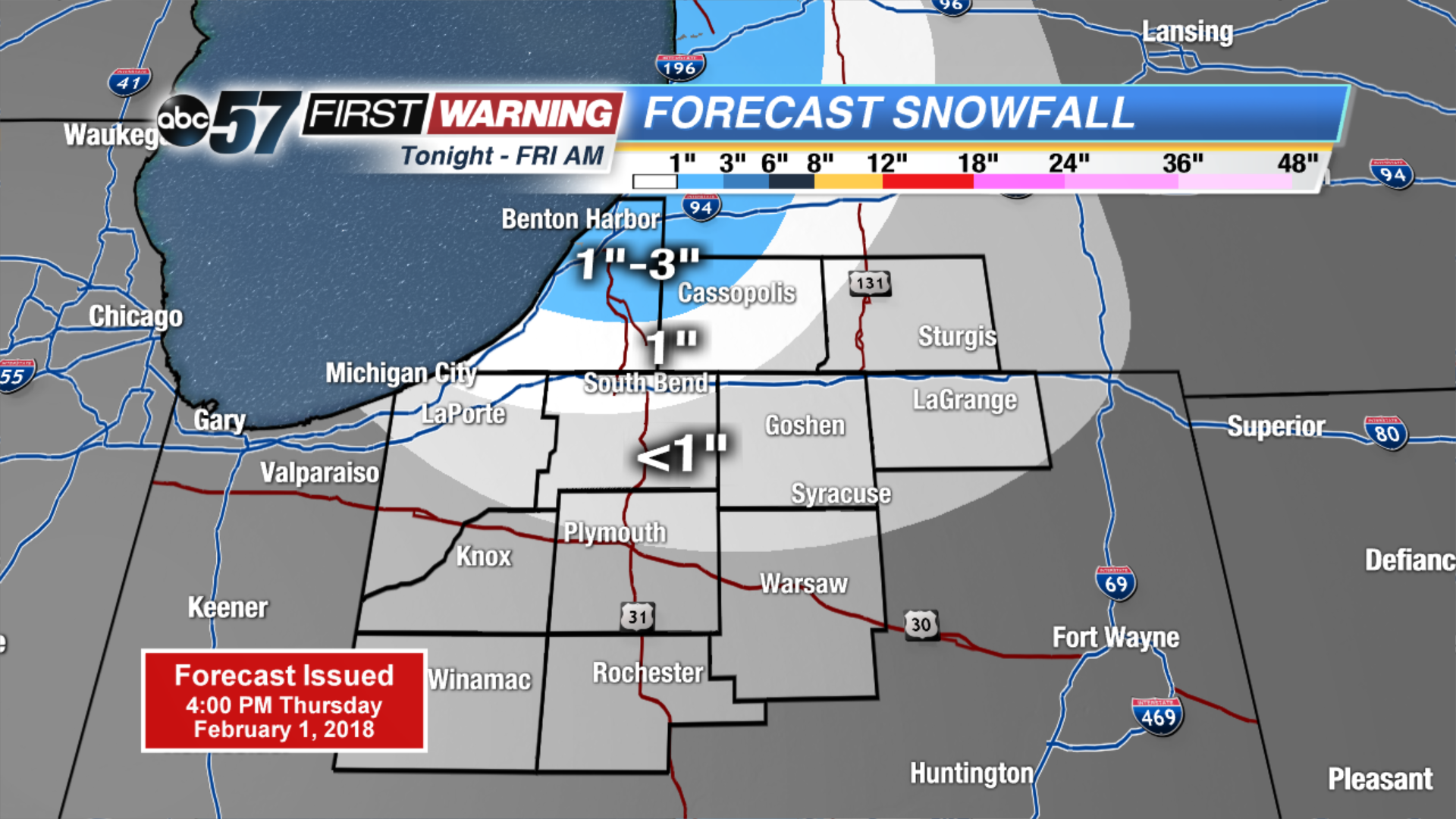
Light lake effect snow showers Thursday night into Friday morning, accumulation up to one inch possible.
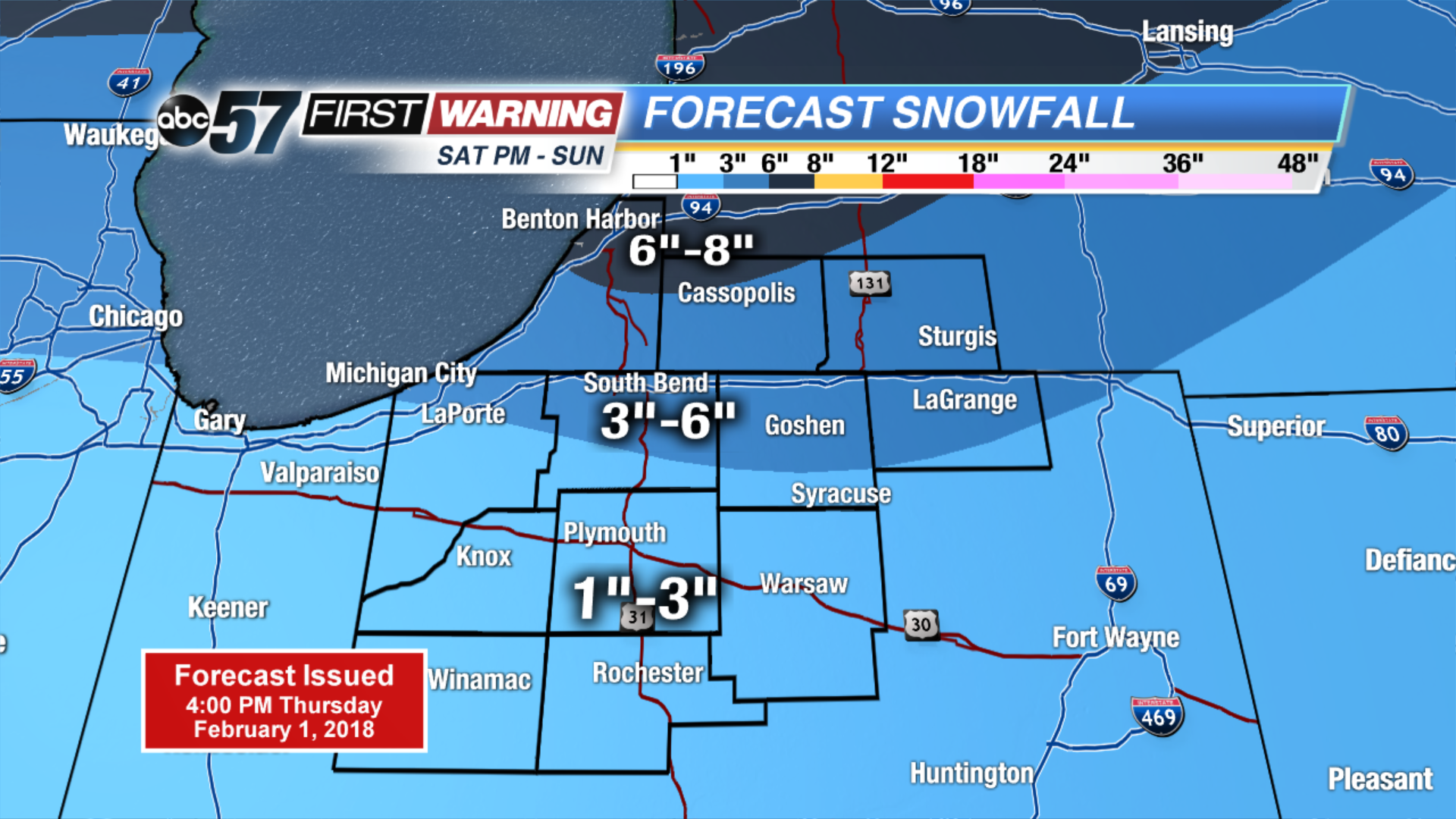
The cold and snowy pattern returns. Light snow and flurries end Friday morning, but temperatures will struggle to break 20. The next round of snow arrives Saturday afternoon and lasts through Sunday. Accumulation of at least three inches is likely for most. The pattern shows no changes for next week with a chance of snow every other day.
Tonight: Mostly cloudy, lake effect snow, low of 10.
Friday: Partly cloudy, chance of snow early, high of 18.
Saturday: Snow by the afternoon, high of 32.
Sunday: Snow showers through midday, highs in the upper 20s.
Sign up for the ABC 57 Newsletter