Cold front arrives before midnight Friday, showers and storms follow
By:
Tom Coomes
Posted: May 20, 2022 8:04 PM EDT

-
4:26

Safety tips for the warmer weather ahead
-
0:58

Washington Park Zookeepers in stable condition after wolf attack
-
0:34

Bristol holds town meeting to discuss a possible data center...
-
2:52

New Northwoods League team coming to Dune Coast in 2027
-
1:15

South Bend Human Rights Commission holds a workshop on fair housing...
-
2:32

Ribbon cutting ceremony held to officially reopen the updated...
-
2:37

Gov. Braun extends IN gas tax suspension, maintaining lowest...
-
2:36

Cass County resource fair features housing, legal and domestic...
-
1:39

Greek Taverna Night honors St. Andrew Greek Orthodox Church’s...
-
3:07

After South Bend Police Tapes ruling, attorneys inform Common...
-
2:57

Knicks defeat the San Antonio Spurs in the first game of the...
-
1:54

Lottery players react to Hoosier Lottery pulling misleading Space...

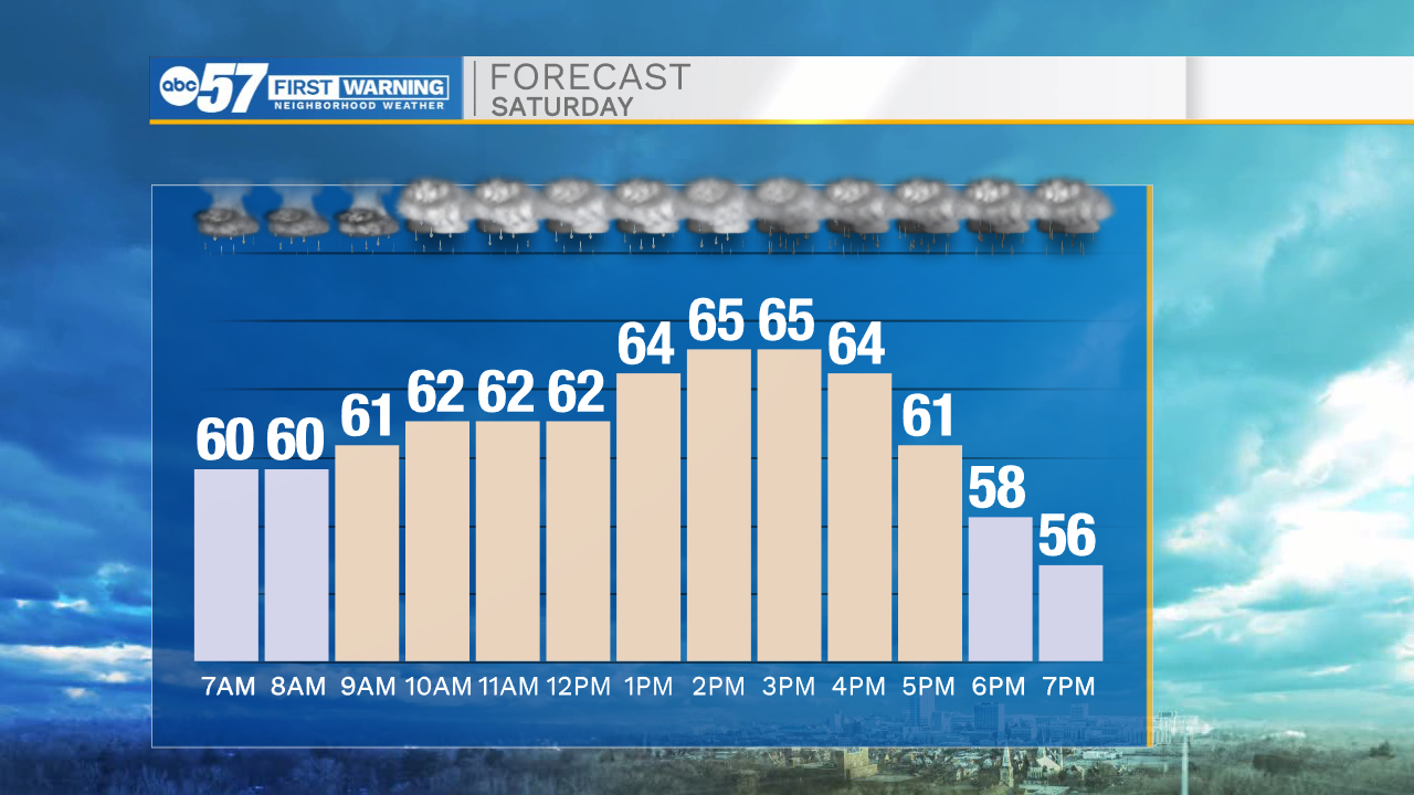
The cold front moves through Michiana early Saturday, bringing with it showers and thunderstorms. The front likely stalls between Plymouth and Ft. Wayne Saturday, keeping the area under rounds of rain, but the storm threat is to the southeast. Severe weather is unlikely. Temperatures will be cool to mild through most of next week.

Tonight: Rain and thunderstorms. Low 60.
Saturday: Rounds of rain. High 66.
Sunday: Mostly cloudy and cooler. High 60
Monday: Mostly sunny. High 66
Sign up for the ABC 57 Newsletter