
-
3:45

Two children taken to Emergency Room after exposure to chemicals...
-
2:20

Penn, Mishawaka meet for sectional title with regional berth...
-
3:23

New Day Intake Center is nearing construction eight months after...
-
2:55

Nearby homeowners express frustrations with Elkhart drivers going...
-
3:41

A Goshen family pushes to grow their family
-
2:01

Chunk’s Ice Cream gets ready to celebrate its second anniversary
-
2:22

Bluegrass Festival celebrates local artists in Niles
-
0:51

PokeDen updates its space for a shop like experience
-
1:00

Another pleasant day for our area
-
1:00

Slightly cooler out the door today
-
1:03

Mentone Egg festival brings a clutch of people to enjoy its history
-
0:46

9th annual Hall of Heroes Comic Con concludes its first day

A cold weekend, with light snowfall. Lake effect snow ends Saturday morning, the highest totals are closer to Lake Michigan. The temperature struggles to stay above 20 this weekend and lows near the single digits. There is a second round of snow Sunday afternoon, but that looks to be rather light and low impact for the area. Next week, temperatures warm to 50 Wednesday and as temperatures fall Thursday heavy rain is possible before a change-over to snow. Stay tuned for a possible (minor) flood threat.
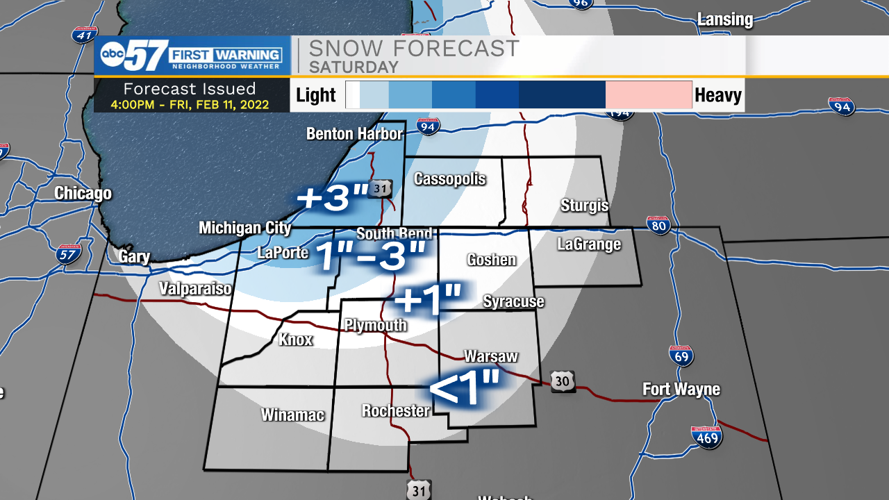
Tonight: Lake effect snow Low 18.
Saturday: AM snow showers. Mostly cloudy and cold. High 22.
Sunday: Mostly cloudy, PM light snow. High 22.
Monday: Partly cloudy. High 28.
Sign up for the ABC 57 Newsletter