
-
4:55

Gus Macker 3-on-3 basketball tournament returns to Benton Harbor
-
4:38

Discon at the Carousel 2026
-
2:28

Registration open for ’Gus Macker on The River’
-
3:01

Makers Collective Market features local small businesses
-
1:01

Breezy but warming up today
-
1:18

Cloudy with hit-or-miss showers early
-
2:35

A lost dog was found two years later due to the info on his ’chip’
-
2:07

Holding Michiana’s Lawmakers Accountable: Reaching out to Rep....
-
3:51

Roseland Town Council President, Mike Schalk, addresses accusations...
-
1:09

Indiana State Police, Bremen Post, holds annual memorial service
-
3:08

Increased security coming to Karl King Tower under IN AG compliance...
-
2:06

Eighth annual Special Olympics Unified Champions Game Day held...

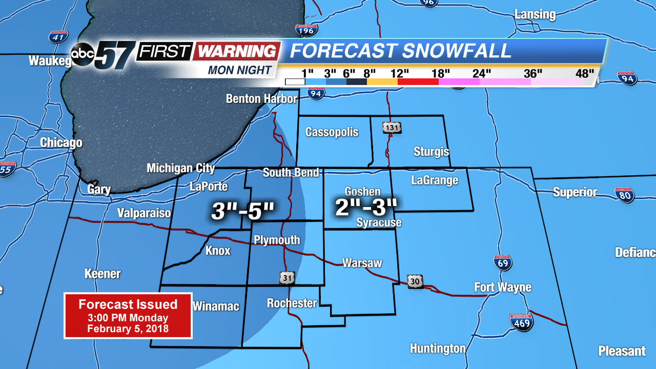
Another round of snow starts Monday evening and lasts through early Tuesday morning. A widespread three inches of snow is likely before the AM drive. A few flurries may last through the morning.
A brief lull in the snow Tuesday, highs will struggle to warm into the low 20s. The next round of snow in the active weather cycle swings through Wednesday morning, likely to bring another three inches to many. There’s another break Thursday before a similar system Thursday night and Friday.
Tonight: Snow showers, low of 12.
Tuesday: Mostly cloudy, high of 20.
Wednesday: Snow showers, high of 22.
Thursday: Partly cloudy, high near 20, chance of snow late.
Sign up for the ABC 57 Newsletter