Much colder today with snow arriving Sunday

-
2:49

White Sox even Crosstown Classic with power-heavy win over Cubs
-
0:52

Hot to start week, cool by Wednesday
-
1:31

Mild tonight, storms Monday
-
0:40

One killed in two vehicle crash on I-65
-
2:14

Dowagiac graduate overcomes his biggest match off the mat
-
1:08

Graves of Revolutionary War veterans get a visit by history fans
-
2:26

White Sox beat Cubs in extras, officially claiming Crosstown...
-
2:46

Notre Dame Valedictorian recalls infamous Ice Chapel in 2026...
-
0:31

Horseback riding program helps senior veterans stay active and...
-
0:54

Calm today, storms start tomorrow
-
1:06

Mishawaka Fieldhouse features Adidas 3Striped basketball tournament
-
2:04

Elkhart high school football players got out on the gridiron...

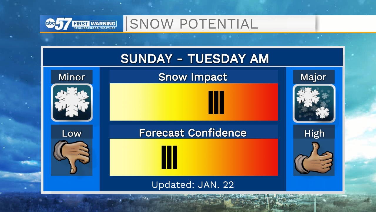
ABC57 First Warning Neighborhood Weather Forecast
Friday, January 22nd, 2020
Colder air moves in through the morning hours, dropping temperatures back into the mid to low 20s this afternoon. The cold NW wind could generate a couple of lake effect flurries as well. The next system moves in on Sunday bringing light snow showers but another system brings more snow on Monday. Monday’s system looks to be the bigger impact but if the track shifts further north then we will see more rain/snow mix, leaving us with lower snow totals. Snow will likely linger into Tuesday morning, continuing slowed travel. Have your shovels on stand-by.
Today: Mostly cloudy, flurries, temperatures falling from 30.
Tonight: Mostly cloudy. Low 17.
Saturday: Partly cloudy. High 30.
Sunday: Snow showers. High 32.