-
3:41

A Goshen family pushes to grow their family
-
2:01

Chunk’s Ice Cream gets ready to celebrate its second anniversary
-
2:22

Bluegrass Festival celebrates local artists in Niles
-
0:51

PokeDen updates its space for a shop like experience
-
1:00

Another pleasant day for our area
-
1:00

Slightly cooler out the door today
-
1:03

Mentone Egg festival brings a clutch of people to enjoy its history
-
0:46

9th annual Hall of Heroes Comic Con concludes its first day
-
2:39

South Bend Barber celebrates retirement after 59 years
-
0:45

OC fireworks reveal their new showroom
-
0:57

Thousands take part in Sunburst Run to raise funds
-
2:00

Annual Studebaker car show takes over Ironwood Plaza

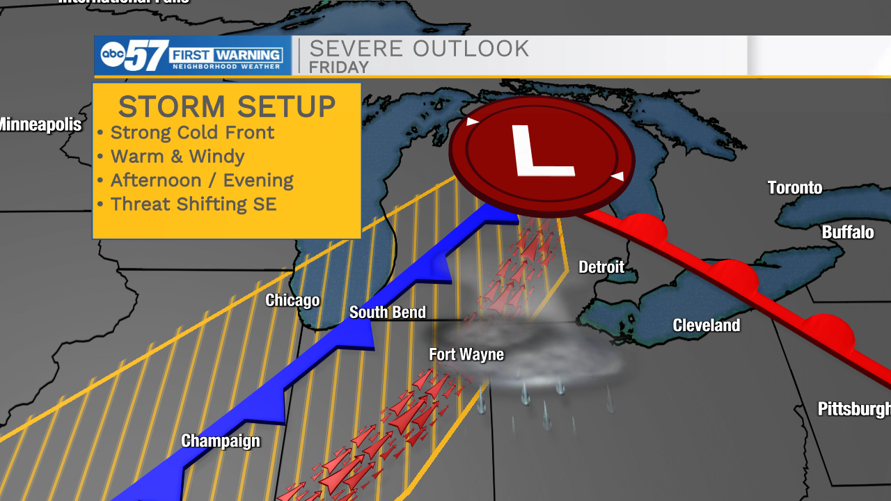
The first change in the forecast is the timing of rain Wednesday, showers are trending earlier, midday to mid-afternoon light rain is likely. The rain tapers-off by the late afternoon. Temperatures warm into the 80s Thursday and Friday along with some humidity. A cold front closes on the area Friday afternoon / evening. The second change in the forecast is the front may reach Michiana as storm begin to pop in the late afternoon. This could change the severe outlook, increasing the storm threat from South Bend to Fort Wayne. Focus will remain on Friday. But the Tuesday update is the storm threat looks lower, than Monday.
Tonight: Mostly cloudy. Rain showers late. Low 52.
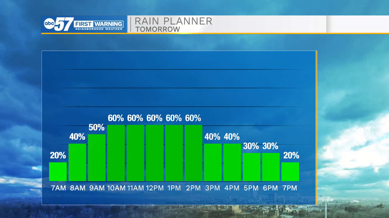
Wednesday: Rain showers. High 68.
Thursday: Partly cloudy. High 82.
Friday: Breezy, PM T-Storms. High 85