
-
1:15

Showers and storms possible for the holiday weekend
-
2:46

Buchanan celebrates unity during fourth annual Pride event
-
1:53

Mishawaka celebrates America’s 250 with music
-
0:24

South Bend community donates blood at Grace UMC
-
1:23

Upgraded to an Extreme Heat Warning
-
1:35

Extreme Heat Watch begins tomorrow
-
0:21

One injured in overnight shooting on South Bend’s northwest...
-
1:11

Pleasant end to the weekend
-
0:48

One person dead after single-vehicle crash in Mishawaka
-
3:37

Local racer hits the pavement at Plymouth Speedway after life-changing...
-
0:58

The beautiful weekend continues tomorrow
-
2:28

Kicking off day two of the Gus Macker Basketball Tournament

Clouds hang on through the lunch hour with clouds breaking up before the sun goes down. Another quick shot of colder air from the north will bring more clouds tomorrow morning and an isolated shower possible. Clouds clear back out, leaving us with more sunshine. Temperatures finally begin to warm on Saturday, back into the mid 40 but Sunday is our mild day as it reaches the 50s. The next chance of rain move in late Sunday evening, lasting through Monday.
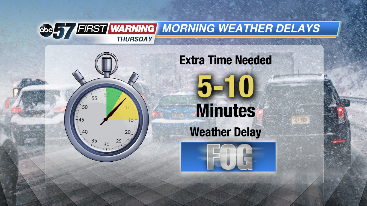
Today: Morning fog/drizzle, mostly cloudy, high of 44.
Tonight: Mostly clear to partly cloudy, low of 32.
Friday: Few morning clouds then clearing, breezy, high of 42.
Saturday: Sunny, high of 46.
Sign up for the ABC 57 Newsletter