

-
0:55

Beautiful weekend expected
-
1:05

Truly wonderful conditions
-
0:41

High-speed pursuit ends in collision after driver flees police...
-
2:15

Fort Wayne Tin Caps put an end to the SB Cubs winning streak
-
1:21

This weekend is the annual Hall of Heroes Comic Con
-
0:46

Elkhart Police Department respond to shots fired call at the...
-
3:55

ABC57 speaks with Cass County Commissioners, Judge and Interim...
-
2:48

Common Council to consider appeal options following South Bend...
-
0:52

South Bend seniors explore local parks, event centers, and available...
-
1:51

Mentone Egg Fest celebrates 80th year
-
4:58

New reactions after Notre Dame releases findings of priest sex...
-
3:05

South Bend Police Tapes ordered to be destroyed after 14-year...

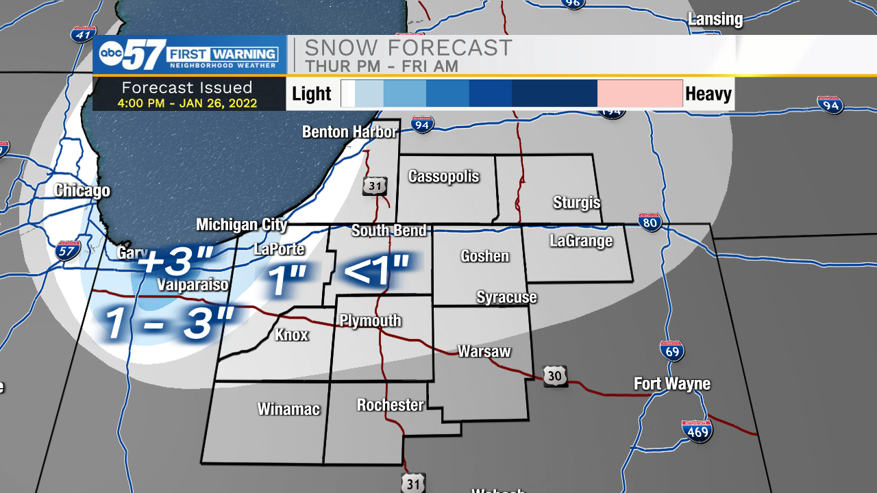
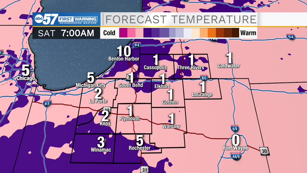
Bitter cold lasts through the weekend. Thursday, there is a slight warm-up, before temperatures crash again through Friday. Lake effect snow is possible Friday morning but the brunt is directed towards Northwest Indiana. Temperatures could fall below zero again Saturday morning, before temperatures warm gradually into next week. There is still concern for ice / flooding the middle of next week with rain still likely.
Tonight: Mostly clear and cold. Low 4.
Thursday: Mostly cloudy. PM snow showers. High 30.
Friday: Clearing. High 18.
Saturday: Mostly sunny. High 18.
Sign up for the ABC 57 Newsletter