A few chances for rain and thunderstorms are in the forecast this weekend into early next week. Some of the storms could be strong to severe on Saturday and again Sunday night. As of Friday afternoon, the
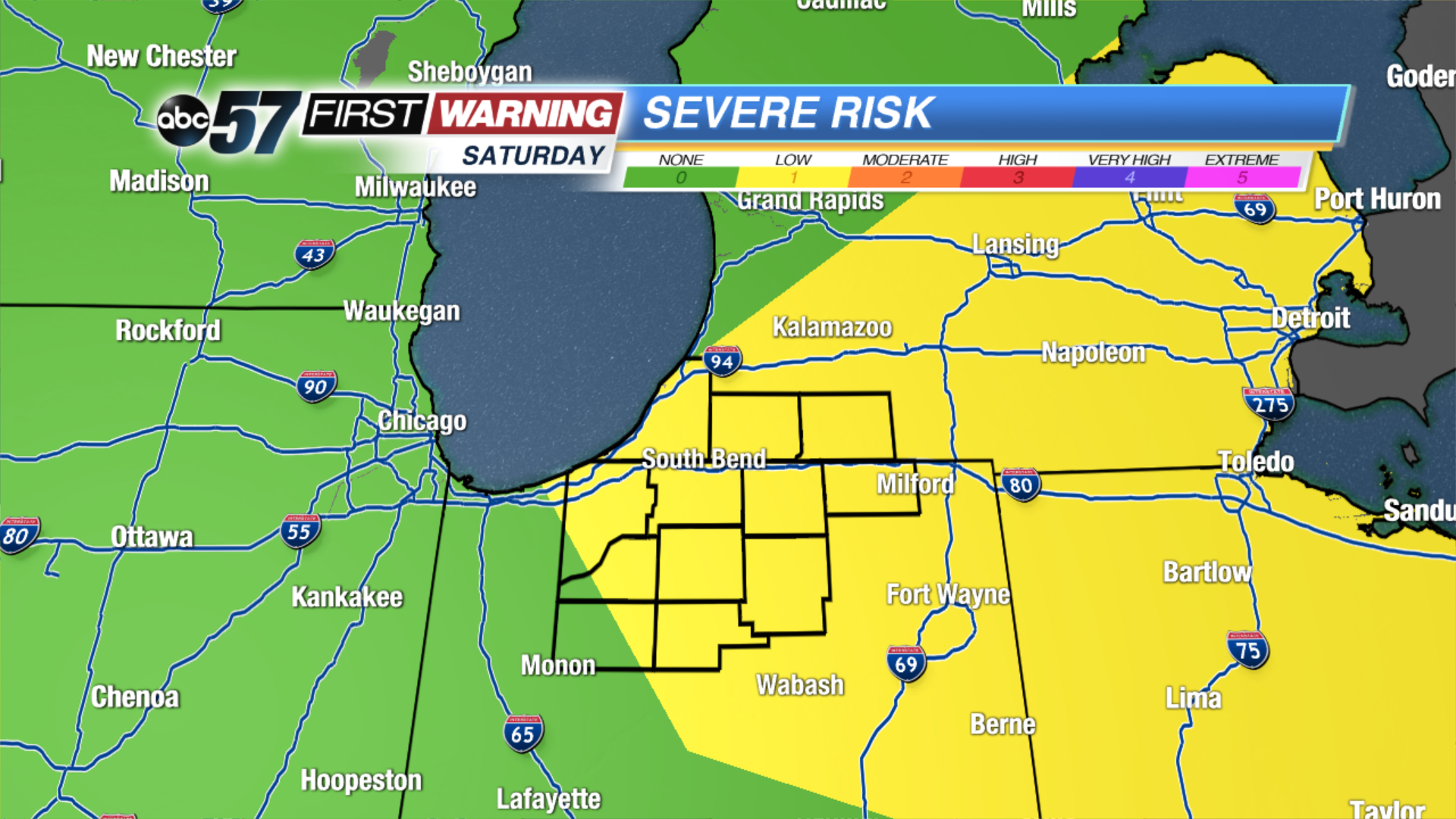
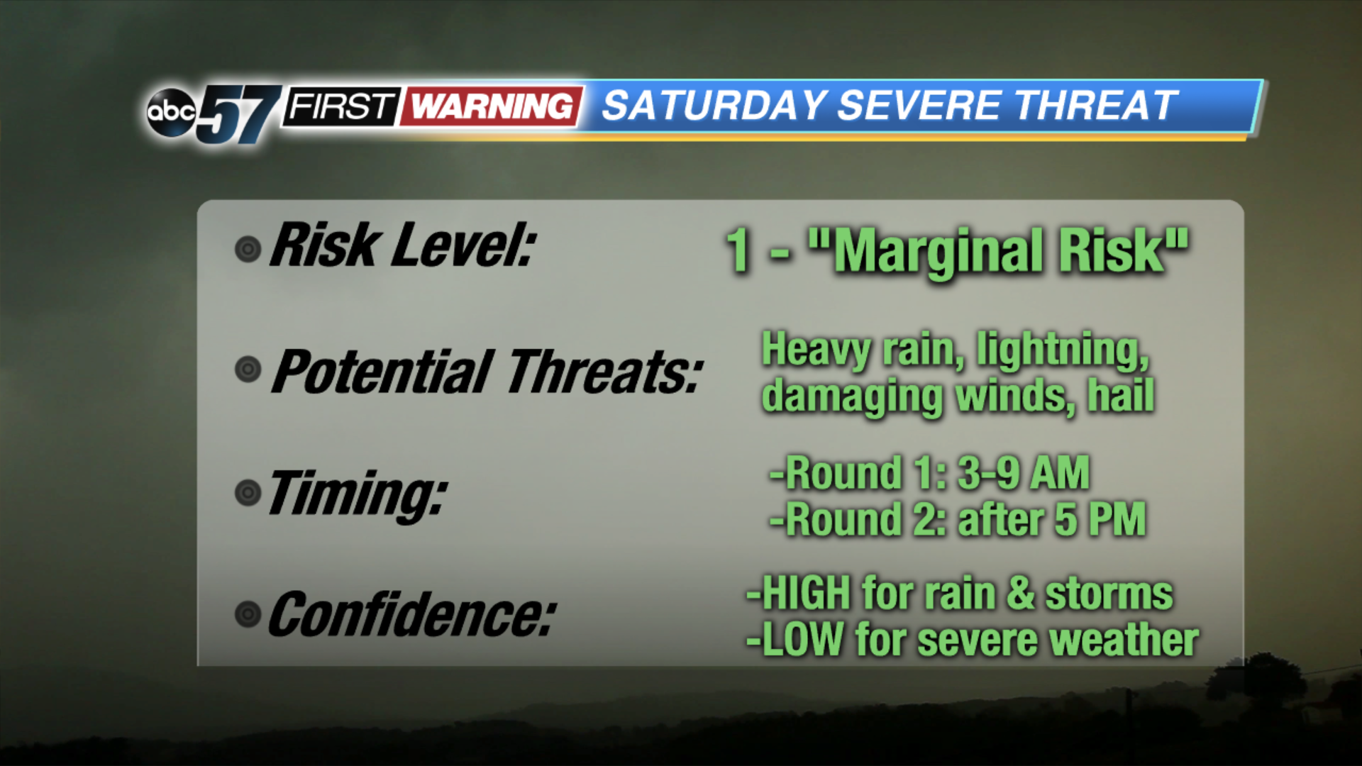
Storm Prediction Center has nearly all of Michiana in a low-end "Marginal Risk" for severe weather on Saturday. There could be two distinct rounds of rain and storms on Saturday; one in the predawn hours and one during the evening. The predawn round is
likely to affect most of the region, and the main threats are heavy rain, lightning and perhaps strong wind gusts.
Confidence in the second round of thunderstorms developing Saturday evening is LOW at this juncture. There are quite a few variables in place regarding Saturday evening, which is why rain chances are only running at 30% for now. There is a wide array of disagreement among the forecast models. However, IF thunderstorms can fire, they will certainly have the potential to boast strong winds and hail, in addition to heavy rain and lightning.
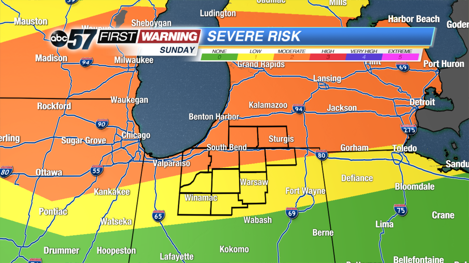
The risk for severe weather is even higher on Sunday. The northern half of Michiana is in a level 2 of 5 "Slight Risk" for severe weather after 6 PM into Sunday night. There
will be a complex, or possibly complexes, of rain and thunderstorms in the vicinity of Iowa, northern Illinois and Wisconsin Sunday afternoon and evening. They will have the potential to produce damaging winds, large hail and torrential rainfall in those areas. Into Sunday evening and night, the storms will rapidly push eastward into Michigan, maintaining their severe potential.
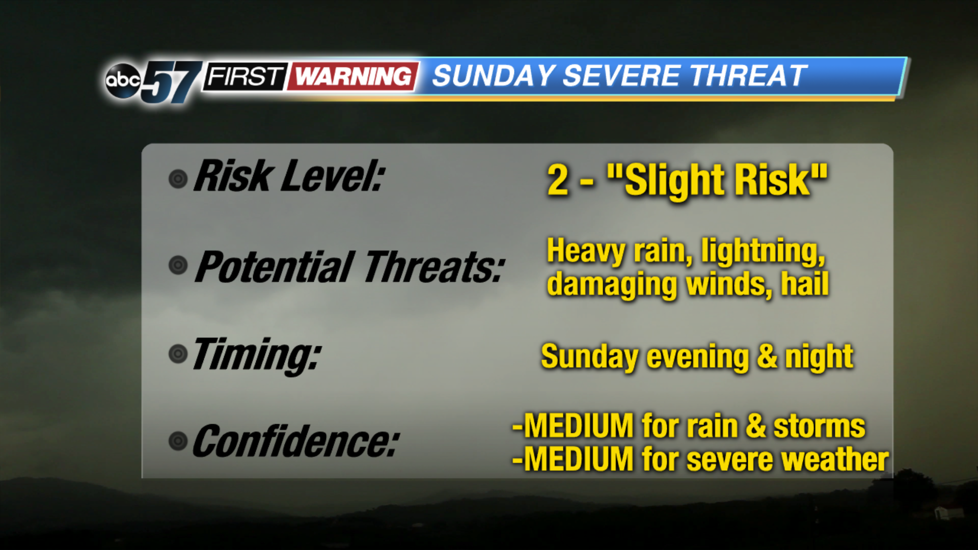
The big question mark with this set-up is whether or not the storms will build far enough south to affect far northern Indiana and southwestern Lower Michigan. Some models show at least a few strong to severe storms being possible north of US 6. Others keep the bulk of the thunderstorm activity in Michigan. Similar to Saturday evening, IF storms build far enough south and move through Michiana, the risk is certainly there for them to be capable of damaging winds and large hail. These are forecasts that will change, perhaps significantly, over the next 12-24 hours as things come together. Be sure to stay with ABC 57 News for additional updates as the newest information becomes available.