Warm and breezy with more rain on the horizon

-
4:24

Michiana Crime Stoppers shredding event
-
1:16

’IvyCares’ program setting students up for success in and...
-
1:45

Windy and wet this weekend, but unseasonable warmth as well
-
3:13

Local players react to $3 million investment in Byer Softball...
-
0:32

Layoffs at Whirlpool could affect workers in Benton Harbor
-
1:03

Annual District Sisterhood Conference at Ivy Tech empowers students
-
1:49

Back home in downtown South Bend, YMCA to open new location
-
2:16

This week’s ABC57 Cub Reporter is Nicholas Zentz
-
3:05

Amazon Web Services invests $11 billion to build data center...
-
4:05

Riley High School student center stage at the NFL Draft
-
1:35

Rain, wind, and milder temperatures forecast this weekend
-
2:49

Joe Alt expected to be drafted in the first round of NFL Draft

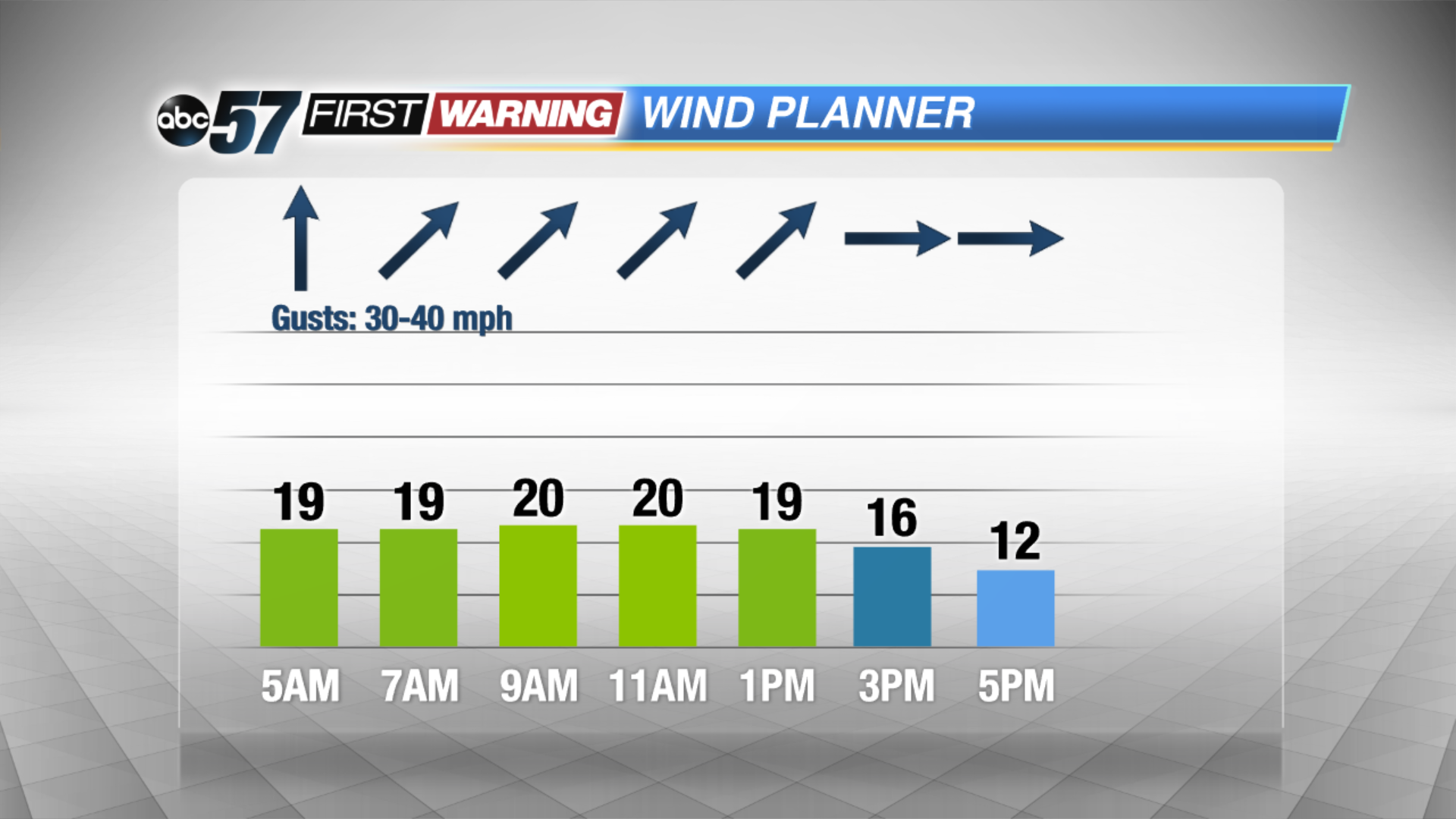
A showers linger into the early morning commute but it quickly dries out for the rest of the day. We’ll see a mix of sun and clouds and it’ll feel like early summer as highs top out near 70! Winds are breezy through the next couple days with more clouds moving back in tomorrow. Highs are back in the low 70s Friday but a few isolated showers and storms are possible after midday. The strong low pressure system moves in Saturday, keep us soggy with a few thunderstorms.
Temperatures take a tumble into Sunday, falling into the 40s. Next week starts out chilly with a possible mix of rain and snow but we warm back up through the week.
Today: Chance rain early, breezy with a mix of sun and clouds, highs near 70.
Tonight: Mostly cloudy, breezy, low of 52.
Friday: Mostly cloudy, chance of showers, high of 72.
Saturday: Rainy, thunder possible, temperatures fall from the mid-60s.