
-
1:47

Hot and smoky today
-
2:07

Locals have big visions for new skatepark in St. Joseph
-
2:29

Elkhart County residents still waiting for repair help a month...
-
1:13

Sinkhole develops on the Southwest side of South Bend
-
3:13

Local restaurants taking extra precautions to try and keep Cyclosporiasis...
-
3:39

World Series of Baton Twirling returns to Notre Dame, bringing...
-
2:37

Historic State Theater project awarded millions of dollars towards...
-
2:05

Building Nicholas Stanley’s defense in the final weeks before...
-
2:03

Fatal June officer-involved shooting of Jujuan Bates deemed justified,...
-
1:15

IDEM forecasts Air Quality Action Day for Northern Indiana due...
-
1:43

Unhealthy smoke headed our way
-
1:23

Kamm Island Pavilion dedicated to former mayor

A break between storm systems Thursday and most of Friday. The lull will be cool and quiet before temperatures start to warm Friday afternoon. Rain starts Friday night and will last into Saturday morning. The wind also increases Friday night and will peak Saturday. Saturday afternoon and evening gusts could top 40 mph. Temperatures drop through Sunday, turning on some light lake effect snow showers.
Tonight: Mostly to partly cloudy, low 34.
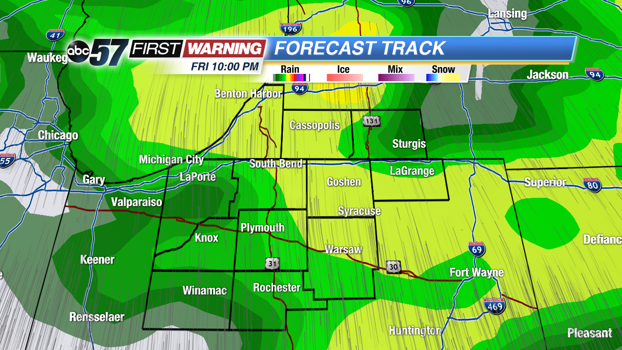 Rain begins Friday night
Thursday: Mostly to partly cloudy, high 40.
Friday: Increasing clouds and wind, rain arrives late, highs in the upper 40s.
Saturday: Rain then windy, highs near 50 but falling through the afternoon.
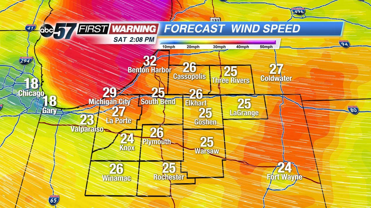 Strongest wind starts Saturday afternoon
Sign up for the ABC 57 Newsletter