

-
2:34

Nic Stanley’s defense attorney gives exclusive interview days...
-
2:04

Twin City Players Costume sale
-
2:28

Shamrocks beat Bucks 30-20, stay unbeaten in 2026
-
3:00

Buchanan’s Sweet Shop faces foreclosure over $6,000 debt as...
-
2:24

50 Years of Nappanee’s Apple Festival, What You Can Expect
-
2:17

Indiana State Police Trooper Fired Upon; One Suspect in Custody,...
-
1:21

Sweater Weather coming soon
-
2:34

Plan for rain for Saturday Night Football
-
1:50

IN AI Roadshow teaching how to apply A.I. in the workplace
-
2:15

Buchanan hopeful stalwart defense will lead them to fourth straight...
-
1:22

Much drier and less humid to end the workweek
-
2:50

Judge rules in favor of St. Joseph County Democrats in ballot...

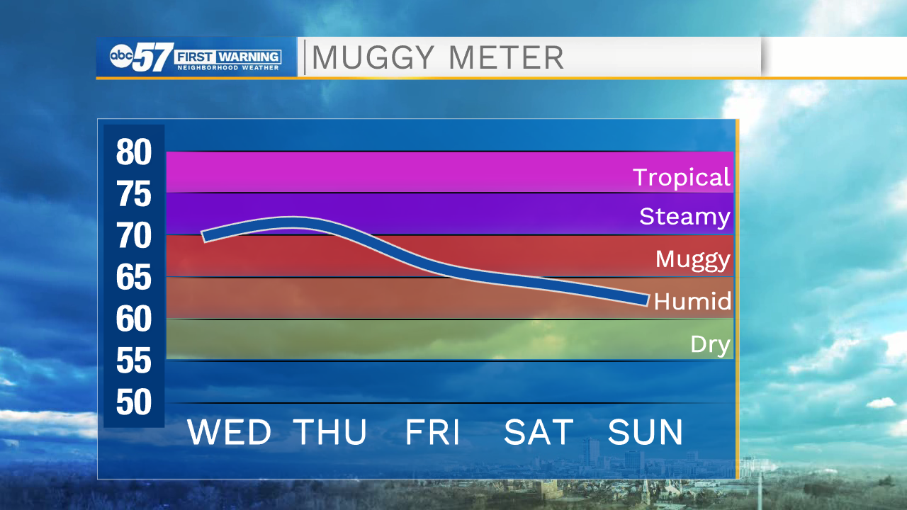
A break from the wet weather and a slight reprieve from the humidity Wednesday. The next surge of steamy air returns Thursday with more showers and thunderstorms Thursday afternoon through Friday. Thursday evening could be a time to watch for stronger storms and more heavy rain / flooding. The weekend looks good for outdoor plans as does next week, with a lot of sunshine.
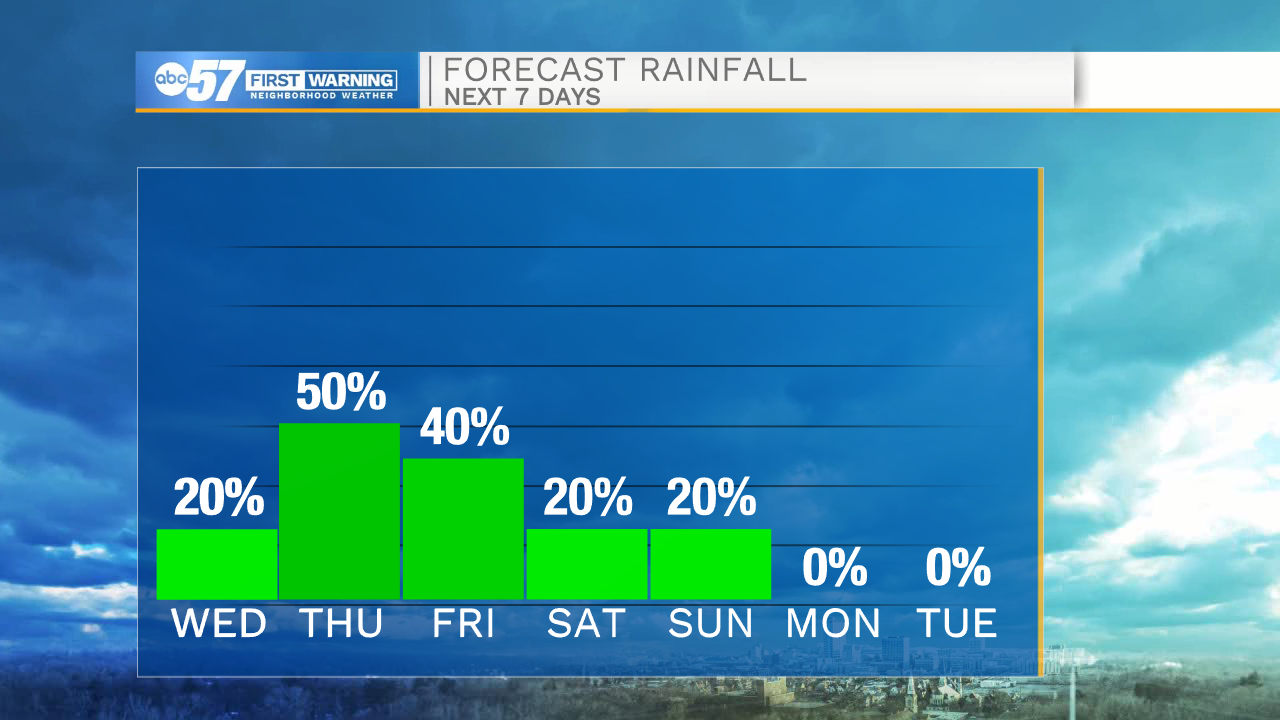
Tonight: Partly cloudy. Low 66.
Wednesday: Mostly sunny. High 84.
Thursday: PM Thunderstorms. High 86.
Friday: Scattered storms. High 80
Sign up for the ABC 57 Newsletter