
-
1:44

Feeling like a sauna next week
-
3:12

How to keep yourself and others protected during firework season
-
0:49

Showers creeping into Michiana
-
0:42

Judge approves $25M water lawsuit settlement
-
1:00

Scattered showers through the day
-
1:53

Hispanic Community Child Safety Meeting: A Call To Action
-
2:51

Obama Presidential Center features work of South Bend company
-
1:54

This week’s ABC57 Cub Reporter is Isaac Knefely
-
1:16

Real summer heat returns next week
-
2:28

South Bend storm drain mural project complete
-
5:17

Three local students return as national powerlifting champions
-
1:09

Rain showers to end the work week

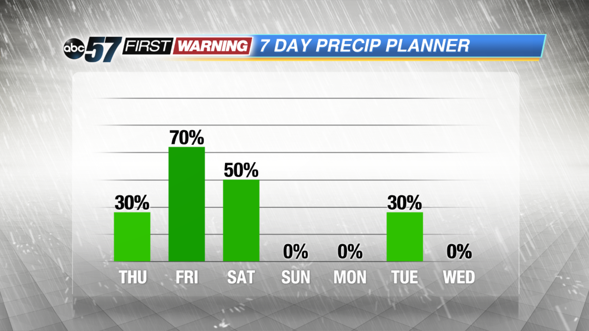
There’s a lull in the wet weather pattern Thursday, still mild with highs in the mid-70s. Rain returns Thursday night and lasts off and on through Saturday. Significant rainfall of more than a half inch is forecast Friday, this would be the most since September 19th. After showers Saturday, skies clear for Sunday and Monday.
Tonight: Partly cloudy, lows in the mid-50s.
Thursday: Partly to mostly cloudy, chance of rain late, high of 72.
Friday: Rainy with storms possible, highs in the upper 60s.
Saturday: Showers, highs in the mid-70s.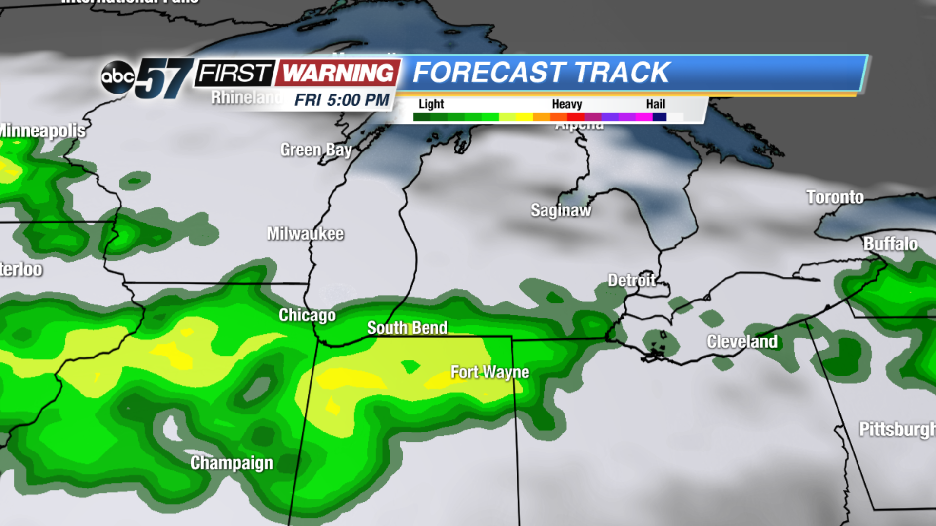 Round 2 Friday evening could bring another 1/4
Round 2 Friday evening could bring another 1/4
Round 2 Friday evening could bring another 1/4
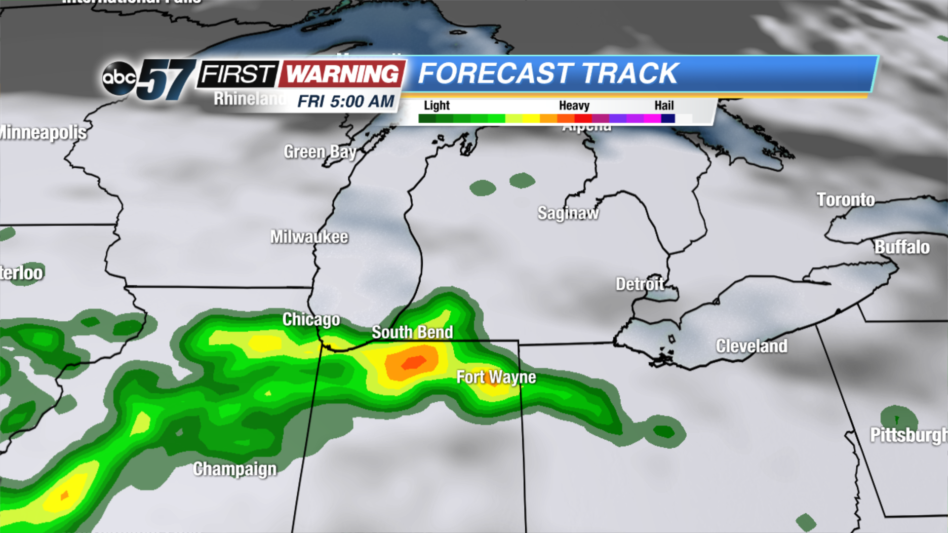 Round 1 of rain Friday could bring significant rainfall of 1/2
Round 1 of rain Friday could bring significant rainfall of 1/2
Round 1 of rain Friday could bring significant rainfall of 1/2