


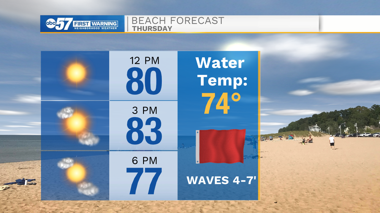
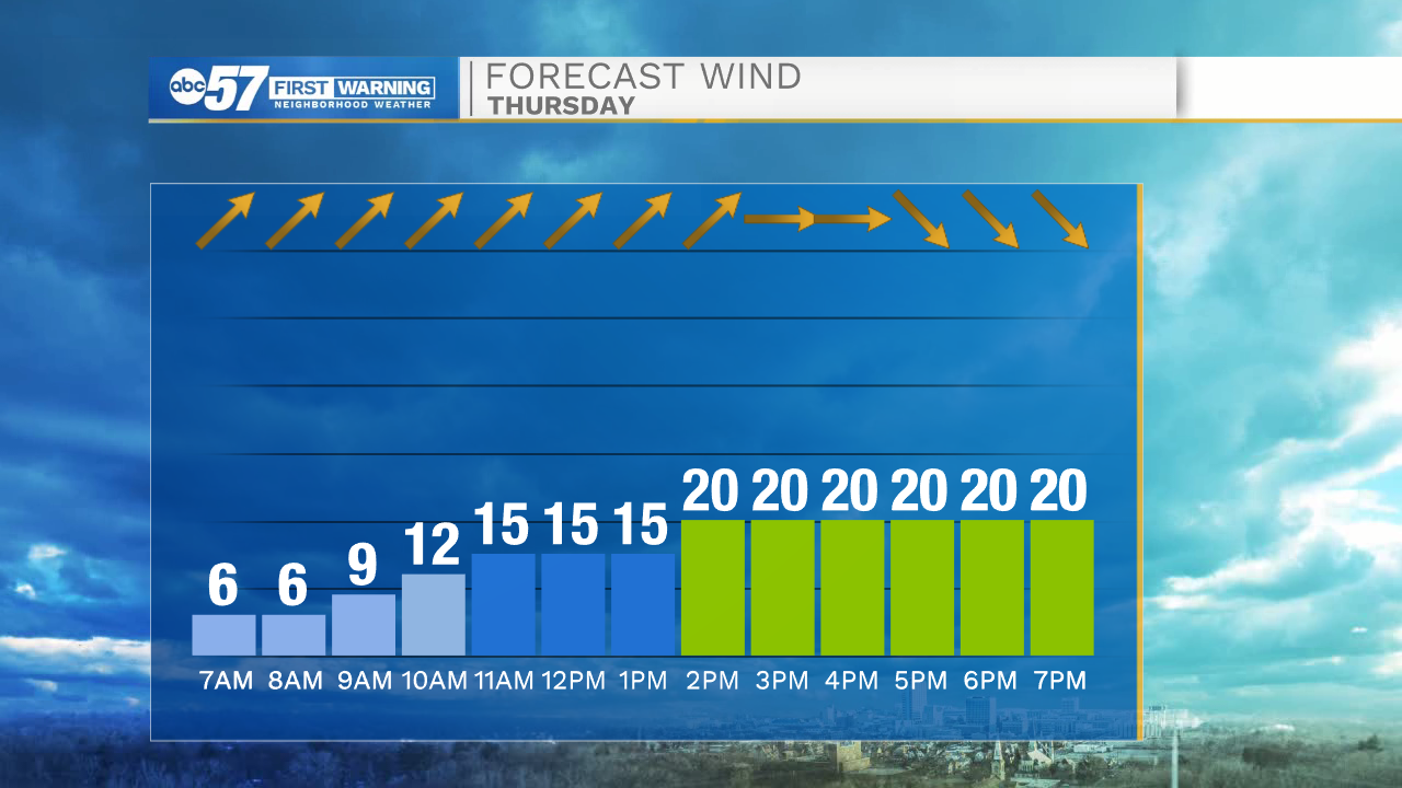
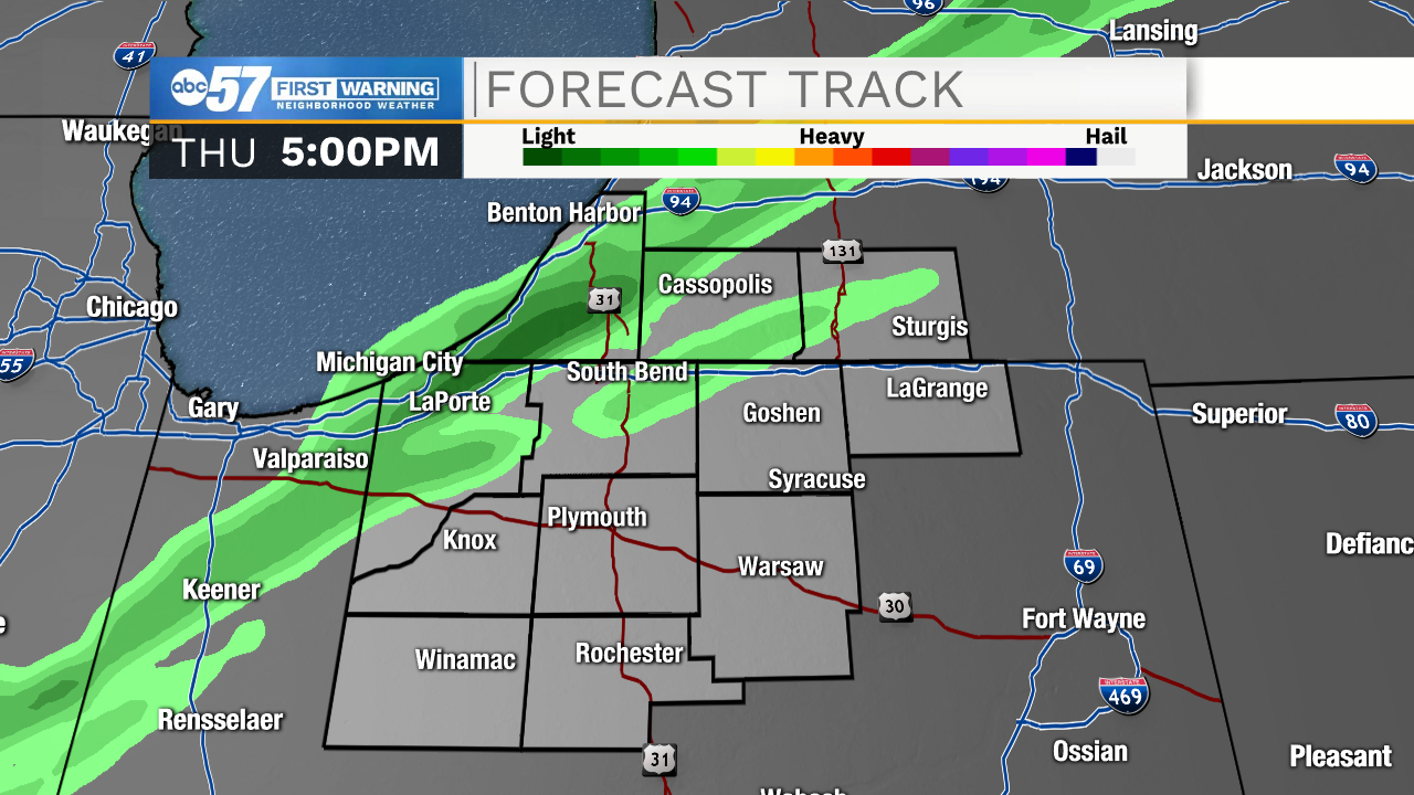
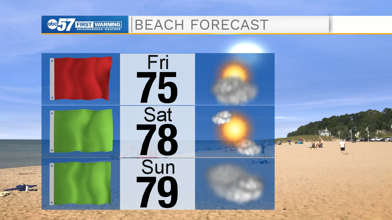
This afternoon a cold front will move through Michiana bringing strong winds and a few isolated rain chances. The front looks to arrive around 4pm. Due to the strong winds, a Red Flag warning has been issued. Stay out of the water on Lake Michigan later today as wave heights will range from 4-7feet. Later tonight winds will subside, but increase again tomorrow, sparking another Red Flag to be issued. Stay out of the water Friday afternoon! High temperatures tomorrow will drop into the mid 70s. Saturday afternoon looks nice and sunny with low humidity. It will be the perfect day to get back outside and take advantage of the dry weather. High temperatures will jump back into the lower 80s.
Sunday afternoon cloud cover will increase, as well as our chances for rain. Scattered showers and storms look to arrive Sunday afternoon and evening. Isolated showers will stick around through Monday, before more scattered chances arrive next Tuesday. Most of next week looks wet and cloudy, as higher rain chances remain in the forecast all the way through next Thursday. Temperatures next week will be in the mid 70s.
Today: Breezy. High 86.
Tonight: Mostly clear. Low 53.
Tomorrow: Sunny. High 75.
Saturday: Mostly sunny. High 80.