-
3:10
Farmers react on Indiana Gov. Mike Braun waving regulations for...
-
0:56
Niles Citizens for Responsible Zoning hold discussion stopping...
-
0:44
South Bend Police Department holds free car seat safety checks
-
3:30
Mother of Bissell Street shooting speaks out, pleading for justice...
-
3:09
Hurricane Impacts at Home: How Pacific storms are reaching Michiana
-
9:02
PREVENTING FALSE TESTIMONY: NDEJC pushes legislation regulating...
-
2:37
Inside Indiana’s Housing: High Demand, High Rates, and the...
-
3:06
Notre Dame O-line focused on making life easier for new backfield
-
3:14
St. Joseph County candidates discuss data centers, mental health...
-
2:05
South Bend community goes Over the Edge to raise money for youth
-
1:56
South Bend International Airport will feature new local food...
-
1:44
EPA says no lasting elevated levels of harmful chemicals following...
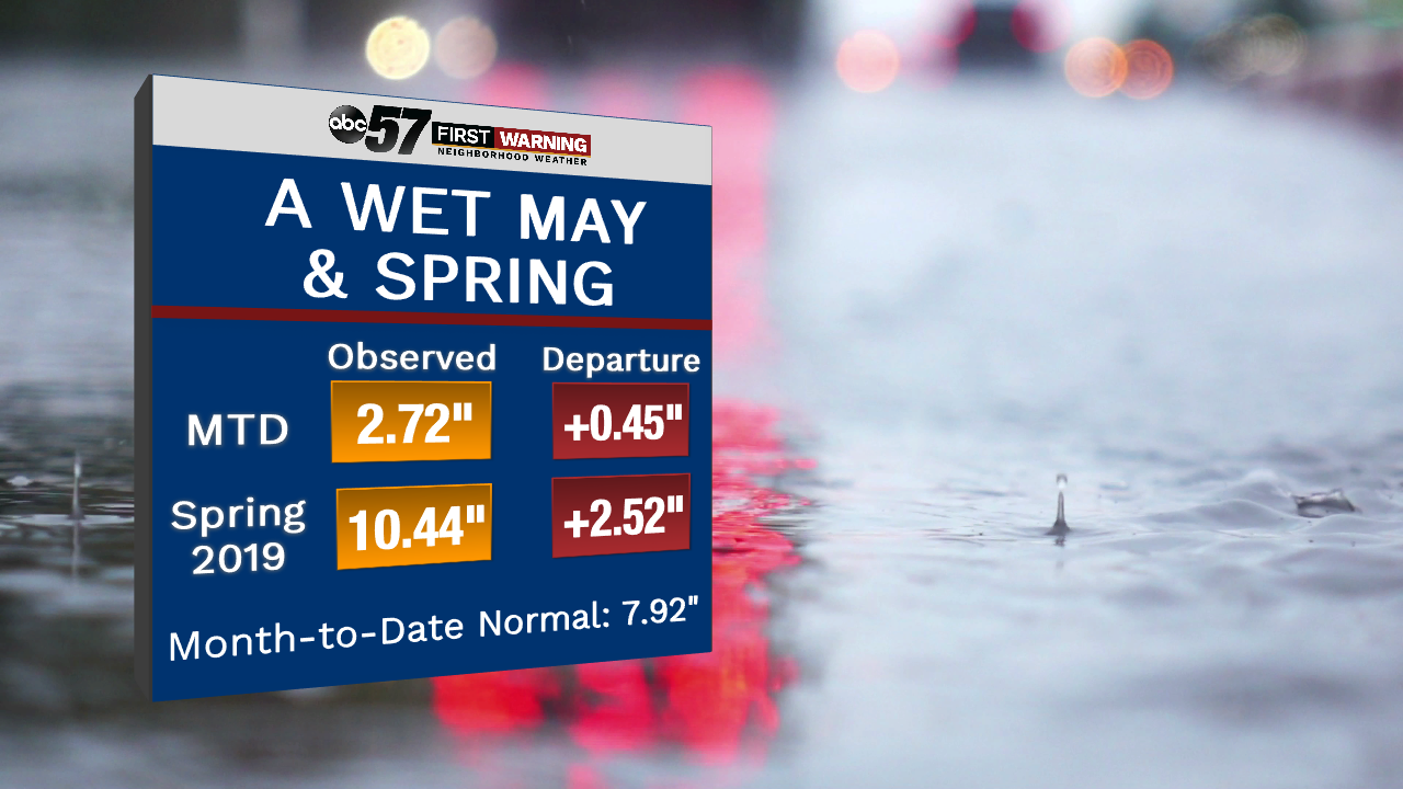
It's been a wet spring and month of may not only for us but much of the country thanks to rounds of rain and severe weather over the past few weeks. Totals for the month of may are obviously running high, but only by about half an inch. Last may was definitely more significant as that may was wettest may in Michiana history. And even the spring season is running on the high side with flooding in early may and above average rainfall through March and April. Departures are closing in on three inches.
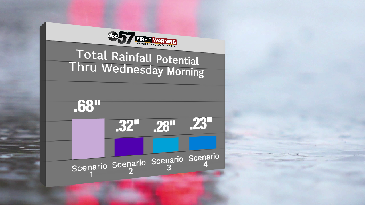
And looking forward throughout the work week, rain chances remain, primarily for Wednesday. Models, or scenarios, between now and Thursday morning aren't putting out big amounts of rain, which is good news for us because we could use the break. Also, we're not anticipating any severe weather through Wednesday as well.