After a week of intense heat, temperatures closer to normal today

-
1:14

Widespread showers and downpours this morning ahead of warm front
-
1:48

Preparations underway as Indiana University football trophies...
-
3:09

Indiana Utility Regulatory Commission collecting consumer data...
-
1:18

St. Joseph County officials host Election 101 Workshop on voting...
-
5:36

Hannah Hidalgo wins Naismith Defensive Player of the Year
-
2:50

New South Bend Cubs manager Daniel Wasinger ready for opening...
-
2:24

South Bend Cubs pitcher Kenten Egbert looks to build on strong...
-
1:52

Hoosiers face a gas tax increase as gas prices continue to rise
-
1:45

Iranian cybercrime group claims to have hacked St. Joseph County’s...
-
1:17

Cold and soaking rain today, another severe risk tomorrow
-
0:44

South Bend High School Music Festival highlights student talent
-
1:55

South Bend house fire possibly caused by lightning

After we had a few showers early this morning, the rest of Monday should be smooth sailing.
A high in the mid 80s today will feel refreshing after our recent heat. Humidity will be lower today, too. Skies stay mostly clear overnight, which will allow temperatures to drop near 60 degrees by Tuesday morning.
Lots of sunshine to enjoy Tuesday, Wednesday, and Thursday. We’ll end the week with just a slight chance for a shower on Friday, otherwise the week looks mostly dry.
Daytime highs will be in the upper 70s to low 80s each day this week. This is just about right for this time of year.
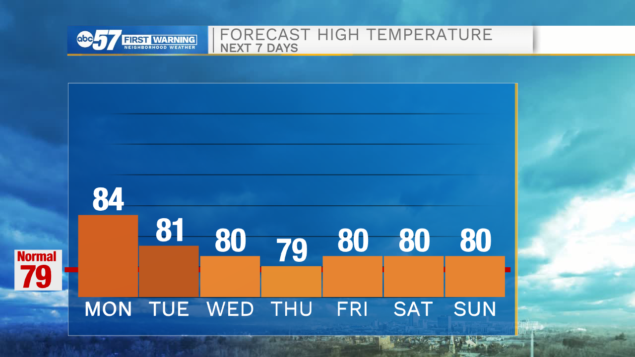
An early look at Labor Day weekend’s forecast shows mainly dry conditions as well.
Today: Partly cloudy. High 84.
Tonight: Mostly clear. Low 61.
Tuesday: Mostly sunny. High 81.
Wednesday: Sunny. High 80.