
-
1:43

Unhealthy smoke headed our way
-
1:23

Kamm Island Pavilion dedicated to former mayor
-
2:29

Kevin Ward Meyers was a man with a lengthy criminal record,...
-
1:10

The peak of the heat wave
-
3:16

Firefighters Blues Festival brings music and food to Mishawaka...
-
0:56

Similarly warm morning to yesterday
-
2:15

Elkhart Community Schools fail to avoid a one-dollar sale
-
3:46

South Bend couple calls on Commissioners for help with flooding...
-
2:37

Marshall County Health Department rewarding students at immunization...
-
2:14

Heat is raising electricity bills, but learn how you can reduce...
-
2:25

South Bend Police Athletic League uses free summer sports camps...
-
3:15

Michigan Dark Sky expert weighs in on light pollution as data...

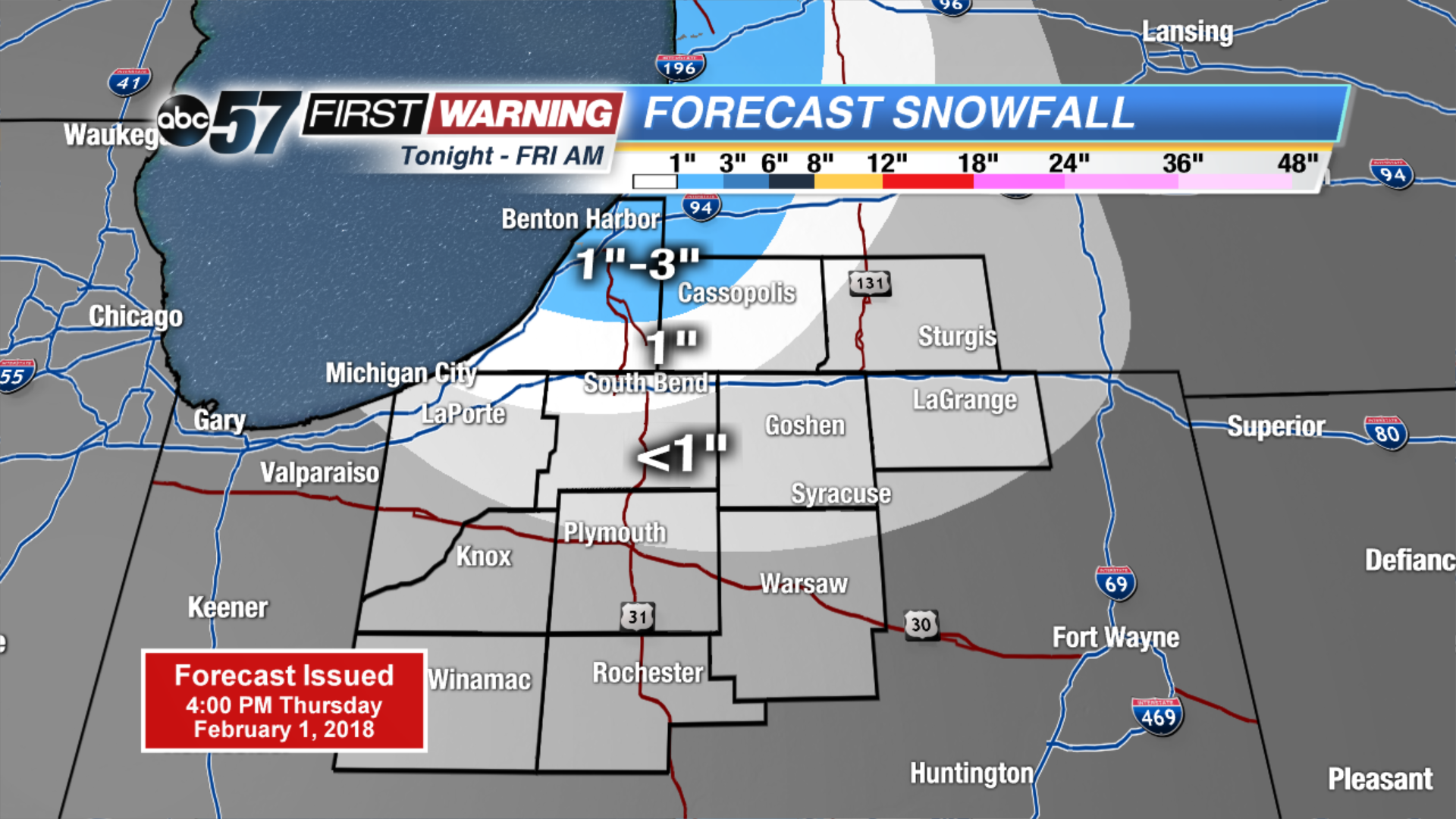
Light lake effect snow showers Thursday night into Friday morning, accumulation up to one inch possible.
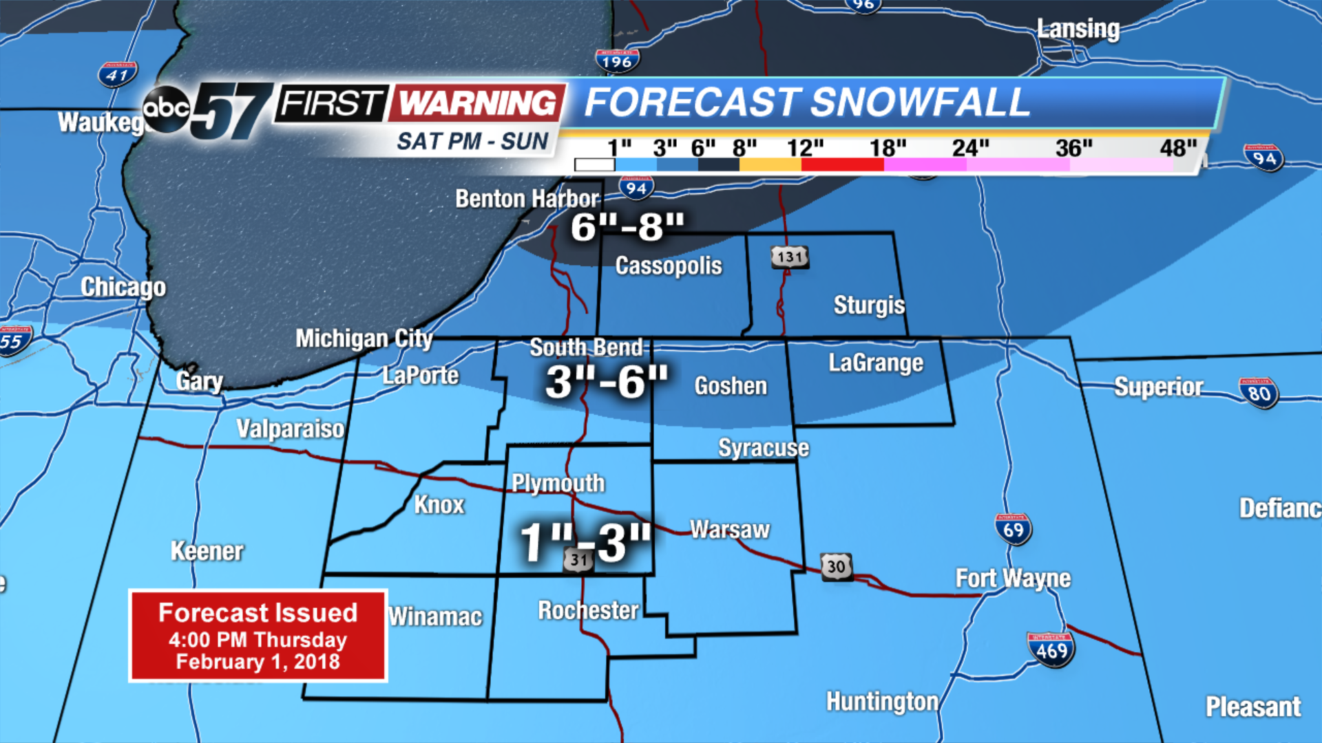
The cold and snowy pattern returns. Light snow and flurries end Friday morning, but temperatures will struggle to break 20. The next round of snow arrives Saturday afternoon and lasts through Sunday. Accumulation of at least three inches is likely for most. The pattern shows no changes for next week with a chance of snow every other day.
Tonight: Mostly cloudy, lake effect snow, low of 10.
Friday: Partly cloudy, chance of snow early, high of 18.
Saturday: Snow by the afternoon, high of 32.
Sunday: Snow showers through midday, highs in the upper 20s.
Sign up for the ABC 57 Newsletter