
-
2:12

South Bend City Council passes resolution urging pause on Midwest...
-
0:46

Niles City Council vote yes on putting marijuana question on...
-
0:29

Multiple Fire Departments battle residential fire in Berrien...
-
2:10

Notre Dame men’s basketball embracing urgency as Shrewsberry...
-
2:37

Local Beef-A-Roo employees still owed paychecks as private equity...
-
1:42

More storms through 8:00 p.m.
-
1:06

2nd annual Inclusive Art Fair
-
2:20

Tracking severe weather through the mid-afternoon
-
3:17

Applications open for Fall Citizens Police Academy in South Bend
-
2:23

Elkhart County 4H Fair food vendors celebrate 50th year of business
-
2:16

Young football athletes learn about protecting their bodies,...
-
1:24

Storm track timing could be shifting

Light snow overnight into early Friday, in general 1” to 3” of snow in Southwest Michigan, less in Northern Indiana. Everyone will see bitter cold temps, where skies clear, lows drop below zero.
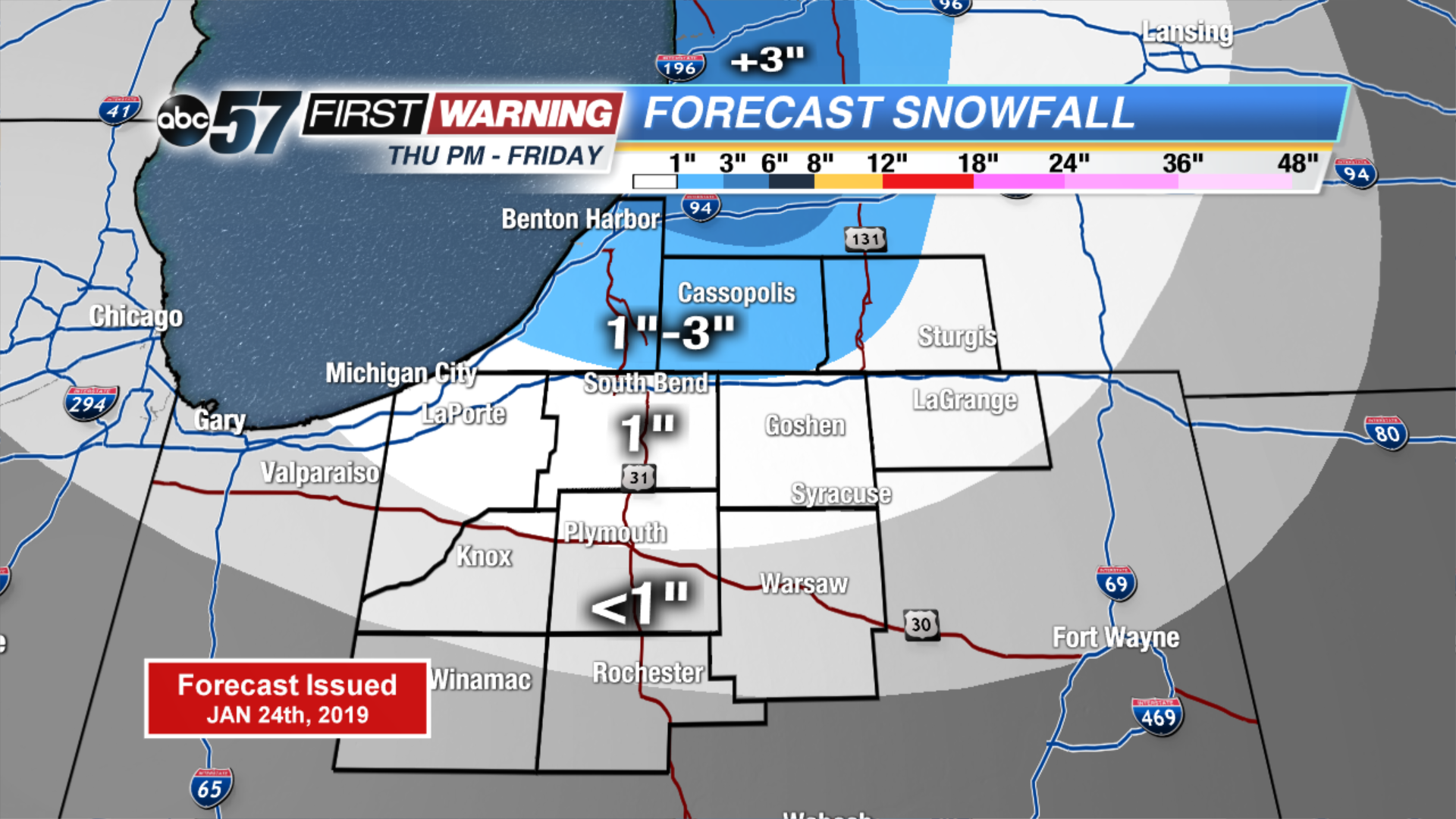
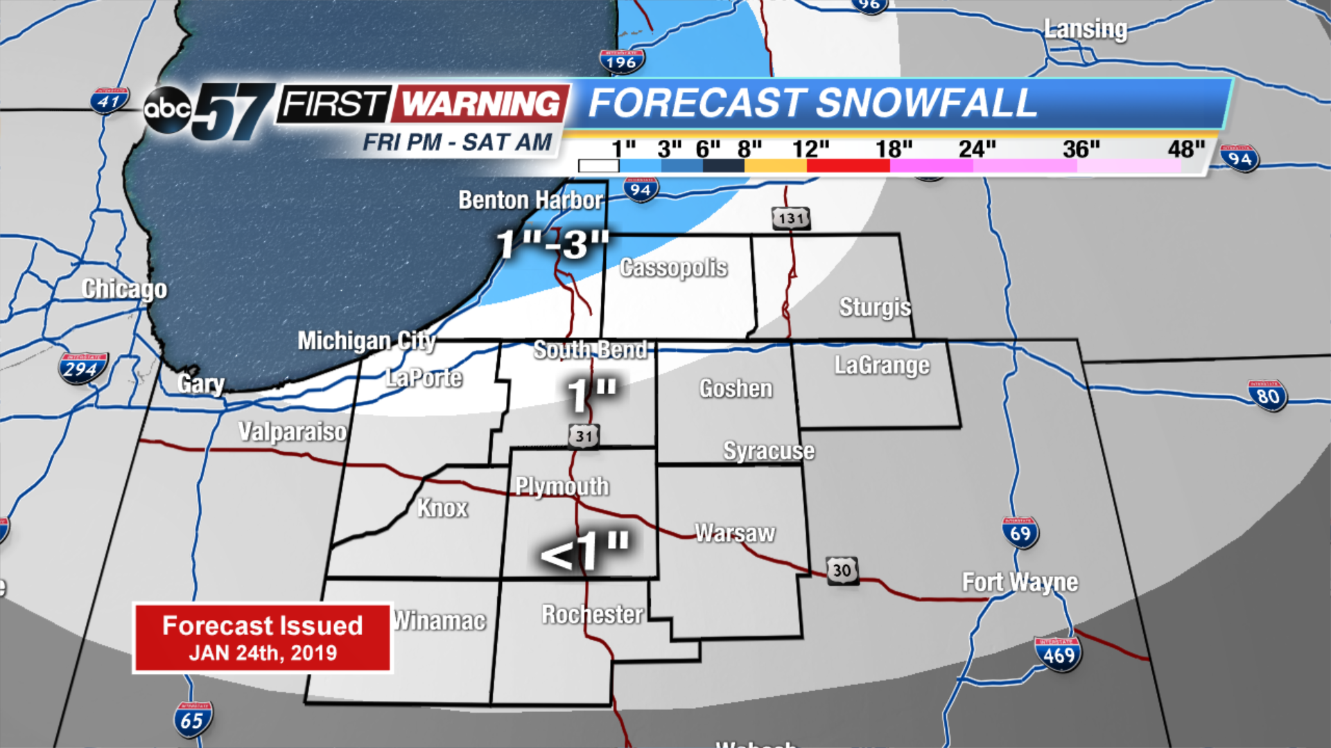
Friday is a very cold day, highs will be lucky to reach the double digits. Another round of light snow is likely Friday night into early Saturday. The cold and snowy pattern continues through Sunday, with mostly light accumulation. Monday could be the most significant snowfall with widespread accumulation. The middle of next week looks extremely cold, as high may not even rise much above zero.
Tonight: Mostly cloudy, lake effect snow showers. Low of 2.
Friday: Morning snow showers, mostly cloudy. High of 8.
Saturday: Morning flurries, mostly cloudy. High of 16.
Sunday: Chance of snow, mostly cloudy. High of 16.