



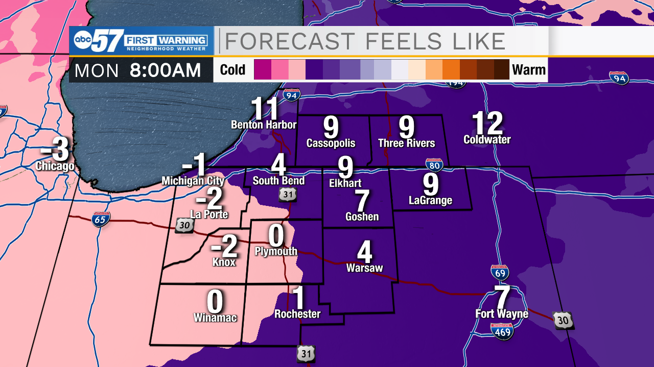
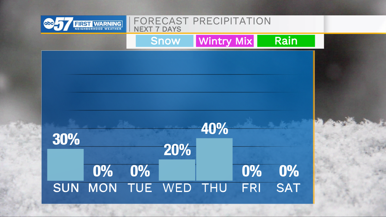
A few lingering snow showers will impact Michiana through mid-morning. After those clear, a round of isolated lake effect snow showers will develop out to our west and impact northwestern Michiana this afternoon and evening. Roadways are very slick this morning, so take it slow if you have to travel. The snow will stick around for awhile as cold air has quickly moved into Michiana. Feel like temperatures this morning are in the single digits. High temperatures today will only top out in the mid 20s. Single digit lows are on the way for tomorrow morning with wind chills dropping below 0. We will briefly hit the 30s for highs Tuesday and Wednesday, but then more bitter cold temperatures return for late week and next weekend.
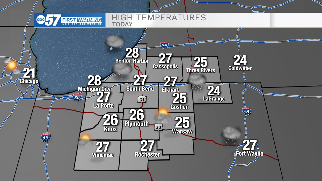
Today: Isolated snow showers. High 27.
Tonight: Partly cloudy. Low 10.
Tomorrow: Mostly sunny. High 25.
Tuesday: Partly cloudy. High 36.