
-
0:38

A Celebration of Life for Kaylon Woods
-
1:57

ABC57 reporter Annie Kate discusses ongoing fuel price hikes...
-
0:53

Michiana drivers share their thoughts about the current gas prices
-
1:12

Decision Day becomes new tradition at John Adams High School
-
6:13

Bethel University baseball player battles a brain tumor to retake...
-
1:22

EPD Chief Dan Milanese steps down from role, interim chief announced
-
1:16

Chilly today, cold tonight
-
3:16

Importance of water safety with warm weather around the corner
-
5:38

Celebrate with the Ivy Tech Impact Gala
-
5:27

Magician Andy Gross comes to Goshen Theater
-
0:53

Cold and soaking rain through this morning
-
2:11

This week’s ABC57 Cub Reporter is Lucas Castillo

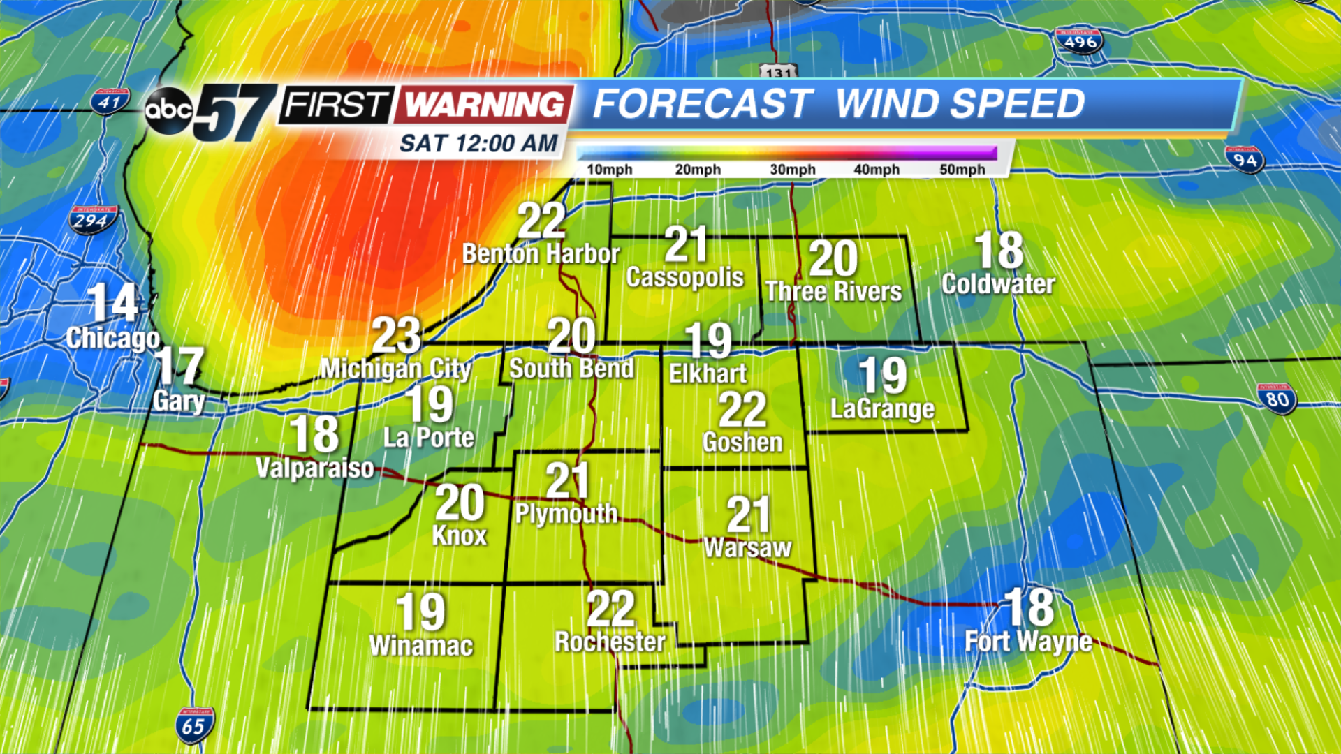 Wind speed at midnight Saturday morning
A brief calm before the weekend storm. Some sunshine is possible through the first half of Friday, clouds fill-in, wind increases and rain returns Friday night into Saturday. Wind gusts may top 40 mph Saturday, there’s a brief lull when the wind changes direction from the south to the northwest Saturday. Temperatures will fall sharply into Sunday, this could lead to some black ice and lake effect snow showers.
Tonight: Mostly cloudy. Low of 30. 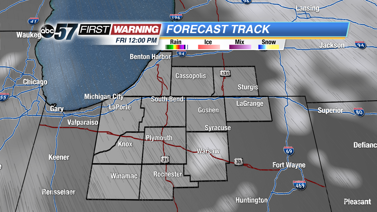 Break in the clouds early Friday
Friday: Partly to mostly cloudy, becoming windy and rainy late. High of 48.
Saturday: Rainy and windy, highs near 52 but falling through the afternoon.
Sunday: Cold, chance of lake effect snow showers, high of 34.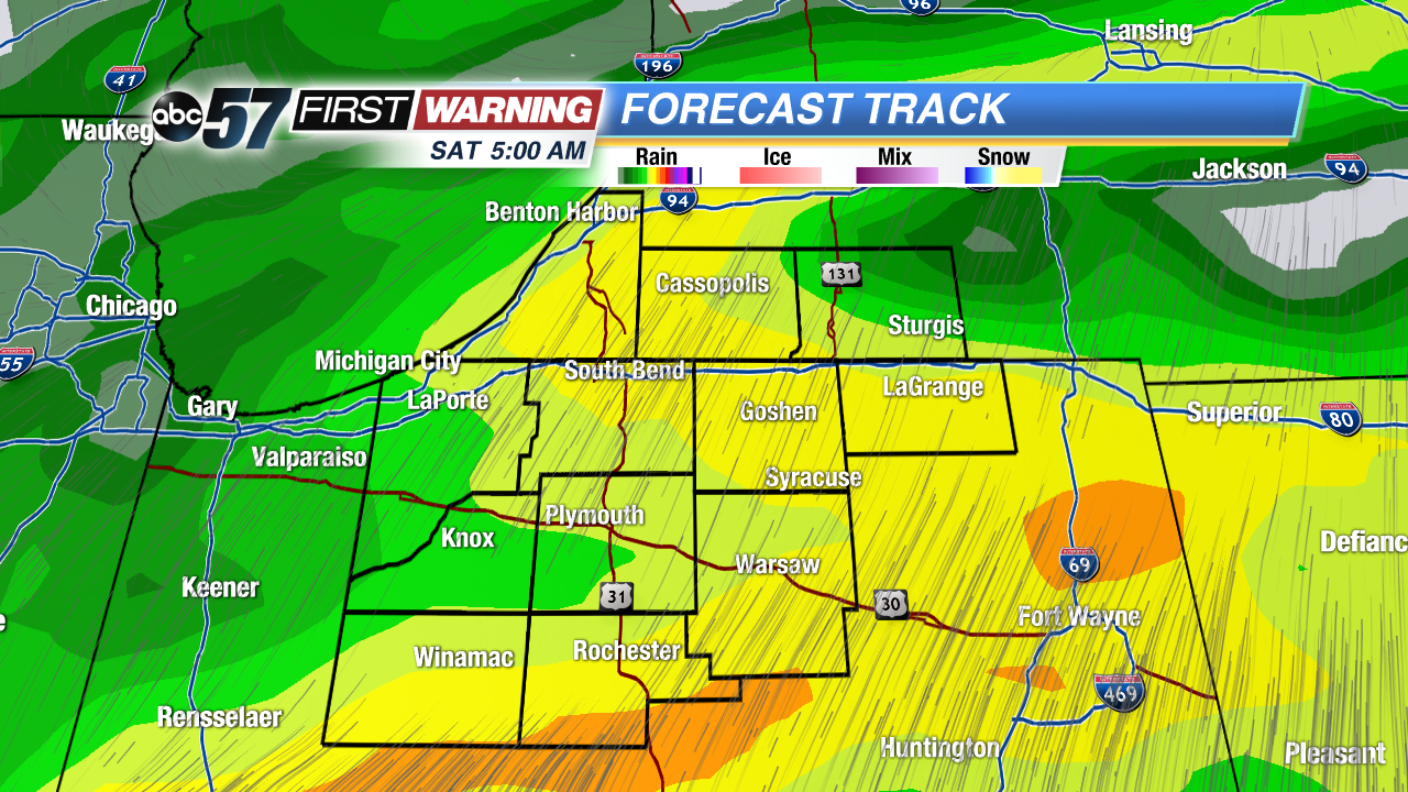 Heaviest rainfall likely early Saturday
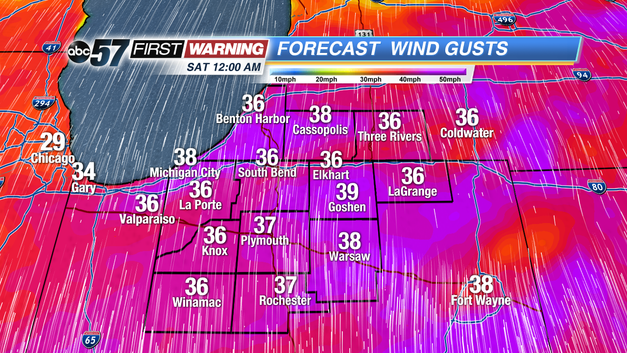 Wind gusts at midnight Saturday morning