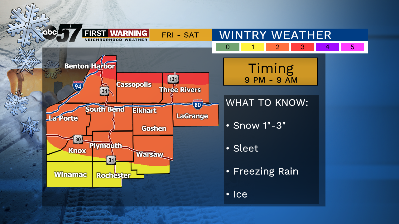
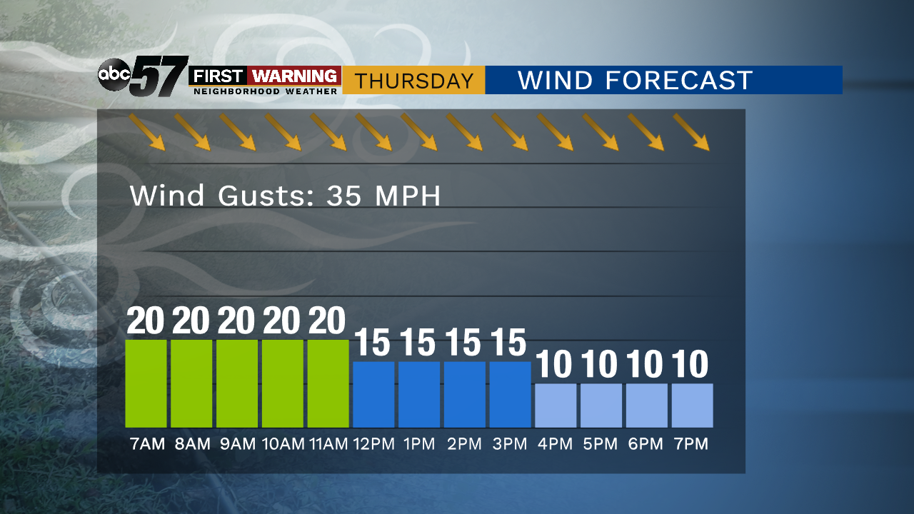
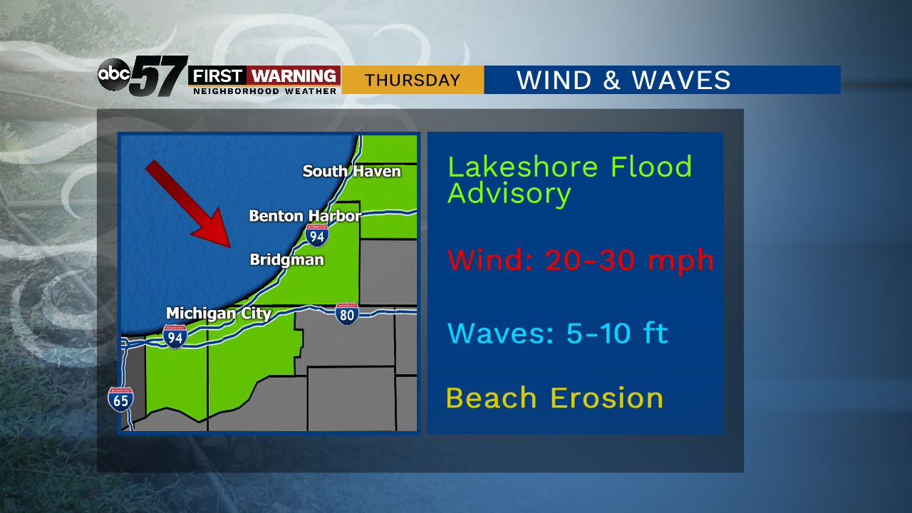
More typical, lasting, January cold is likely as the pattern flips to end the week. Wednesday is still mild with a slight chance of rain / drizzle. Temperatures fall through Thursday, breezy with gusts topping 30 mph. Friday is cold and dry during the day. Friday evening snow is likely, changing to sleet, then freezing rain early Saturday morning. The greatest concern for slick / icy roads is before 9 AM Saturday. Temperatures warm above freezing Saturday, ice melts and precipitation is all rain. Temperatures fall again Saturday night with a chance of light snow off the lake.
Tonight: Partial clearing. Low of 30.
Wednesday: Mostly cloudy, chance of drizzle. High of 42.
Thursday: Partly cloudy, breezy, colder. Temperature fall from 30.
Friday: Mostly cloudy, snow late. High of 30.
Saturday: Freezing rain early, then all rain. High of 40.
Sloppy Saturday: Three inches of snow is possible and may accumulate quickly early Saturday morning (before 3 AM) then start to slush as rain falls on top of the snow. The biggest concern is freezing rain / ice through 9 AM Saturday. Temperatures warm above freezing after that.