
Cold and quiet, a more active winter pattern next week
By:
Tom Coomes
Posted: Jan 20, 2021 5:15 PM EDT

-
1:59

ANOTHER round of strong storms possible early this afternoon
-
2:44

Heavy rainfall floods roads, businesses in Winamac
-
1:08

Congressman Rudy Yakym visits Forest River plant in Elkhart
-
2:21

La Porte homeowners evacuate after uprooted tree causes natural...
-
3:30

’All it takes is one,’ Calls for tips and new tech bring...
-
3:27

Rain pelts Winamac, flooding ensues
-
3:23

Severe threat ending, flood threat continues
-
1:47

Cool Your Engines makes annual return
-
2:34

South Bend City Council votes to override mayor’s veto of resolution...
-
2:08

Severe storms already impacting Michiana counties
-
2:14

Storms arriving by the lunch hour
-
2:36

Damaging wind threat increases for Michiana this afternoon

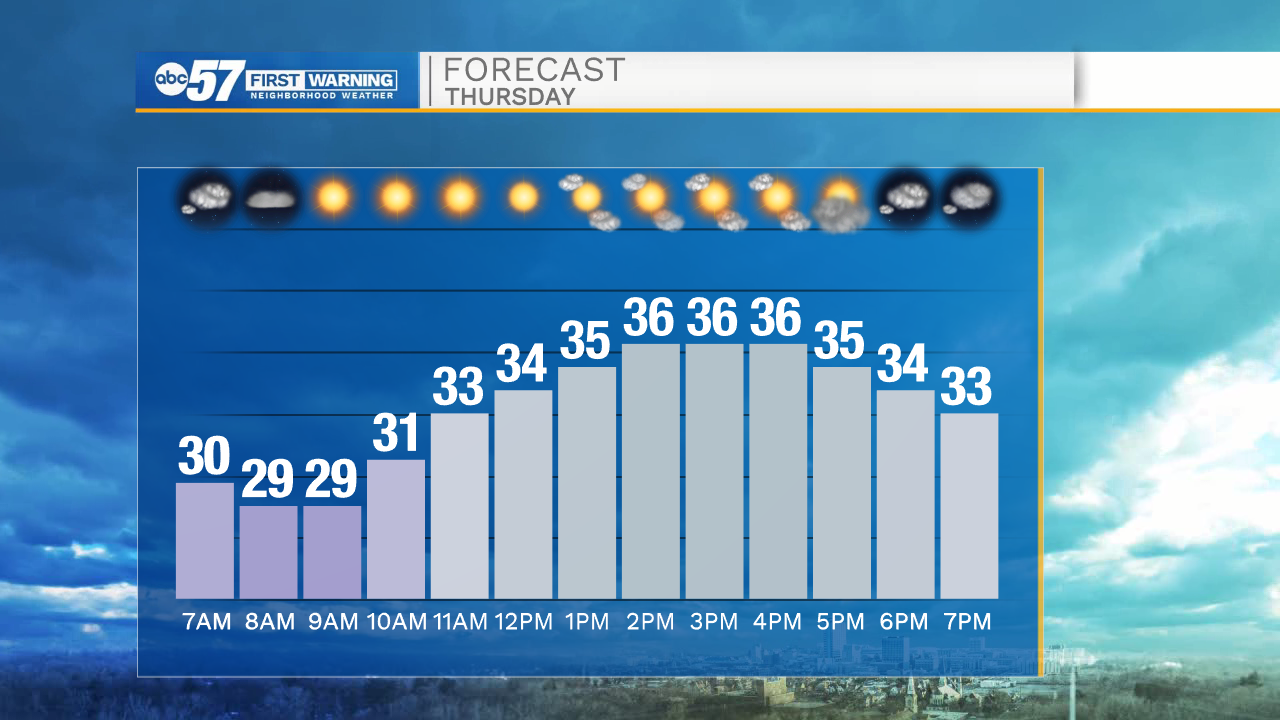
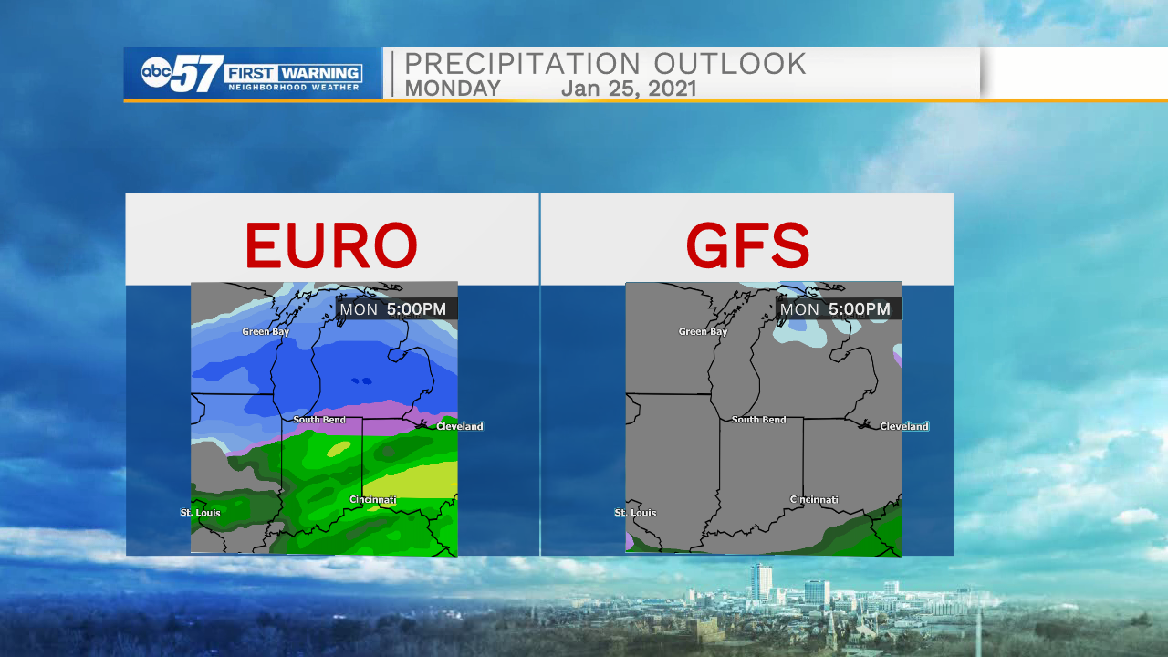
A thaw is in the forecast Thursday, temperatures warm above freezing and sunshine will melt most the snow. The cold returns for the weekend, but the forecast remains quiet through Saturday. Sunday-Monday remains the focus for a potential winter storms, the track of which still remains a question. That path could bring rain, snow, or as some recent trends show a grazing-miss. At this time, we are not picking one solution, but highlighting the potential for wintry weather.
Tonight: Mostly clear. Low 25.
Thursday: Mostly clear. High 36.
Friday: Mostly cloudy. High 26.
Saturday: Partly cloudy. High 28.
Sign up for the ABC 57 Newsletter