
Cold and snow coming to an end
By:
Tom Coomes
Posted: Apr 16, 2018 4:38 PM EDT | Updated: Apr 16, 2018 4:40 PM EDT

-
0:54

Back to jacket weather out the door
-
2:10

Mishawaka honors fallen officers
-
2:52

Two Hoosiers serving as Perpetual Pilgrims for the National Eucharistic...
-
2:31

Berrien RESA holds public hearing to discuss starting school...
-
2:26

Officials break ground on $20 million facade, traffic flow project...
-
3:34

Brian Conybeare interviews Jennifer Copeland’s dad, Dr. Larry...
-
1:13

Shamrocks Sports Bar opens next to Four Winds Field
-
2:24

New Carlisle opens the door to back yard beekeeping
-
4:19

Elkhart High School and Mosaic promoting accessibility with flag...
-
1:13

Cool and windy today
-
1:07

A breezy and cool start to Wednesday
-
0:56

Porter Township leadership pass one-year data center moratorium

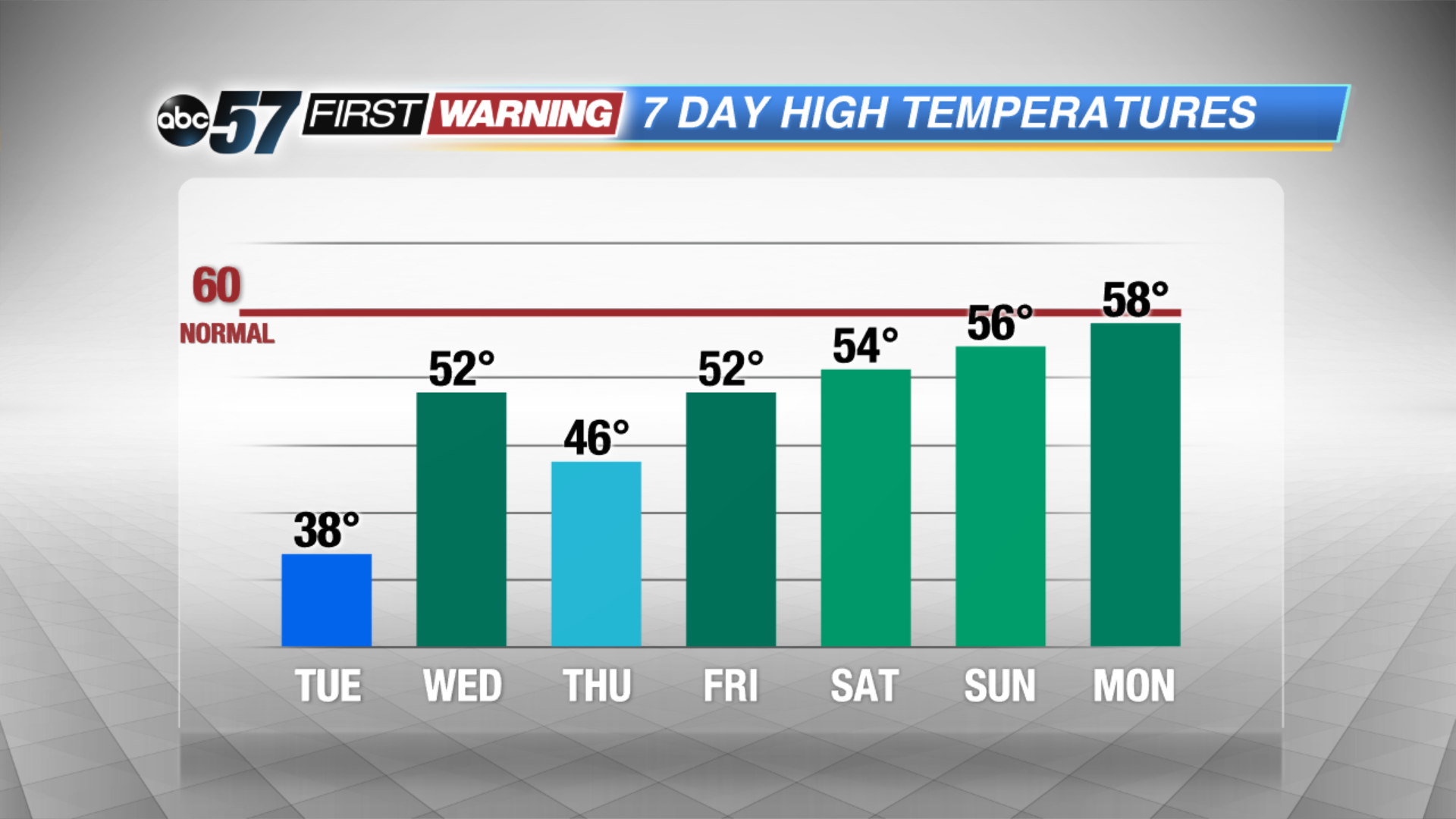
Cold weather continues Tuesday, as the snow showers come to an end. Temperatures turn milder midweek and sunshine returns by the weekend. A quick clipper system will bring a chance of rain Wednesday and possible rain/snow Wednesday night. After that the pattern is very quiet and warms gradually through the weekend.
Tonight: Flurries / light snow, low 28.
Tuesday: Chance of snow early, mostly cloudy, high 38.
Wednesday: Chance of rain, mostly cloudy, high of 52.
Thursday: Mostly cloudy, highs in the mid-40s.
Sign up for the ABC 57 Newsletter