
-
2:28

Kicking off day two of the Gus Macker Basketball Tournament
-
0:50

Beautiful weekend starts this morning
-
2:32

Gus Macker Three-on-Three Basketball Tournament is taking over...
-
1:44

Feeling like a sauna next week
-
3:12

How to keep yourself and others protected during firework season
-
0:49

Showers creeping into Michiana
-
1:32

Judge approves $25 million water lawsuit settlement in Benton...
-
1:00

Scattered showers through the day
-
1:53

Hispanic Community Child Safety Meeting: A Call To Action
-
2:51

Obama Presidential Center features work of South Bend company
-
1:54

This week’s ABC57 Cub Reporter is Isaac Knefely
-
1:16

Real summer heat returns next week

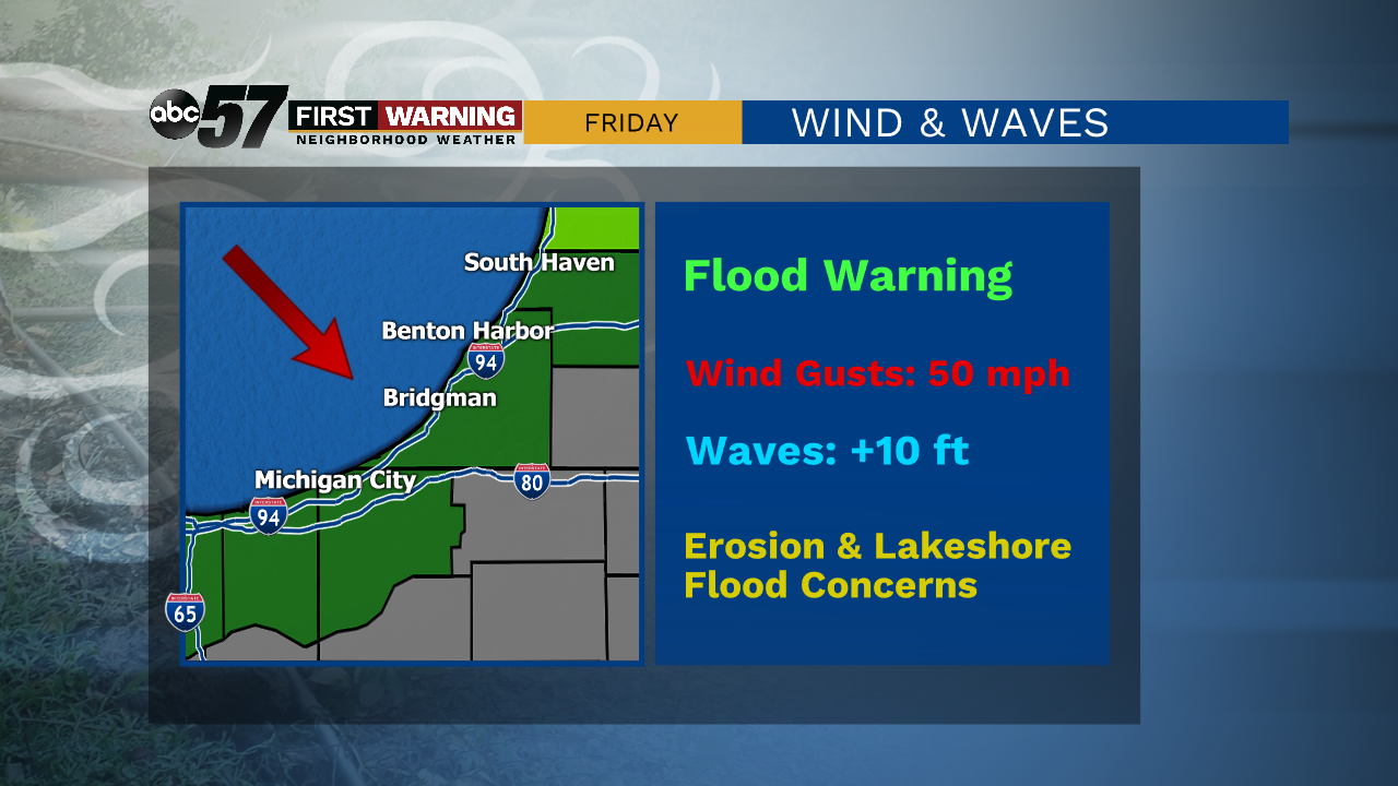
Tonight rain showers turn to a wintry mix, then turn to snow showers as temperatures drop. Snow continues Friday morning. While some areas will not see much of an accumulation, areas in the northwest could see an inch or more of snow. Friday is breezy and chilly, with gusts as high as 50 miles per hour in the morning. The high is 36 degrees. The weekend will be warmer with sunshine both Saturday and Sunday. By Monday, there is another chance for rain but temperatures stay in the 50s.
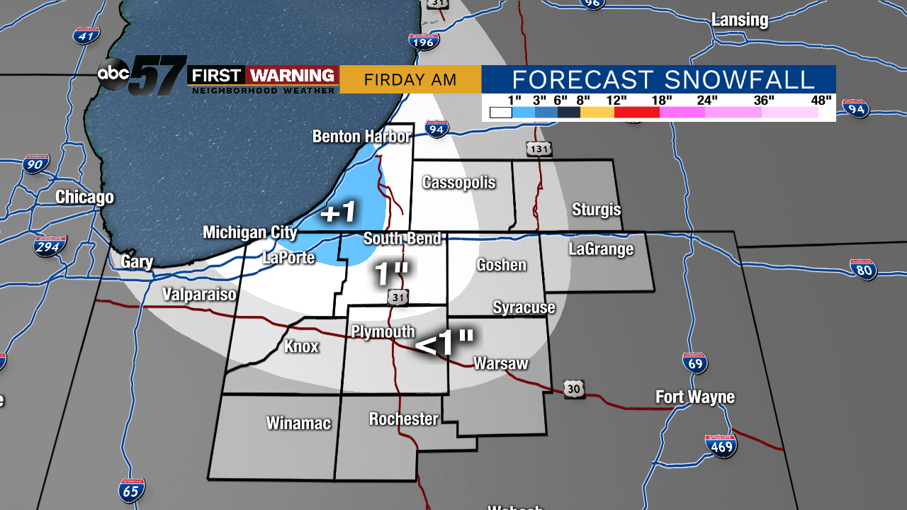
Tonight: Cloudy with rain/snow mix, then snow. Low 32.
Friday: Morning flurries, breezy, and mostly cloudy. High 36.
Saturday: Sunny. High 48.
Sunday: Mostly sunny. High 58.
Sign up for the ABC 57 Newsletter