Cold enough to see your breath
Posted: Sep 27, 2018 12:59 PM EDT
"I can see my breath!" That is probably what some of us were saying Thursday morning as temperatures fell into the mid-40s. Wait a minute. It's possible to see one's breath when temperatures are around 45°? It doesn't have to be in the 30s? Contrary to popular belief, temps only need to fall to or just below 45° in order to see your breath. That is just cold enough to allow the warm water vapor from your mouth to condense into a cloud.
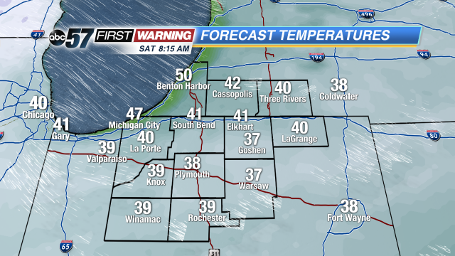
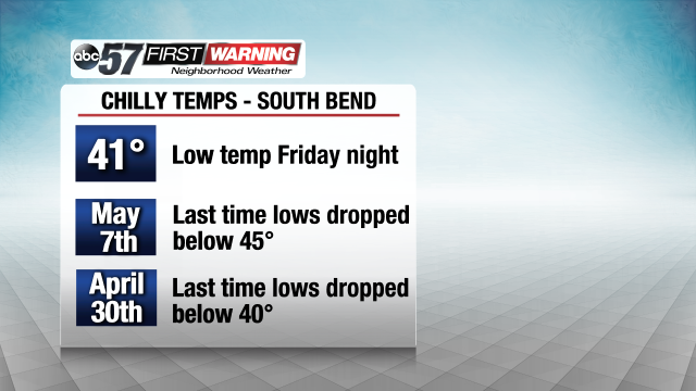
If you didn't get to witness it Thursday morning, you will likely have a chance Saturday morning as an even colder night in store. A fresh Canadian air mass will push in behind a cold front that will move through Friday afternoon. Low temps will fall well into the 40s for most locations. If you're near Lake Michigan, temps will likely stay in the upper 40s. It will likely be the coldest night since May 7th for South Bend.
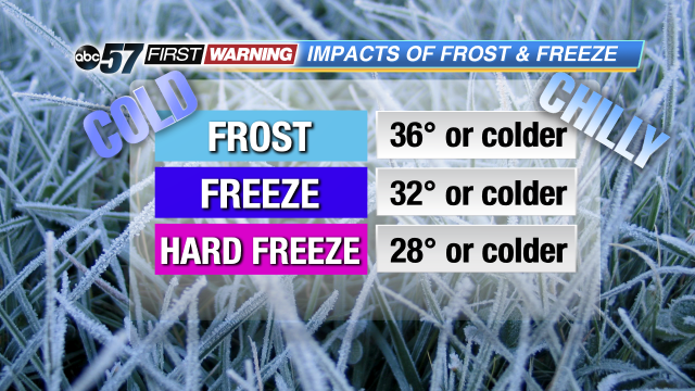
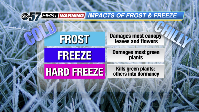
Some spots, especially away from cities and towns, will drop to or just below 40° by 6-8 a.m. Saturday. Areas like Knox, Winamac, Plymouth, Rochester, Warsaw, Goshen, Bremen, Syracuse, and Mentone have the highest chance of seeing temps dip into the upper 30s. What it will come down to is how quickly the cloud cover will move out. Behind Friday afternoon's cold front will exist plenty of cloud cover. By Friday night enough dry air should move in to eat away at the cloud deck. If we clear out enough, temps of 37-41° will happen. If clouds remain later into the night, we will likely stay in the 41-46° range. Regardless of what happens with the cloud cover, it is unlikely that anyone will reach the threshold for a frost. Temps have to drop to or below 36° in order for legitimate frost development to be possible. While it can't completely be ruled out, it doesn't appear likely as it currently looks. That bodes well for those hoping to see vibrant fall foliage across Michiana in the coming weeks. Frost events can hinder the potential of leaves to go through their color changing process. That is especially true if multiple nights at or below 36° occur in a row early in the season (before October 1st). With lows expected to stay just above 36°, those with plants and flowers should not have to worry about them sustaining any sort of damage. What you will likely need to do is simply turn that on your thermostat to "heat."


