
-
2:12

South Bend City Council passes resolution urging pause on Midwest...
-
0:46

Niles City Council vote yes on putting marijuana question on...
-
0:29

Multiple Fire Departments battle residential fire in Berrien...
-
2:10

Notre Dame men’s basketball embracing urgency as Shrewsberry...
-
2:37

Local Beef-A-Roo employees still owed paychecks as private equity...
-
1:42

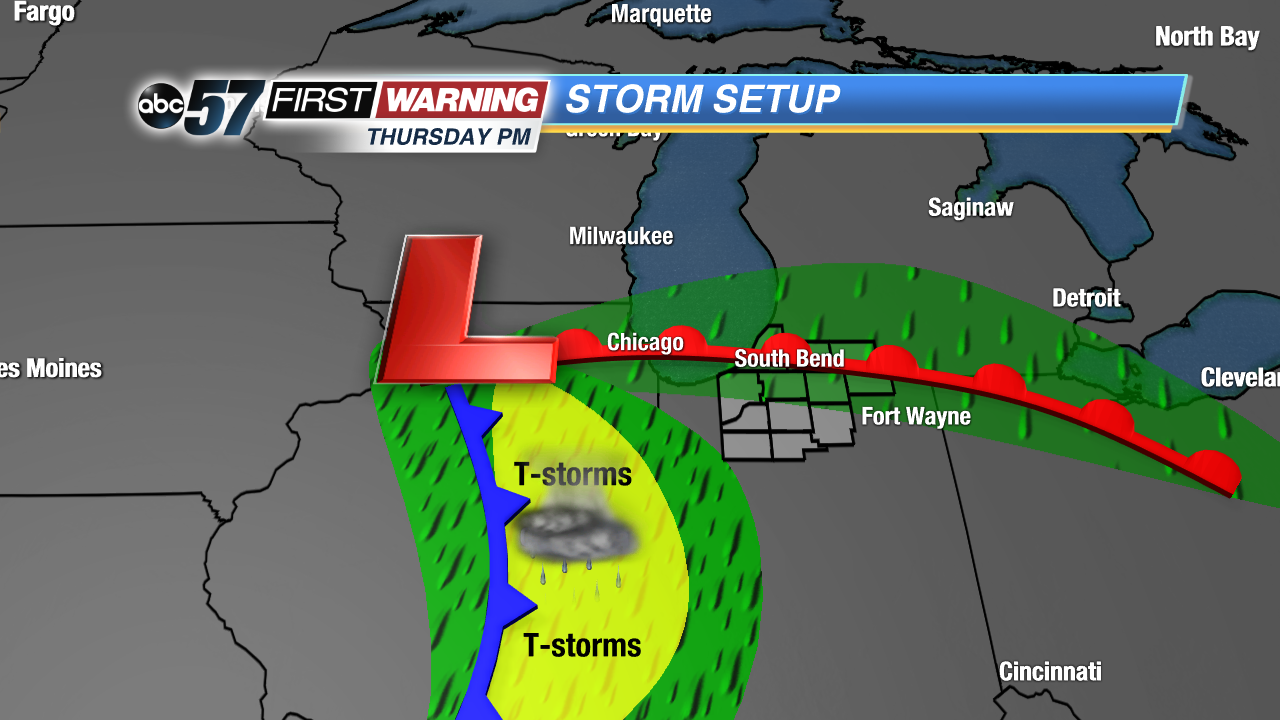
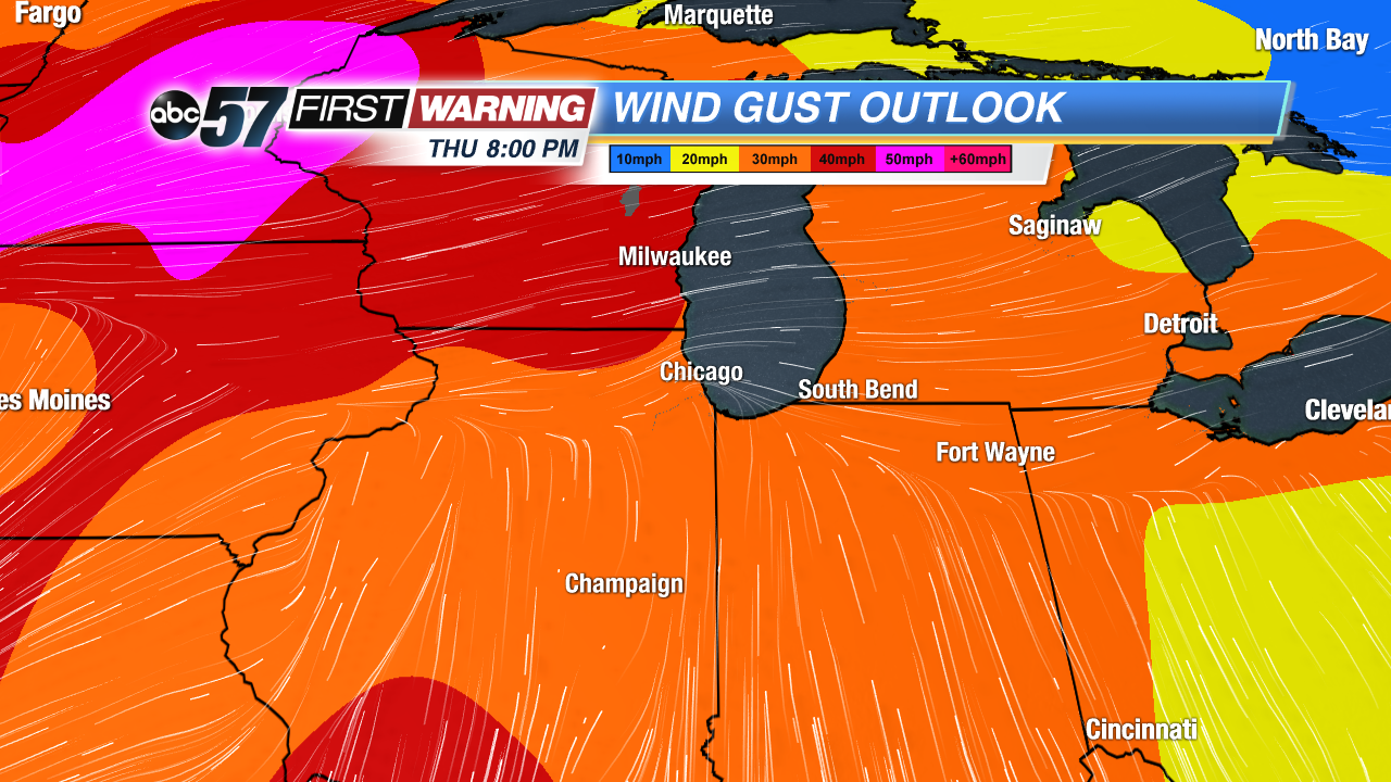
More storms through 8:00 p.m.
-
1:06

2nd annual Inclusive Art Fair
-
2:20

Tracking severe weather through the mid-afternoon
-
3:17

Applications open for Fall Citizens Police Academy in South Bend
-
2:23

Elkhart County 4H Fair food vendors celebrate 50th year of business
-
2:16

Young football athletes learn about protecting their bodies,...
-
1:24

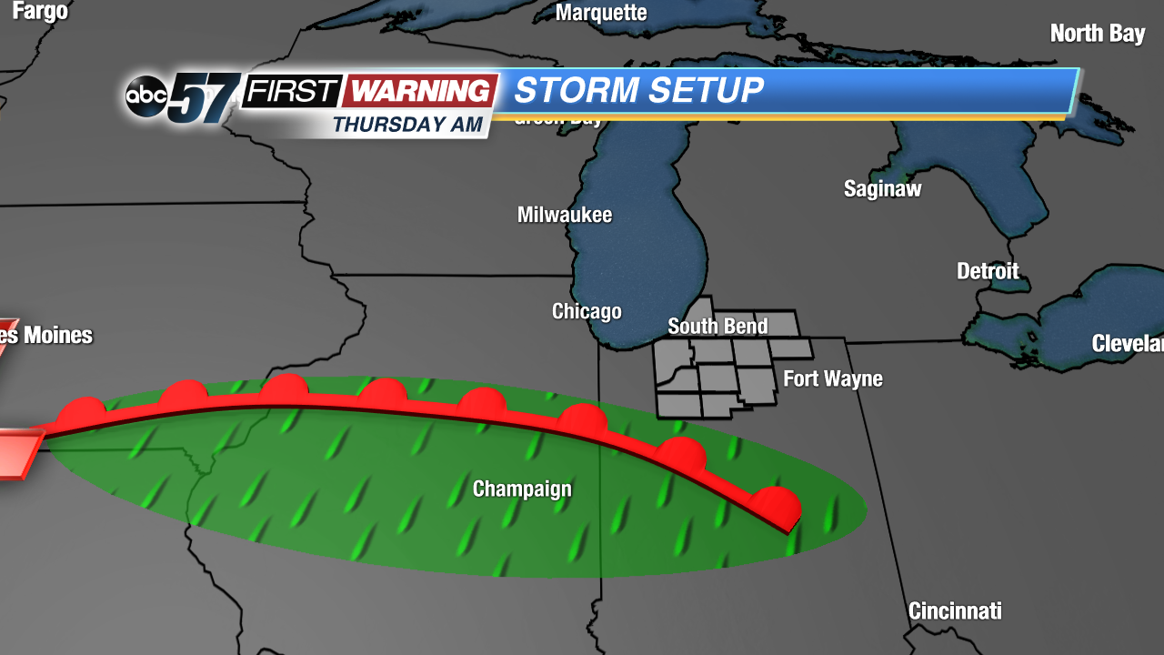
Storm track timing could be shifting

The forecast trends cooler, grayer and wetter through the end of the week. Tuesday is still fair with highs near 60, the northwest breeze keeping temperatures cooler. The wind turns northeast Wednesday with clouds, a chance of rain and temps struggle to reach 50. Thursday the wind gusts out of the southwest as highs spike into the 60s again ahead of a rain and possible storms Thursday night. Temperatures fall again into the weekend.
Tonight: Clear skies, low of 45.
Tuesday: Sunny high of 60.
Wednesday: Mostly cloudy, chance of rain, high of 50.
Thursday: Breezy, increasing clouds, chance of rain/storms late, high of 64.
Sign up for the ABC 57 Newsletter