
-
2:34

From Niles to South Bend: Jays 2 Keeps the Spirit Alive for basketball...
-
0:46

44th annual Tri Kappa Antique Show boosts charities and scholarships
-
1:48

Scattered showers this evening, Much cooler overnight
-
1:50

Showers and storms this afternoon
-
0:20

One person injured in shooting
-
0:36

Eddies Circuit Robotics holds competition Saturday
-
0:32

21st annual Nappanee Model Train Show
-
0:38

Local boys basketball team headed to IHSAA state finals
-
3:49

Midwest Meowfest brings kitten advocacy to attendees, new homes...
-
1:52

Mild tonight, showers tomorrow
-
1:43

Pleasant to start the weekend
-
3:06

Pulaski County weighs stricter solar rules amid resident concerns

The thaw and fog cycle continues. Temperatures will be rising above freezing Wednesday morning, as light rain and drizzle move into the area. The combination of melting snow and falling rain will lead to a super-saturated lower atmosphere, the conditions for thick fog. Areas with the most snowpack will have the densest fog and coolest temperatures. There’s more rain and fog in the forecast for Thursday.
There is still much doubt in a potential ‘ major ‘ winter storm Friday and Saturday. That doesn’t mean we won’t see snow but a significant snowfall may not impact Michiana. There is still the potential significant snowfall and winter weather in the Midwest this weekend.
Tonight: Dense fog and drizzle developing overnight, low 30. 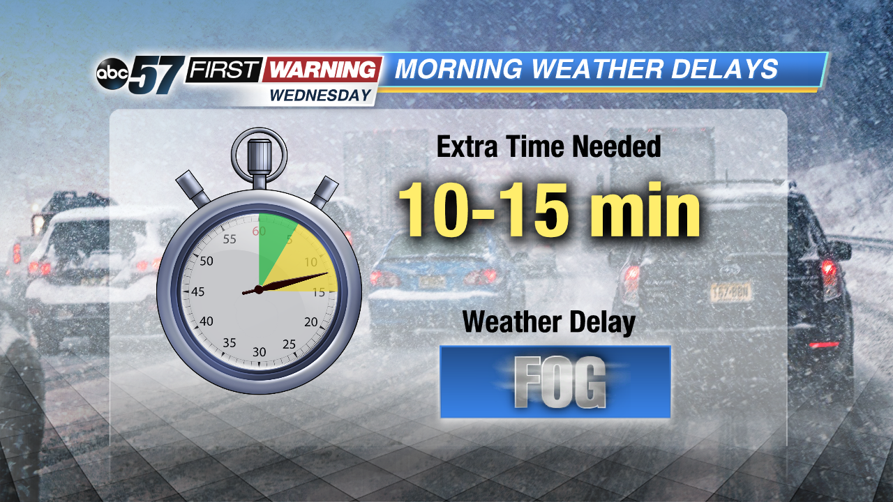
Wednesday: Fog and drizzle, high of 46.
Thursday: Rain and fog, highs near 50.
Friday: Snow showers, high of 30.