
-
0:56

Heat wave starts today
-
1:59

Kosciusko County Fair opens 109th year with parade, new alcohol...
-
2:00

Music enthusiasts gathered for the inaugural South Bend Record...
-
5:22

Coaches vs. Cancer raises money for American Cancer Society
-
0:57

Heat knocking on our door
-
0:54

Pleasant weekend continues
-
1:31

Longtime South Carolina Senator Lindsey Graham dead at 71
-
1:01

Summery Sunday
-
1:55

Bristol Homecoming Festival brings another year of family fun
-
0:55

Concours d’Elegance celebrates its 8th annual two-day event
-
0:57

Fairly average summer weekend
-
0:54

Mild morning setting up beautiful weekend

Monday night into Tuesday light lake effect rain, drizzle and sleet may change to a few flakes overnight along and north of the state line. Accumulation is not exacted but a few slick spots are possible on bridges and overpasses.
Halloween will be chilly, highs struggle to warm into the 40s. Gloomy weather continues with mostly cloudy skies but the forecast is dry through Wednesday afternoon. Rain returns Thursday along with warmer temperatures in the 60s. The pattern is more up-and-down through the weekend.
Tonight: Mostly cloudy, lake effect rain/snow possible, low 34.
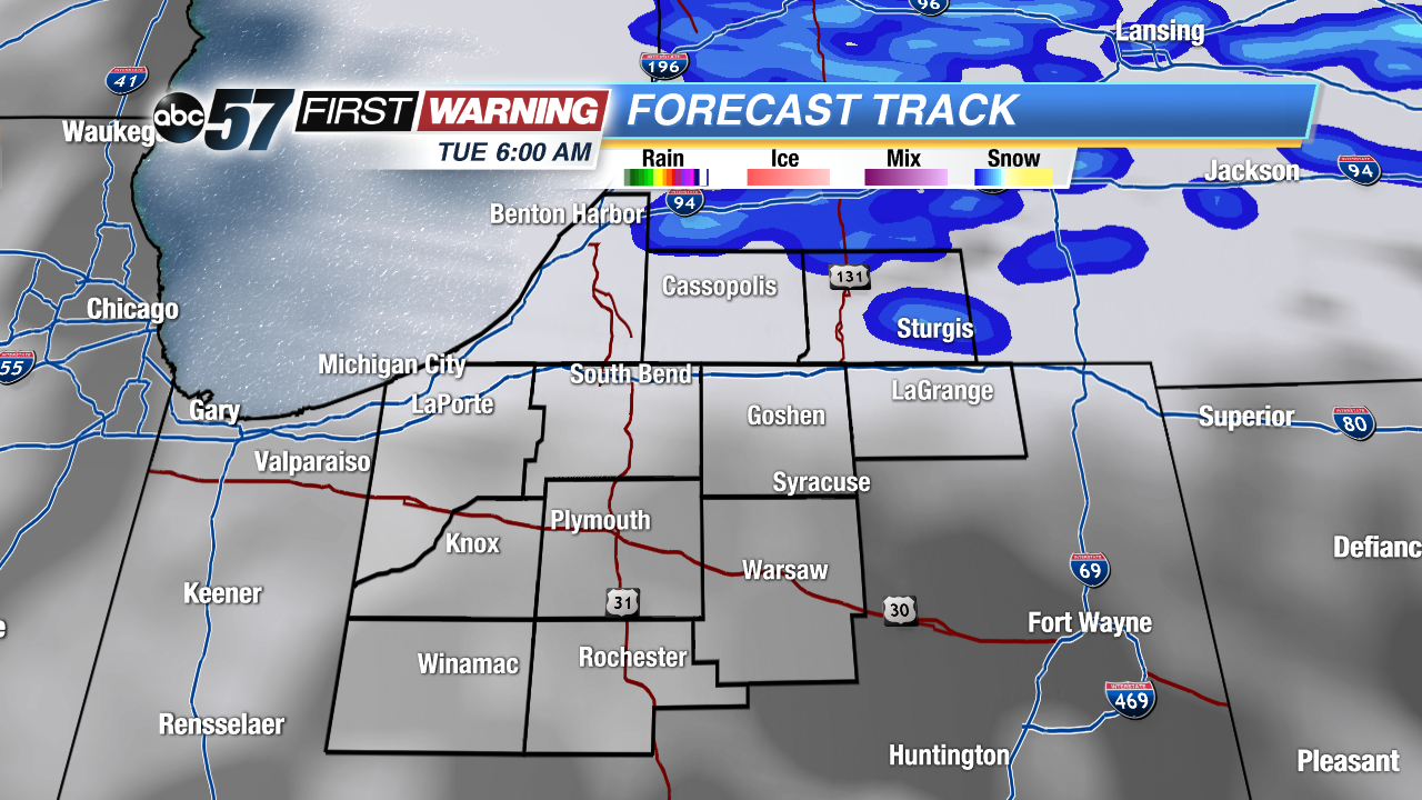 Chance of flurries along and north of the state line TUE AM
Tuesday: Mostly cloudy, high of 42.
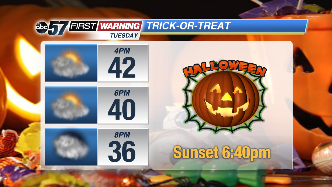 Cool but dry for Trick-or-Treating TUE Eve,
Wednesday: Mostly cloudy, highs of 48.
Thursday: Rain showers, highs near 60.
Sign up for the ABC 57 Newsletter