Dry and sunny Friday; chances for weekend rain and storms


Another dry, sunny, and hot day to end the week. Temperatures will warm near 90 this afternoon.
Overnight, temperatures will fall into the upper 60s with mostly clear skies. The dry period will finally come to an end this weekend.
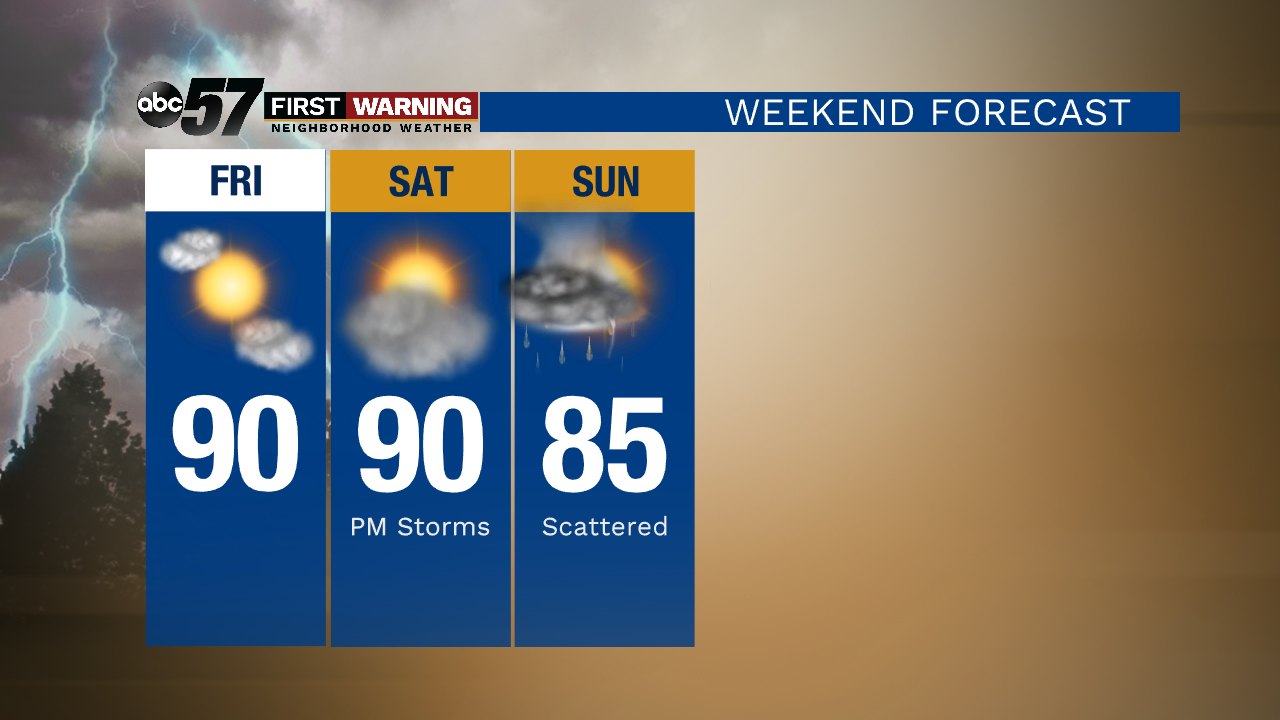
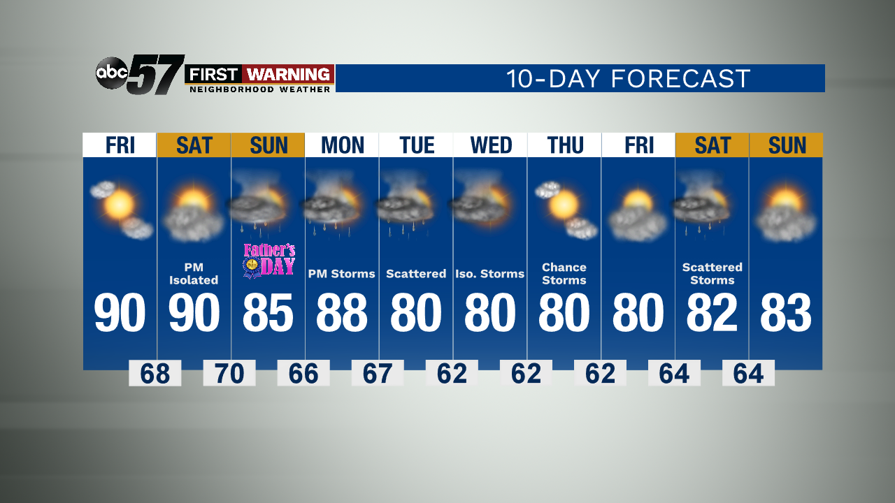
Saturday will start dry with partly sunny skies. Most of the day will be okay to spend outdoors, so don’t cancel your Saturday plans. There is a chance for a few isolated showers or thunderstorms in the afternoon and cloud cover increases. Then, showers and thunderstorms are more likely Saturday night into Sunday. Scattered storms continue Sunday. The unsettled pattern continues next week with a few more chances for thunderstorms. High temperatures will stay in the 80s Monday through Friday.
Today: Mostly sunny. High 90.
Tonight: Mostly clear. Low 68.
Saturday: Increasing clouds. A few isolated PM storms, then storms likely overnight. High 90.
Sunday: Scattered thunderstorms. High 85.