Drying out today

-
1:54

Lightning may be the only thing lighting up the sky tonight
-
2:02

More storms this evening
-
0:57

Michigan family turns backyard into enormous slip ’n’ slide...
-
1:53

America’s Birthday Celebration at Howard Park
-
2:03

More storms tonight
-
3:39

RedBud Weekend, America 250 Edition
-
49:01

An ABC57 News special
-
2:06

Strong storms arriving in Michiana soon
-
4:24

The future of Michiana
-
3:45

Understanding America’s founding values and what’s changed...
-
3:19

Southwest Michigan fruit farming as American as it gets
-
5:48

Immigrant groups find their ’American dream,’ a seat at...

Showers and storms will continue to work their way through Michiana during the early morning hours. By the afternoon, most of the activity will push out of the area and we’ll slowly start to clear out by the end of the day. The start of the new work week looks to be dry and a little cooler with highs in the middle 70s. By Thursday and Friday, storm chances return as our highs climb back into the lower to middle 80s.
Sunday: AM lingering showers and t-storms, then partly to mostly sunny PM. High 80.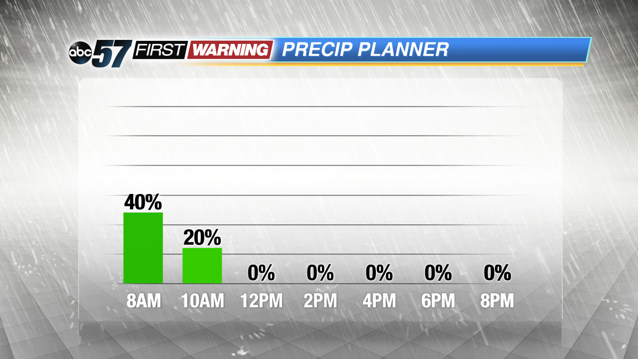 Rain chances will fall to near zero for all of Michiana by noon today.
Monday: Mostly sunny with a slight chance for a PM shower. Highs in the mid 70s.
Tuesday: Mostly sunny with a chance for a PM shower. High in the mid 70s.
Wednesday: Partly sunny. Highs close to 80.