
-
0:49

Gas leak at remains of Zimmy’s Tavern leads to temporary evacuation...
-
2:12

South Bend City Council passes resolution urging pause on Midwest...
-
0:46

Niles City Council vote yes on putting marijuana question on...
-
0:29

Multiple Fire Departments battle residential fire in Berrien...
-
2:10

Notre Dame men’s basketball embracing urgency as Shrewsberry...
-
2:37

Local Beef-A-Roo employees still owed paychecks as private equity...
-
1:42

More storms through 8:00 p.m.
-
1:06

2nd annual Inclusive Art Fair
-
2:20

Tracking severe weather through the mid-afternoon
-
3:17

Applications open for Fall Citizens Police Academy in South Bend
-
2:23

Elkhart County 4H Fair food vendors celebrate 50th year of business
-
2:16

Young football athletes learn about protecting their bodies,...

Warm weather continues through midweek, sunshine and highs in the mid-80s Wednesday and Thursday. The best chance of rain is late Thursday into early Friday morning with a chance of storms ahead of a cold front. The heat and humidity drop Friday afternoon, the weekend looks mild and sunny.
Tonight: Mostly clear, low 62.
Wednesday: Mostly sunny, highs 84.
Thursday: Mostly sunny to partly cloudy, high 86.
Friday: A chance of storms early, then mostly sunny, high in the upper 70s.
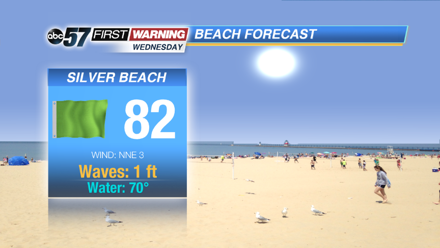 Another great beach day Wednesday.
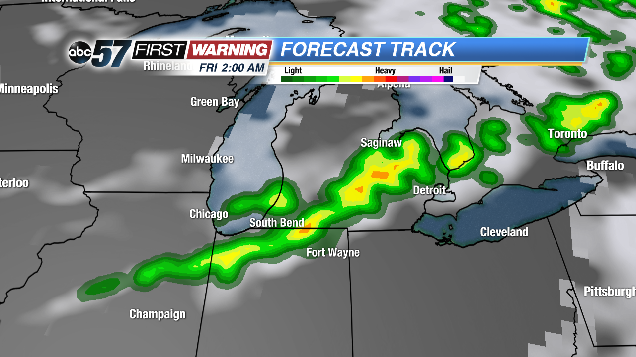 Line of storms ahead of a cold front early Friday morning.
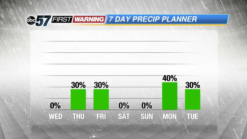 Chance of storms to end the week is low impact, best chance is early Friday morning.
Sign up for the ABC 57 Newsletter