
-
2:32

Gus Macker Three-on-Three Basketball Tournament is taking over...
-
1:44

Feeling like a sauna next week
-
3:12

How to keep yourself and others protected during firework season
-
0:49

Showers creeping into Michiana
-
1:32

Judge approves $25 million water lawsuit settlement in Benton...
-
1:00

Scattered showers through the day
-
1:53

Hispanic Community Child Safety Meeting: A Call To Action
-
2:51

Obama Presidential Center features work of South Bend company
-
1:54

This week’s ABC57 Cub Reporter is Isaac Knefely
-
1:16

Real summer heat returns next week
-
2:28

South Bend storm drain mural project complete
-
5:17

Three local students return as national powerlifting champions

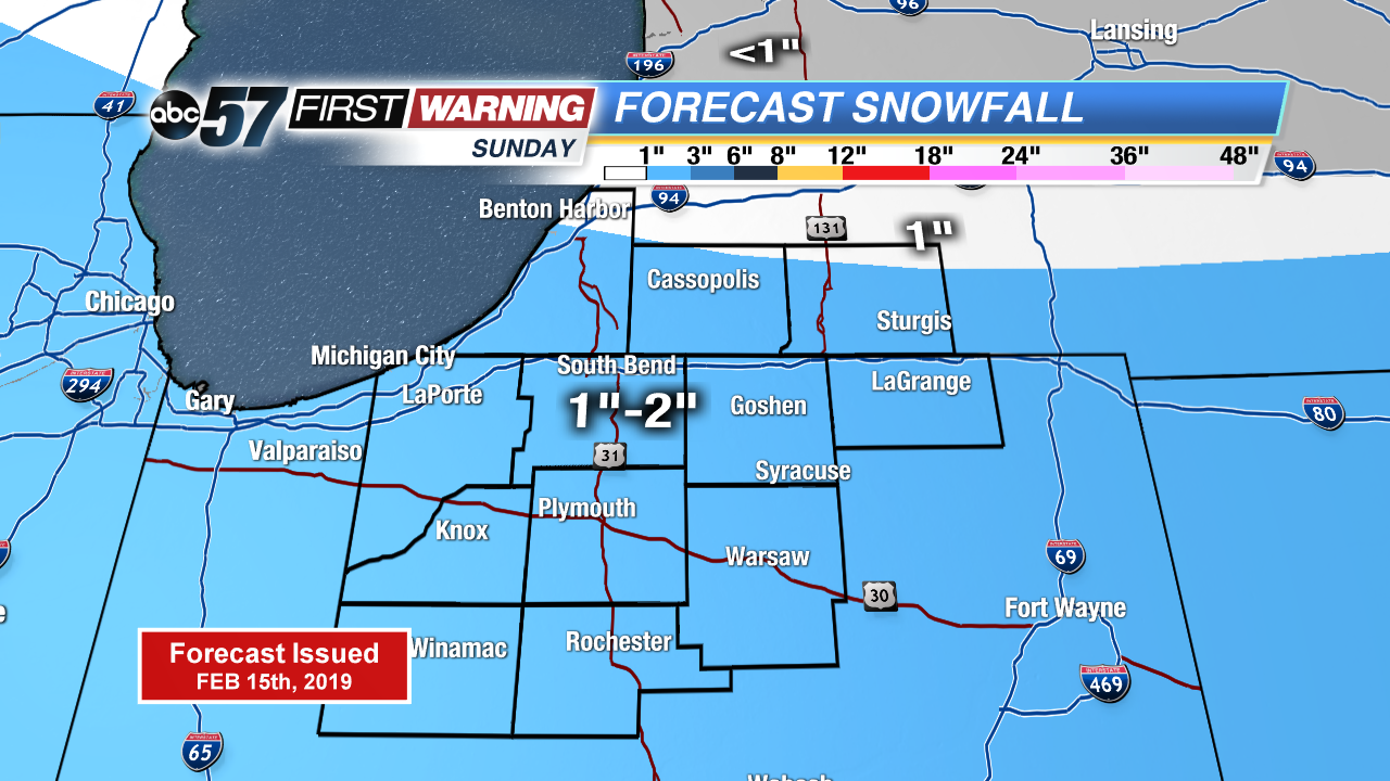
A fair Saturday before light snow Sunday. The latest starts snow earlier but amounts still look to be minimal. Snow will start around mid to late morning Sunday, continuing through the afternoon. Accumulation around one inch looks most likely for the area with localized higher amounts. Temperatures are far from frigid but look to be just below normal through next week.
Tonight: Few clouds moving through, low of 16.
Saturday: Partly cloudy, high of 32.
Sunday: Light snow showers, high of 30.
Monday: Mostly cloudy, high of 28.
Sign up for the ABC 57 Newsletter