Falling temperatures and lake effect snow

-
0:45

Still chilly most of the week
-
0:50

Freeze Warning active this morning
-
1:21

Three injured in shooting near downtown Elkhart
-
0:38

A Celebration of Life for Kaylon Woods
-
1:57

ABC57 reporter Annie Kate discusses ongoing fuel price hikes...
-
0:53

Michiana drivers share their thoughts about the current gas prices
-
1:12

Decision Day becomes new tradition at John Adams High School
-
6:13

Bethel University baseball player battles a brain tumor to retake...
-
1:22

EPD Chief Dan Milanese steps down from role, interim chief announced
-
1:16

Chilly today, cold tonight
-
3:16

Importance of water safety with warm weather around the corner
-
5:38

Celebrate with the Ivy Tech Impact Gala

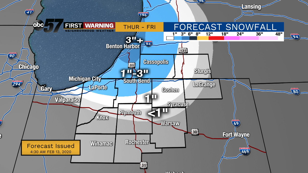
Thursday, February 13th, 2020
Light snow showers from the system continues early this morning. The system moves out before noon with lake effect snow developing around that time. Lake effect snow will add up for our NW counties this afternoon into early Friday morning. Temperatures drop today along with it, falling from 30 degrees. Overnight temperatures will fall into the single digits and the wind will make it feel even colder! After a frigid Friday, temperatures rise again over the weekend with a chance of rain to start the new work week.
Today: Snow showers early, then afternoon lake effect snow. Temperatures drop from 30.
Tonight: Lake effect snow, mostly cloudy. Low of 8.
Friday: A few flurries early, then partly cloudy. High 18.
Saturday: Increasing clouds then evening wintry mix. High 33.