


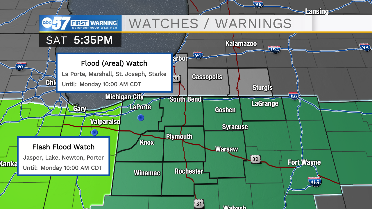
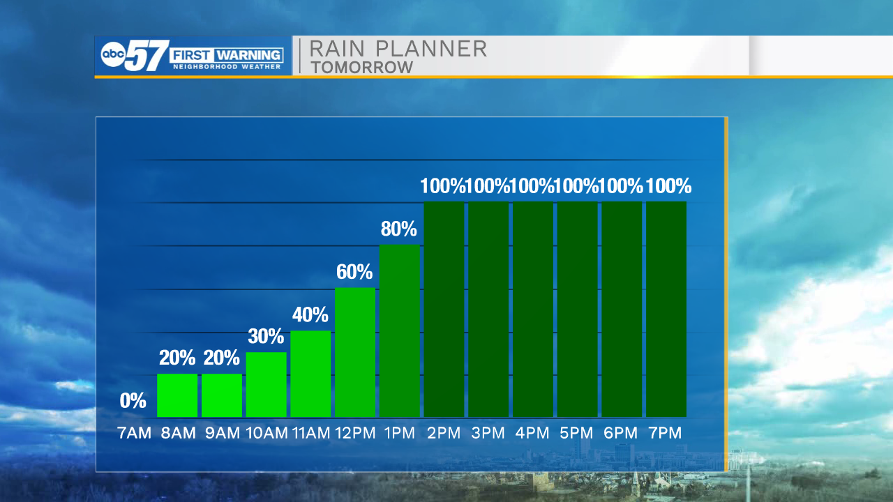
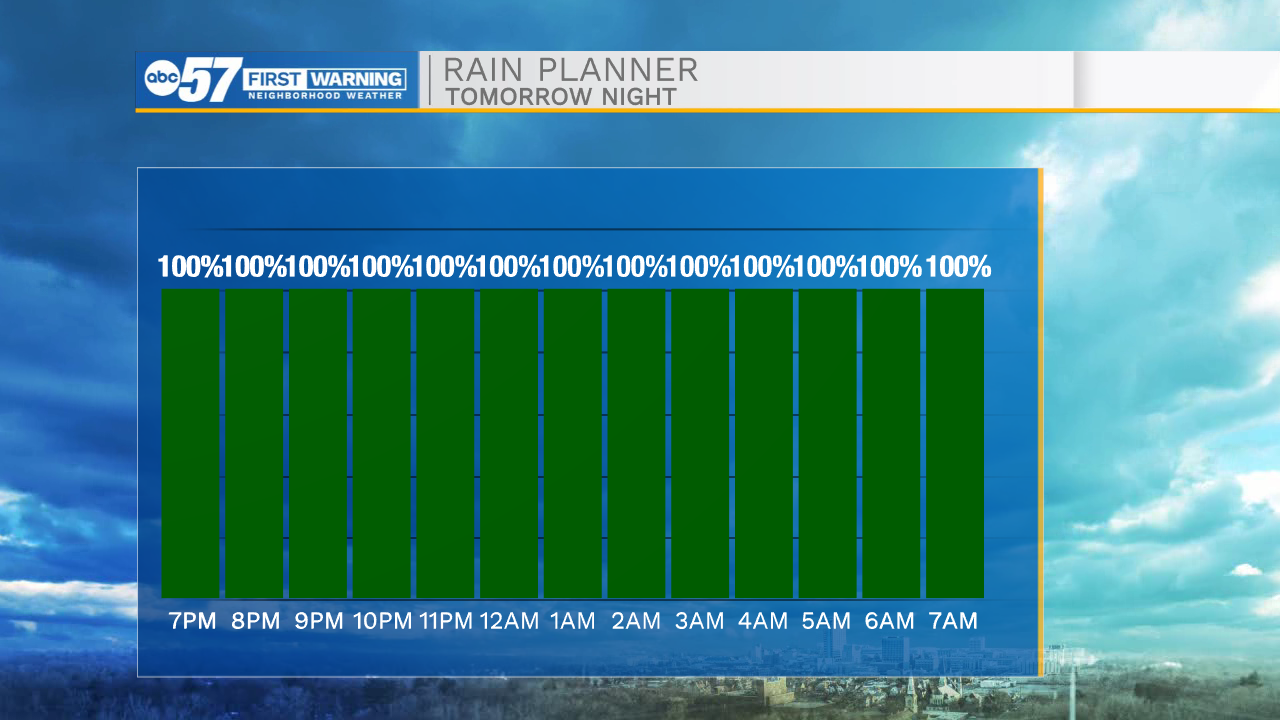
Scattered showers will move into Michiana tomorrow morning. By 10am light rain is expected in our southern counties. The band of rain will lift north bringing scattered showers for all of us here in Michiana. Rain will remain very persistent throughout the day. Once we hit the evening hours a few thunderstorms are possible, overall storm strength will remain minimal, but prolonged heavy downpours will increase the flooding potential. There is a flood watch in effect for all of us here in Michiana. Rain will begin to move out during the early afternoon Monday. Rain fall accumulation looks to be around 2 inches for most, but a few isolated areas could total over 3 inches, especially in our southern counties.
Tonight: Mostly clear. Low 38.
Tomorrow: Scattered showers. High 52.
Monday: AM Rain/Mostly cloudy. High 56.
Tuesday: Partly cloudy. High 56.